Updated 10.11.21 @ 12a
You must be logged in to view this content. Click Here to become a member of IndyWX.com for full access. Already a member of IndyWx.com All-Access? Log-in here.

Oct 11
Updated 10.11.21 @ 12a
You must be logged in to view this content. Click Here to become a member of IndyWX.com for full access. Already a member of IndyWx.com All-Access? Log-in here.
Permanent link to this article: https://indywx.com/2021/10/11/video-storms-arrive-this-afternoon-and-evening-tracking-a-cooler-push-of-air-for-the-weekend/
Oct 10
Updated 10.10.21 @ 10:14a
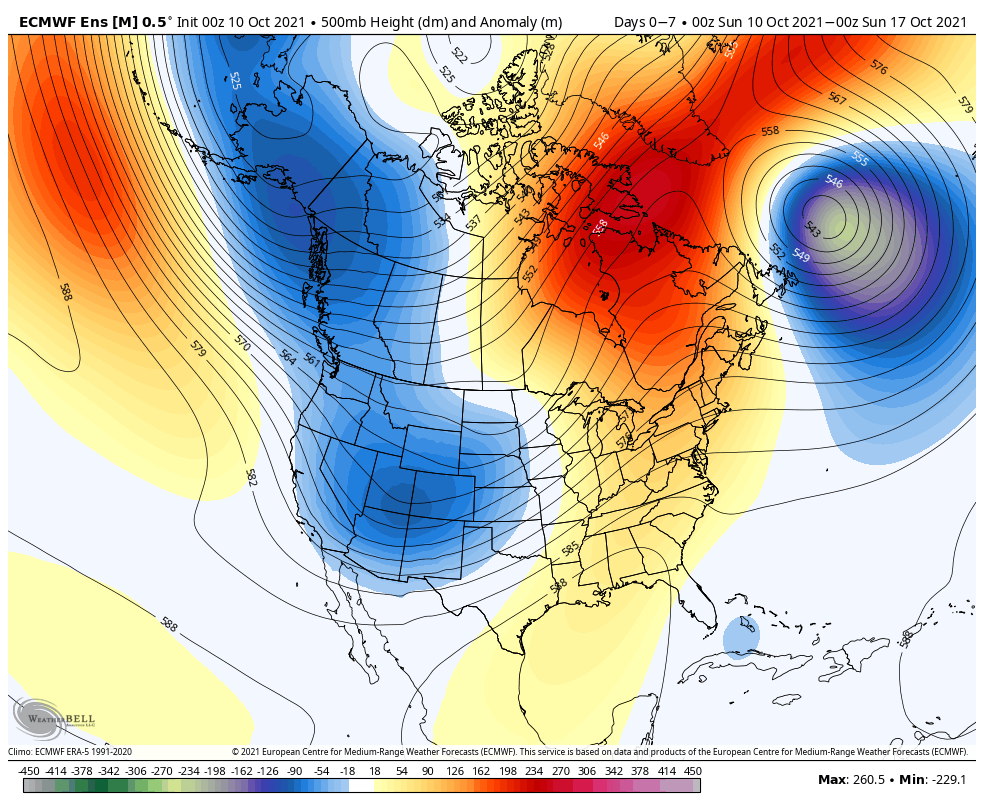
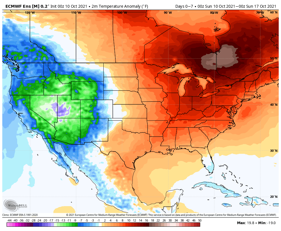
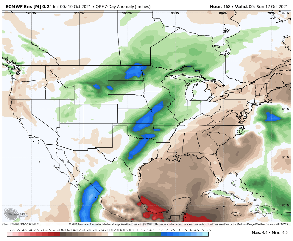
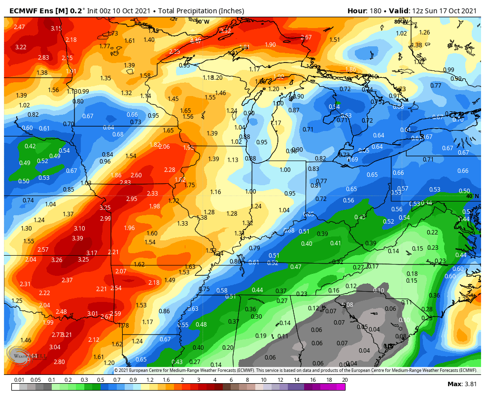
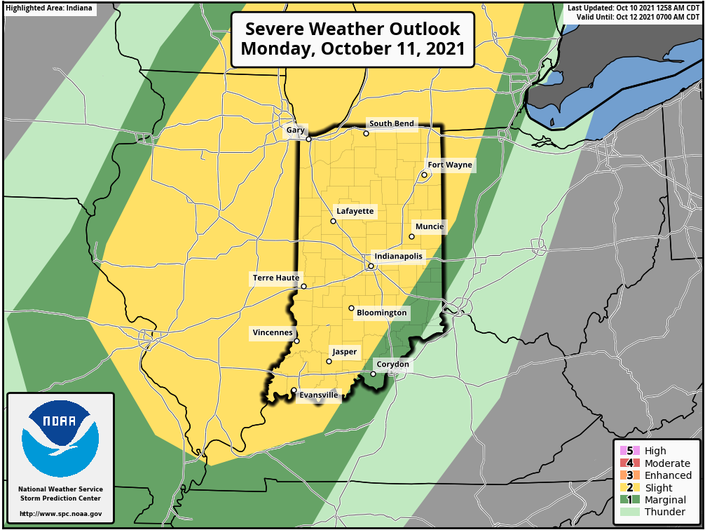
Forecast Period: 10.10.21 through 10.17.21
While the bulk of the forecast period will run well above normal, this will be a much more active 7-day period than we’ve seen of late. The first storm system will approach Monday afternoon. After a warm, breezy, and mostly dry day, a line of storms will move through from west to east during the afternoon and evening. Strong damaging straight line winds appear to be the greatest threat but there will also be the potential of an isolated tornado. We bracket the hours from 2p to 10p for this line of storms to impact the state. Another storm system will move through the area late in the work week with widespread rain and a shot of much cooler, fall-like air as we head into next weekend. Dry conditions should return just in time for the weekend.
Permanent link to this article: https://indywx.com/2021/10/10/weekly-agwx-and-harvest21-outlook-6/
Oct 09
Updated 10.09.21 @ 9:30a
After a mostly dry, sunny, and unseasonably warm weekend, our next storm system will approach as we kick off the work week. Southerly winds will usher in an unseasonably moist airmass to combine with August-like temperatures (highs once again are expected to shoot into the lower and middle 80s).
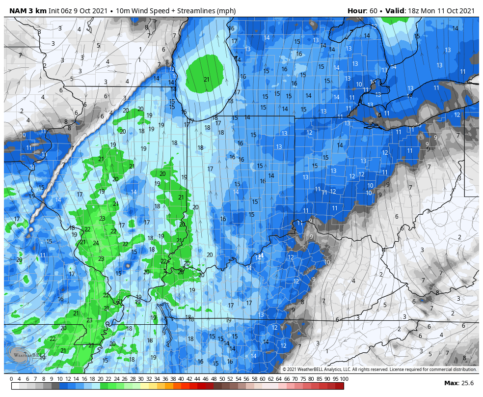

The Storm Prediction Center (SPC) outlines the western Ohio Valley, including most of Indiana, into the central Great Lakes region for a Slight Risk of severe weather Monday.
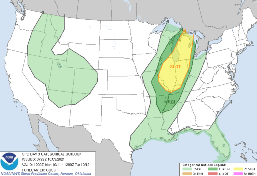
A surface wave is expected to develop along the pressing cold front Sunday evening and track northeast into the Great Lakes. After a warm, dry, and breezy start to Monday, a line of thunderstorms should develop late Monday morning or early afternoon across western IL. This line will then track east and move into Indiana during the late afternoon and evening hours.
Given some of the ingredients in place, the primary concern with this line of storms will be the potential of damaging straight line winds. There also is the potential of a couple rotating storms within this overall line of storms that could pose an isolated tornado threat.
After the stormy time of things Monday PM (rainfall amounts should check-in between 0.50″ and 1″ for most), conditions will improve as we move through the day Tuesday. Another (weaker) system will push into the area midweek, but as of now this doesn’t look like a significant event.
A stronger cold front will arrive to close the week with more widespread rain. After an unseasonably warm stretch, cooler air should finally filter into the region next weekend.
Permanent link to this article: https://indywx.com/2021/10/09/monitoring-mondays-storm-threat/
Oct 08
Updated 10.08.21 @ 11:35a
You must be logged in to view this content. Click Here to become a member of IndyWX.com for full access. Already a member of IndyWx.com All-Access? Log-in here.
Permanent link to this article: https://indywx.com/2021/10/08/video-warming-up-this-weekend-another-busy-week-ahead/
Oct 07
Updated 10.07.21 @ 11:15a
You must be logged in to view this content. Click Here to become a member of IndyWX.com for full access. Already a member of IndyWx.com All-Access? Log-in here.
Permanent link to this article: https://indywx.com/2021/10/07/video-conditions-improve-through-the-weekend-tracking-2-storm-systems-next-week/
Oct 06
Updated 10.06.21 @ 1:54p
You must be logged in to view this content. Click Here to become a member of IndyWX.com for full access. Already a member of IndyWx.com All-Access? Log-in here.
Permanent link to this article: https://indywx.com/2021/10/06/video-unsettled-times-give-way-to-summer-like-warmth-this-weekend-taste-of-winter-settles-into-the-west/
Oct 06
Updated 10.06.21 @ 9a I. Unsettled conditions will continue through the end of the work week. A “cut off” low pressure system will begin to lift north today and pull…
You must be logged in to view this content. Click Here to become a member of IndyWX.com for full access. Already a member of IndyWx.com All-Access? Log-in here.
Permanent link to this article: https://indywx.com/2021/10/06/wednesday-morning-rambles-10/
Oct 05
Updated 10.05.21 @ 6:55a
You must be logged in to view this content. Click Here to become a member of IndyWX.com for full access. Already a member of IndyWx.com All-Access? Log-in here.
Permanent link to this article: https://indywx.com/2021/10/05/video-widespread-rain-returns-thursday-summer-like-weekend-ahead/
Oct 04
Updated 10.04.21 @ 7:20a
You must be logged in to view this content. Click Here to become a member of IndyWX.com for full access. Already a member of IndyWx.com All-Access? Log-in here.
Permanent link to this article: https://indywx.com/2021/10/04/video-timing-out-more-when-rain-becomes-more-widespread-warm-pattern-continues/
Oct 03
Updated 10.03.21 @ 11a
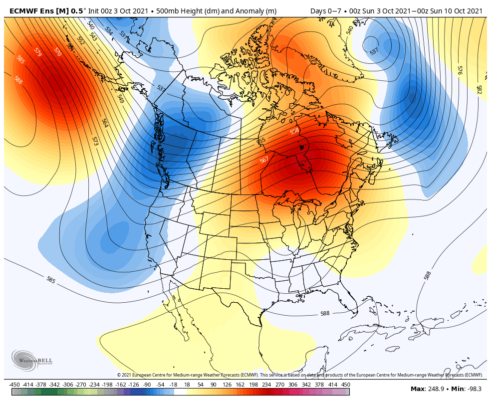
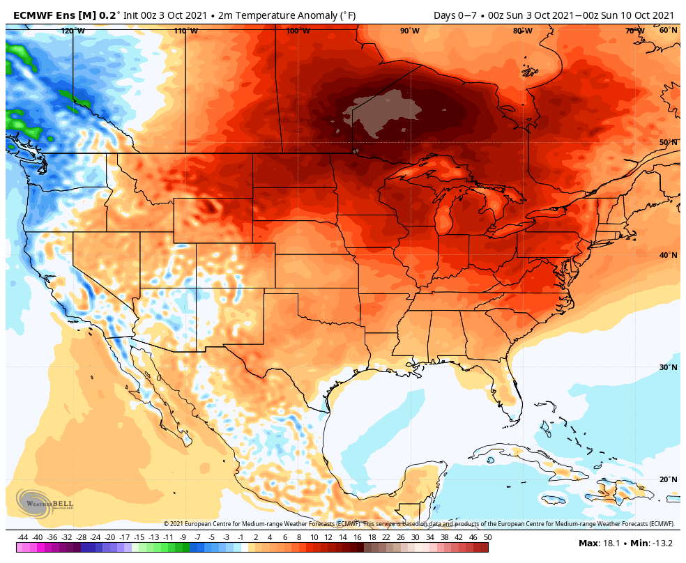
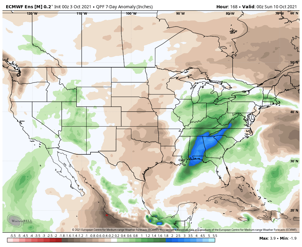
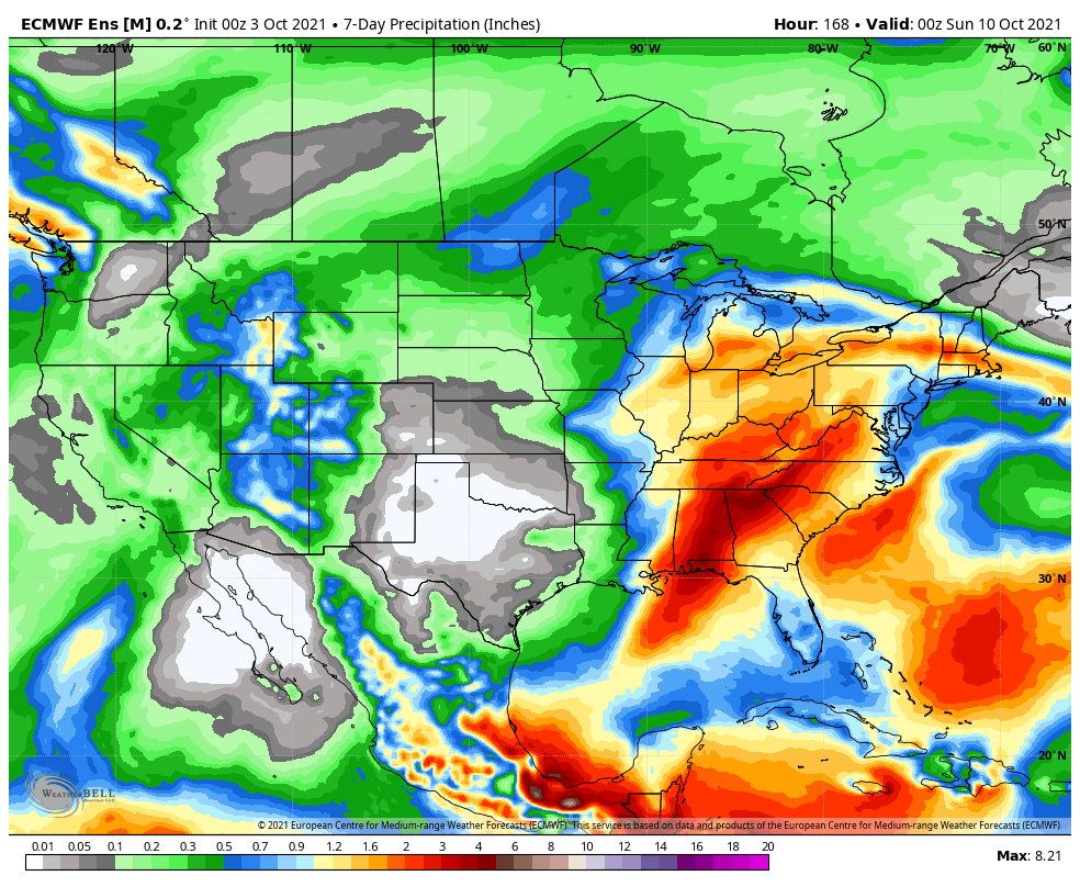
Forecast Period: 10.03.21 through 10.10.21
A stubborn cut off low pressure system will keep things unsettled around these parts for a good chunk of the forecast period. It certainly won’t rain the entire period, but compared to the past couple of weeks, most will notice a drastic difference in the wetter conditions. We think greatest coverage of rain will come today and midweek. By this time next week, most central Indiana rain gauges can expect to tack on an additional 0.50″ to 1″ of rain with locally heavier totals.
The other big story by late in the week will be an expanding ridge of high pressure. This will keep our region well above normal from a temperature perspective, including the likelihood of multiple days of 80°+ in the 6-10 day stretch. This will be driven by a strongly negative PNA and positive EPO and is supported by October La Ninas from the past (analogs). The persistent warmer than normal regime shouldn’t really go anywhere in the longer range. It’s not until we get to the 2nd half of November (and beyond) when we believe a more profound shift to more persistent cold lurks.
Permanent link to this article: https://indywx.com/2021/10/03/weekly-agwx-and-harvest21-outlook-5/