
You must be logged in to view this content. Click Here to become a member of IndyWX.com for full access. Already a member of IndyWx.com All-Access? Log-in here.
September 2020 archive
Permanent link to this article: https://indywx.com/video-soon-to-be-sally-heads-for-the-north-central-gulf-coast-pattern-takes-an-active-turn-towards-late-month/
Sep 11
Long Range Update: Walking Through The Back Half Of September…
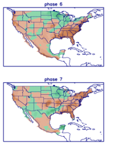
We believe the pattern during the 2nd half of the month will be driven by the MJO and PNA. The MJO is forecast into Phase 6 and 7 by the 18th-24th time frame.

Phase 6 is quite warm, but notice how the chilly air begins to push during Phase 7.
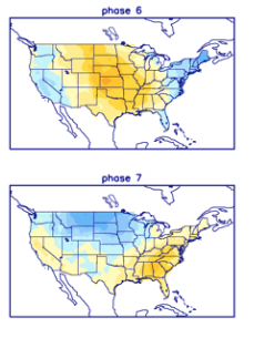
Neither phase is overly wet, but there’s hope compared to how dry it’s been over the past 2-3 weeks.
Interestingly enough, after a “neutral” phase with the PNA, both the GFS and European ensemble products predict a strong positive shift just after the 20th. This suggests to me that the week starting around that point should feature more widespread and stronger chill, compared to normal.


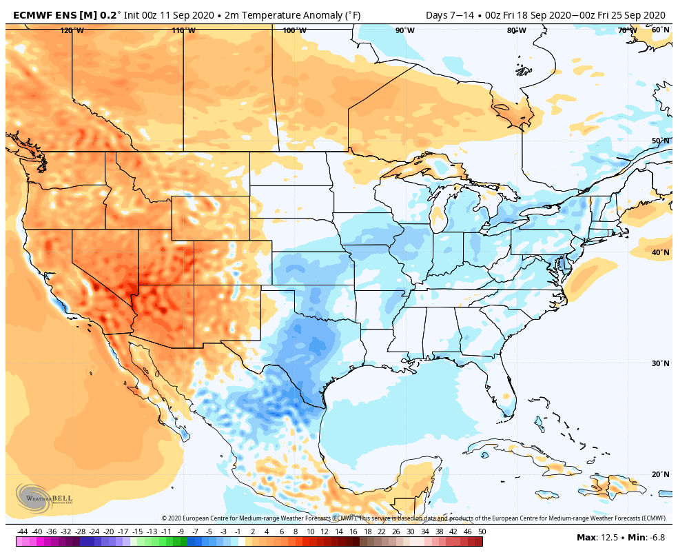
Let’s look at the latest model guidance, starting with the European ensemble:
Week 1 is still warmer than normal across our region, but notice the strong cooling by Week 2 (Sept. 18th-25th time frame).

The GFS ensemble is similar during the Week 1 and Week 2 time frame.

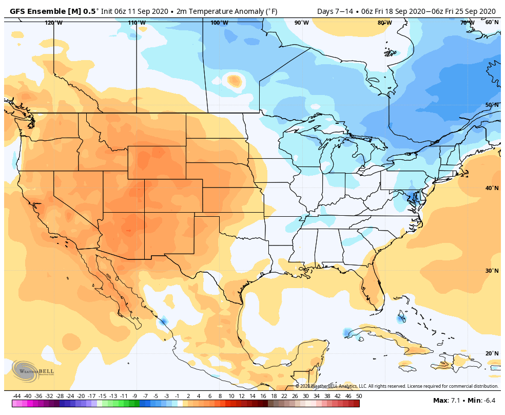
Given that strong PNA by late month, it wouldn’t surprise me to see these anomalies grow cooler as time gets closer during that Week 2 period.
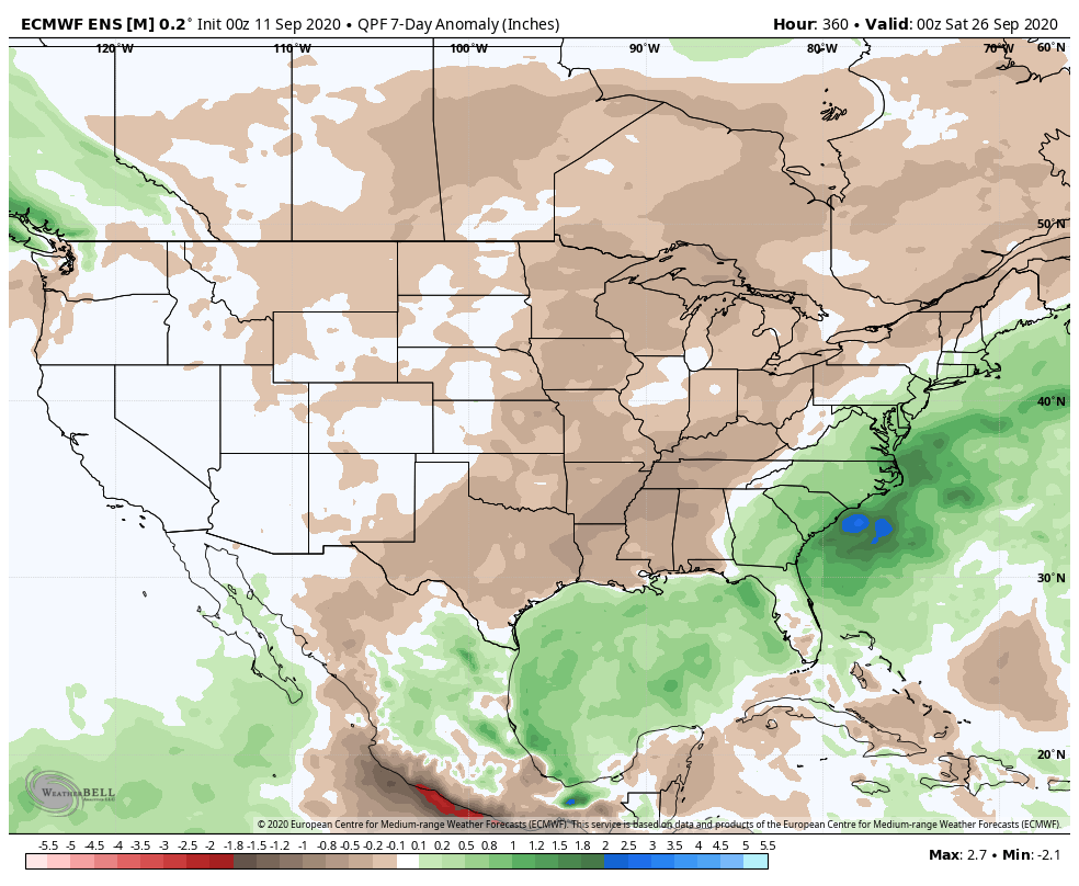
Overall, the pattern continues to look dry, although there should be a better shot of rain/ storms as the cold front moves into the region that will ultimately deliver the much cooler air late month.
Permanent link to this article: https://indywx.com/long-range-update-walking-through-the-back-half-of-september/
Sep 10
VIDEO: Dry Conditions Remain, Overall, Through The Short-Term; Eyeing A Stronger Cold Front Days 8-10…
You must be logged in to view this content. Click Here to become a member of IndyWX.com for full access. Already a member of IndyWx.com All-Access? Log-in here.
Permanent link to this article: https://indywx.com/video-dry-conditions-remain-overall-through-the-short-term-eyeing-a-stronger-cold-front-days-8-10/
Sep 09
Big Temperature Spread Across The State; MJO Connection With The Longer Range Precipitation/ Temperature Pattern…
You must be logged in to view this content. Click Here to become a member of IndyWX.com for full access. Already a member of IndyWx.com All-Access? Log-in here.
Permanent link to this article: https://indywx.com/big-temperature-spread-across-the-state-mjo-connection-with-the-longer-range-precipitation-temperature-pattern/
Sep 08
2 Sides To Every Storm…
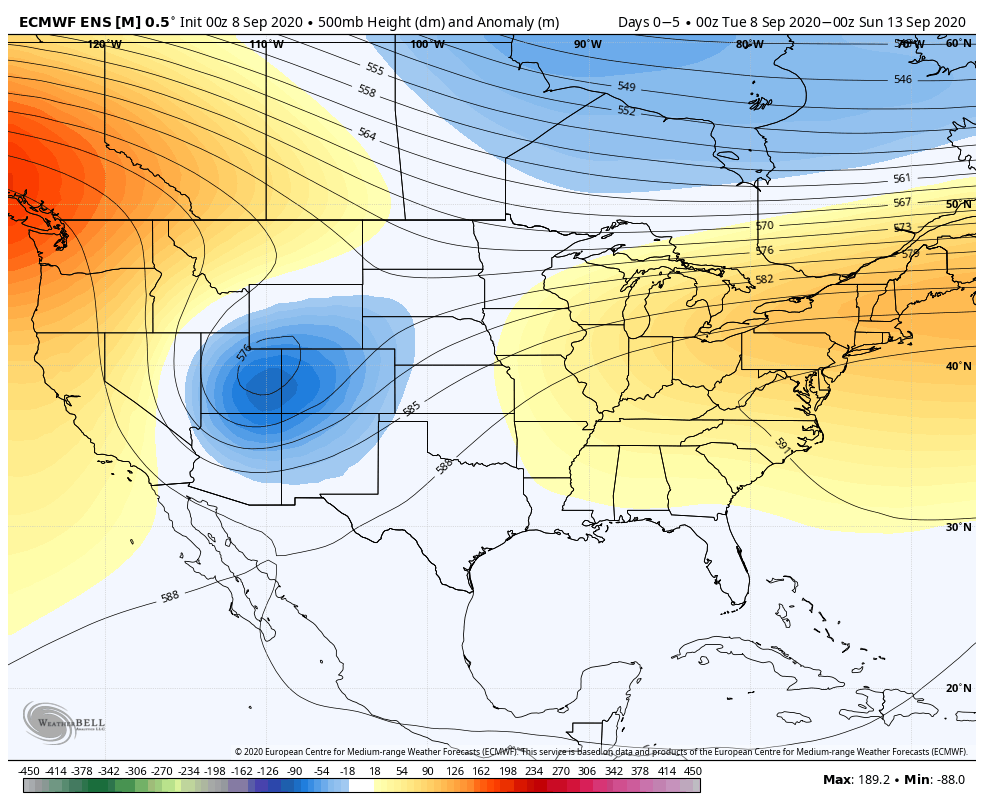
An early taste of winter is descending on the Rockies today (the town of Breckenridge camera will be fun to check in on from time to time over the next 24 hours). Places, such as Denver, that were in the 90s yesterday will fall into the 20s and 30s today with snow.

Note the big spread in temperatures across the country this morning and corresponding 24 hour temperature change:


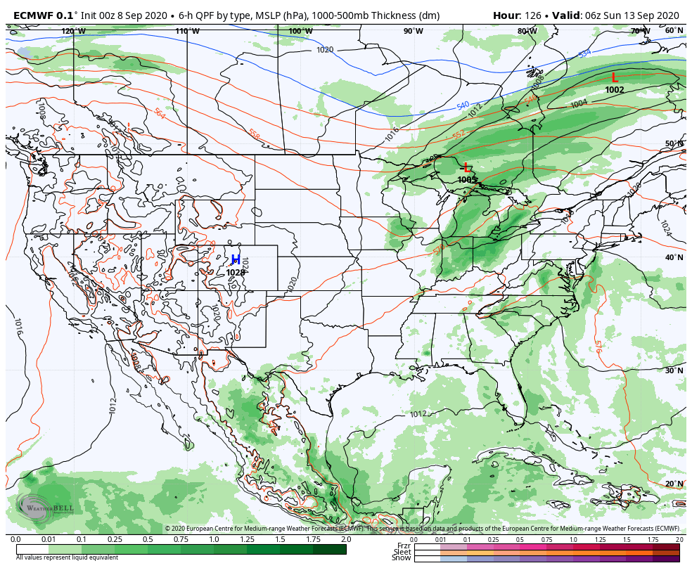
We’ll remain on the mostly dry and warm side of this event until the weekend.
Once the storm system lifts northeast and gets close enough to impact our region, it’ll be in a much weaker state. Scattered showers and thunder are possible over the weekend, but widespread significant rainfall isn’t expected.
After heavy rains fell across north-central Indiana Monday, a much drier theme can be expected throughout the next several days. A widely scattered shower or thunderstorm is possible before Saturday, but most should remain rain-free. Even as the storm system draws closer, weekend rainfall should average only between 0.25″ and 0.50″ for most.

Cooler air (nothing to the extent or magnitude of what our friends out west are seeing) will filter in here late weekend and early next week. Lows into the 50s can be expected with a couple of days of highs in the 70s.
Permanent link to this article: https://indywx.com/2-sides-to-every-storm/