
You must be logged in to view this content. Click Here to become a member of IndyWX.com for full access. Already a member of IndyWx.com All-Access? Log-in here.
March 26, 2019 archive
Permanent link to this article: https://indywx.com/2019/03/26/all-access-video-wet-open-to-the-weekend-on-the-way-changeable-pattern-for-the-1st-half-of-april/
Mar 26
Gorgeous Stretch Of Weather Through Midweek; Weekend Turns Unsettled…
High pressure will supply absolutely beautiful weather around these parts through Wednesday. Look for plentiful sunshine along with moderating temperatures.
While mornings will be chilly, afternoon highs will begin to rise. We’ll be near 50 this afternoon, mid to upper 50s Wednesday, and lower 60s Thursday.
A gusty southwesterly wind will not only push those warmer temperatures into the region, but moisture will also be on the increase. Scattered showers will return to the forecast Thursday afternoon before steadier rain arrives Friday into Saturday as a cold front sags south through the region. A couple thunderstorms are also possible.
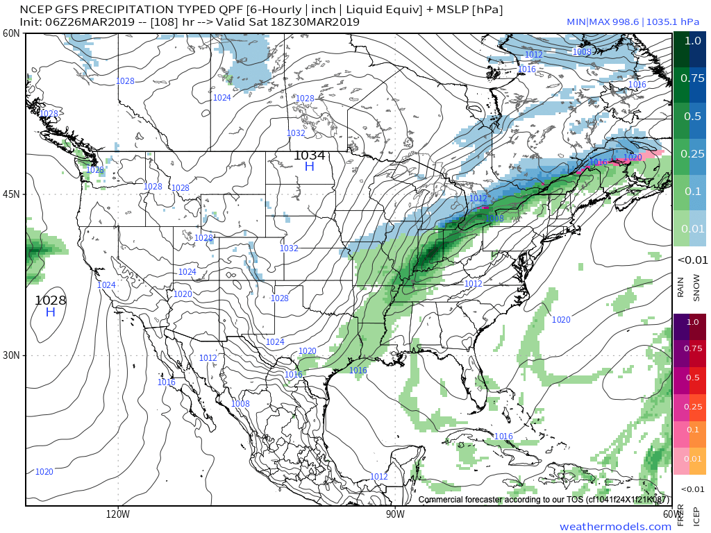
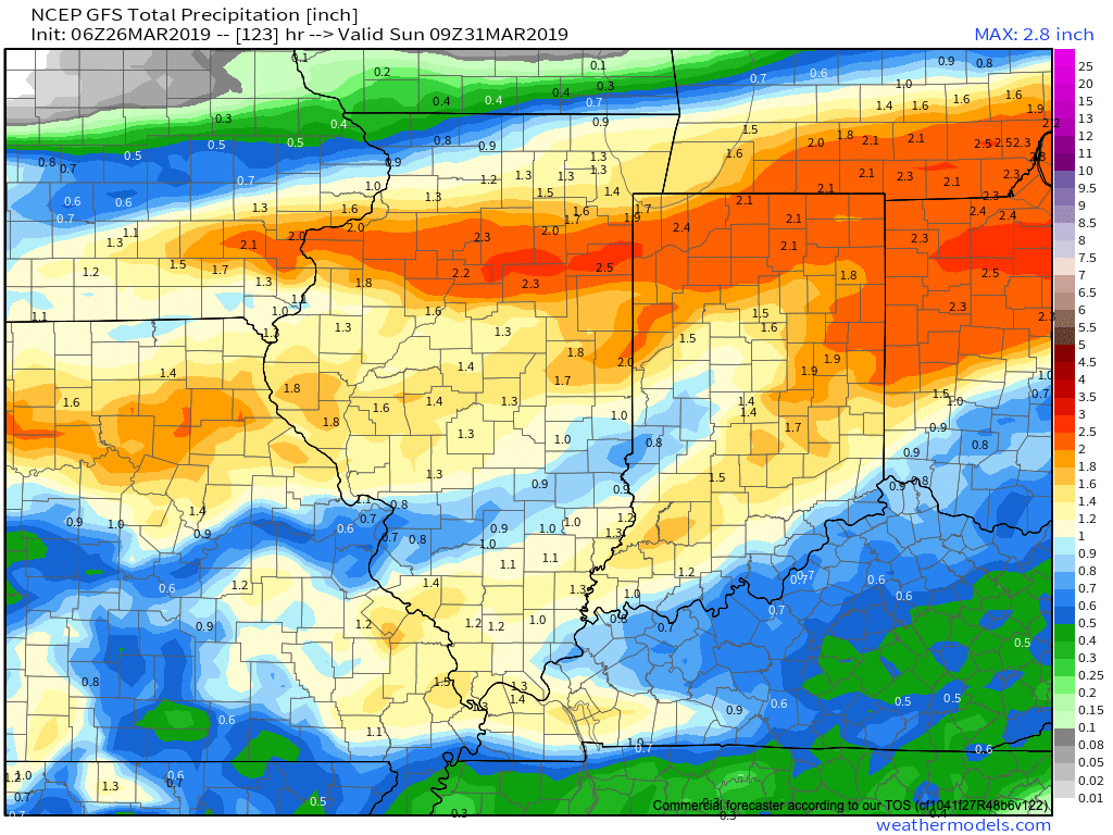
By the time all is said and done Sunday morning, widespread 1″+ rainfall totals are expected with this storm system across central Indiana. Locally heavier totals can be expected.
High pressure will support a drier close to the upcoming weekend, but temperatures will be much colder.

Permanent link to this article: https://indywx.com/2019/03/26/gorgeous-stretch-of-weather-through-midweek-weekend-turns-unsettled/