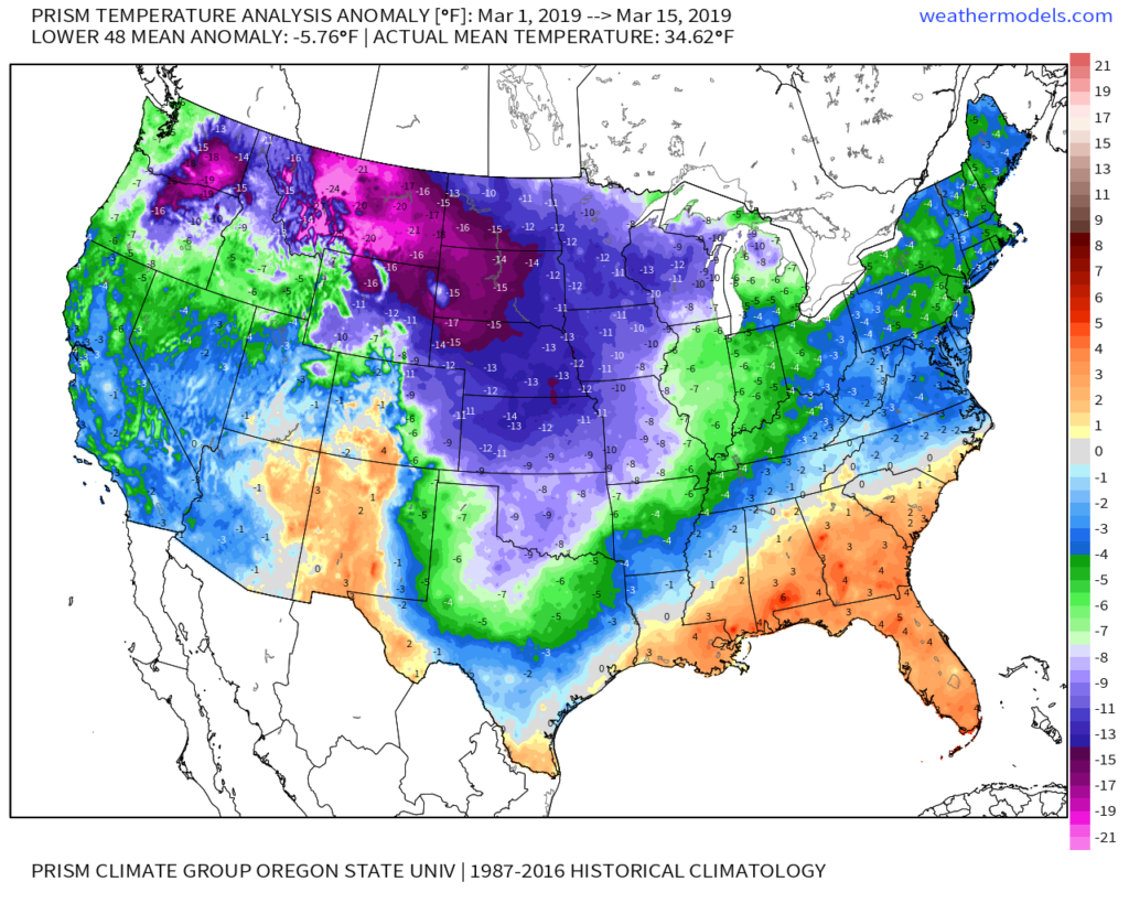
Meteorological Spring has gotten off to a cold start- to the tune of nearly 5 degrees below average at IND through 3/15.
Note the brutal cold across the Northern Plains and Rockies.

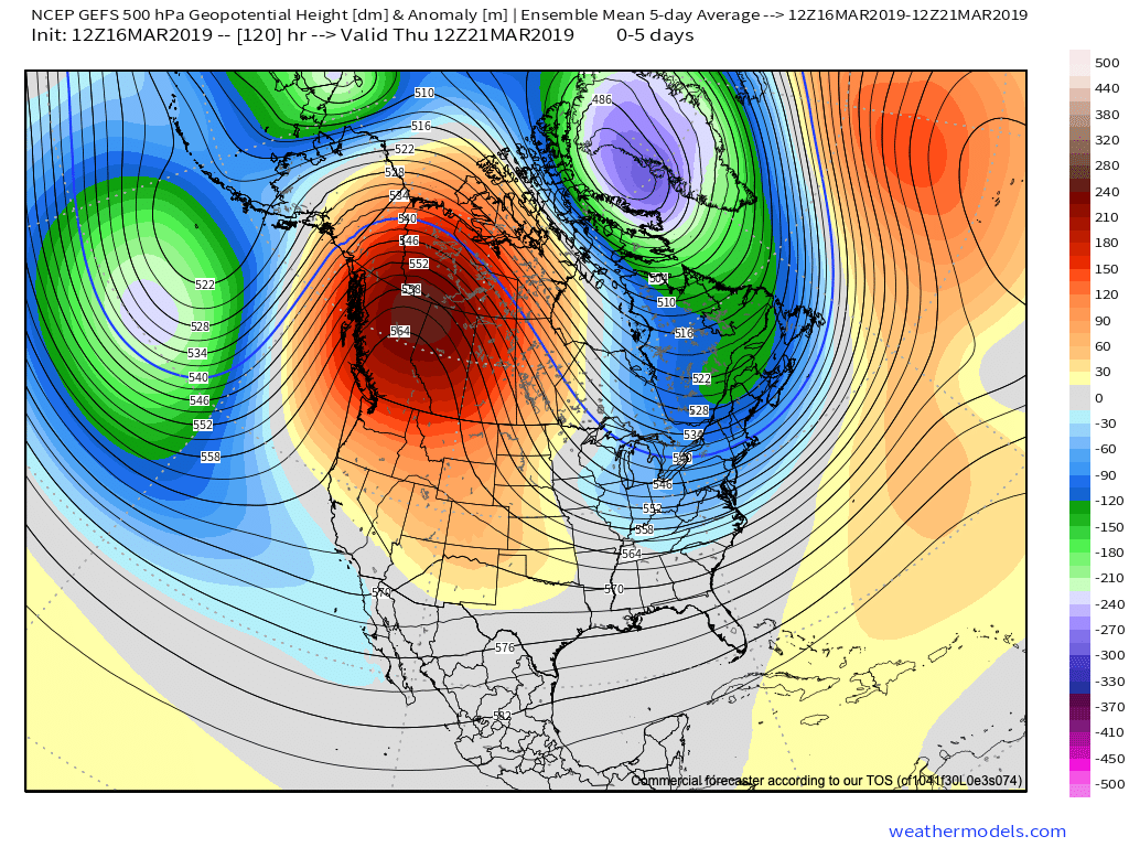
The upcoming week will feature a positive PNA pattern and associated cooler than average theme to open, before beginning to moderate mid-to-late in the work week.

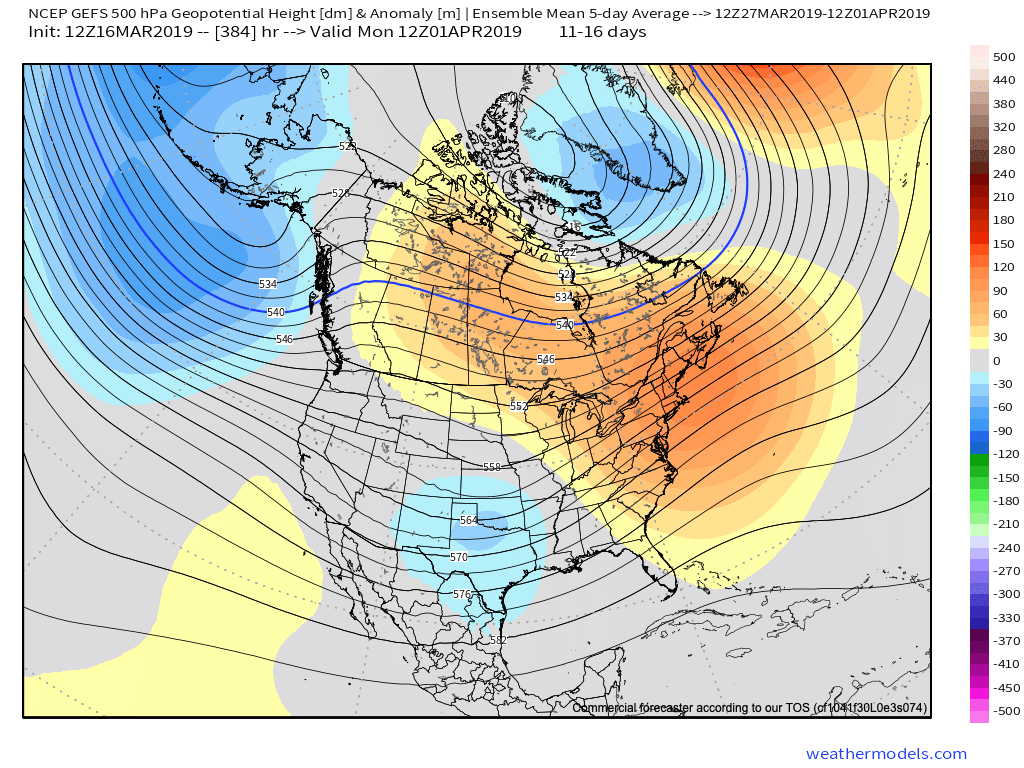
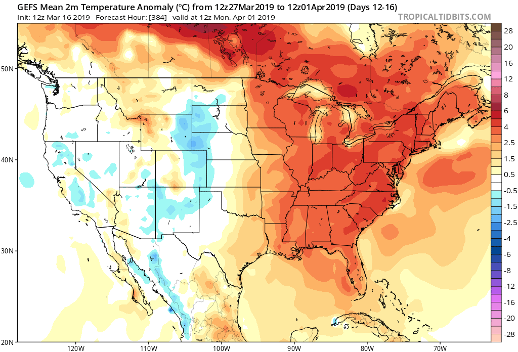
That said, time is limited on the chilly pattern and an overall significant shift to more of a sustained spring-like pattern awaits to close March and as we head into April.

Note the warmth that follows:

This will result in many more days in the 60s and 70s as we put a wrap on March and open April.
While weak systems will continue to impact the area (tomorrow, Wednesday, and again next Sunday), the deeper, moisture-laden storms will take a “backseat” during the fast-moving northwest flow. That begins to change during the last few days of the month and on into April. The latest ensemble guidance sees the return of a more active pattern, likely complete with heavier rain events and the potential of stronger storms.

