
You must be logged in to view this content. Click Here to become a member of IndyWX.com for full access. Already a member of IndyWx.com All-Access? Log-in here.
August 2018 archive
Permanent link to this article: https://indywx.com/video-bumpy-start-friday-early-week-storm-is-followed-by-a-hint-of-fall/
Aug 15
Winter 2018-2019 Notes…
As the calendar turns from July to August, we really begin to increase the amount of research into the upcoming winter season. While still a couple months out from publishing our official Winter Outlook, we did want to touch base on a couple of items.
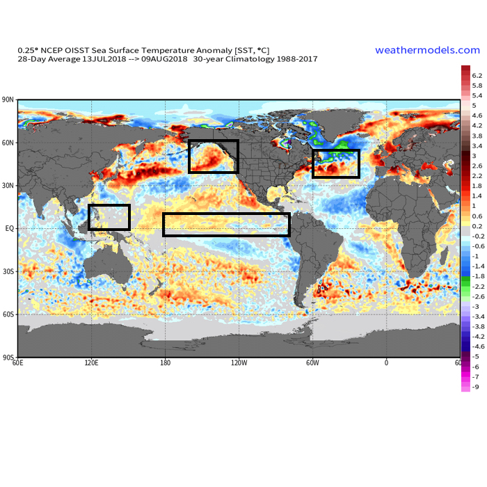 The early “baseline” of our ideas focuses on the likelihood of El Nino returning for the upcoming winter season. As we’ve stated many times in the past, each Nino event is different from one another and other ingredients (highlighted above) can play a significant role in ultimately determining the eventual outcome.
- Weak Modoki (central-based) Nino is expected this winter
- SST configuration in the NPAC (north Pacific) is perhaps the most “intriguing” item at the moment
- Low solar/ QBO
Somewhat of a surprise is that the majority of longer range, seasonal data is aligning for a cold, stormy eastern winter. Included in the cold, stormy camp are the JAMSTEC, European, and CanSIPS. A few snap shots are included below…

JAMSTEC Sea Surface Temperature Anomalies for meteorological winter (December through February).
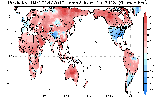
JAMSTEC Surface Temperature Anomalies for meteorological winter.
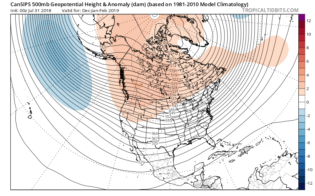
CanSIPS 500mb for meteorological winter.
The CFSv2 is siding with a warmer winter, but it appears as if the model is struggling with the coming Nino and “over-hyping” things. Accordingly, the model results in a blow torch winter. Again, remember, we’re leaning towards a weak, central-based event.

 That sea surface temperature configuration in the northern Pacific argues for western Canada ridging and downstream troughiness such as the JAMSTEC, European, and CanSIPS would imply.
Just wanted to touch base briefly on our early thinking before we release our official 2018-2019 IndyWx.com Winter Outlook in October.
Permanent link to this article: https://indywx.com/winter-2018-2019-notes/
Aug 14
VIDEO: Heavy Rain And Cooler Air On The Horizon…
You must be logged in to view this content. Click Here to become a member of IndyWX.com for full access. Already a member of IndyWx.com All-Access? Log-in here.
Permanent link to this article: https://indywx.com/video-heavy-rain-and-cooler-air-on-the-horizon/
Aug 14
Periods Of Heavy Rain Move In For The 2nd Half Of The Week…
Tuesday will remain dry across central Indiana with plentiful sunshine and warm temperatures. The quiet times will give way to unsettled conditions as we progress through the second half of the week, including periods of locally heavy rain.
This is all part of a pattern that will remain active around these parts. We note the latest European model delivers three storm systems between now and this time next week. Each of these systems will be capable of producing hefty rainfall across the region.
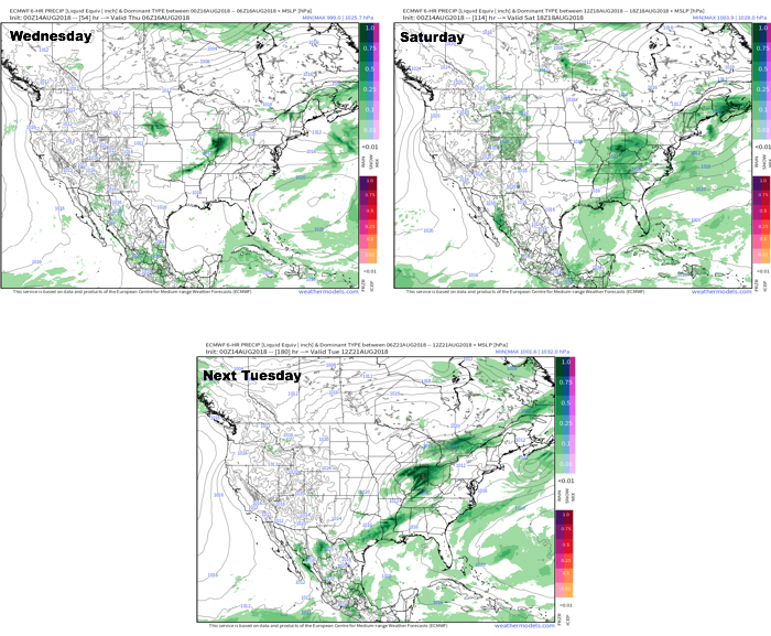 In the more immediate term, after a dry Tuesday, rain will arrive on the scenes Wednesday afternoon.

Forecast radar 1p Wednesday. Image courtesy of weathermodels.com.
Rainfall coverage and overall intensity will increase as Wednesday evening gives way to night, continuing into Thursday morning.
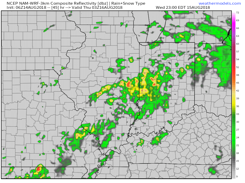
Forecast radar 11p Wednesday. Image courtesy of weathermodels.com.

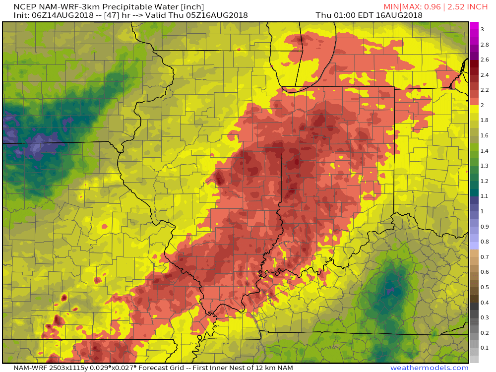
Forecast radar 6a Thursday. Image courtesy of weathermodels.com.
Note the high resolution models suggesting widespread precipitable water values (PWATs) in excess of 2″. This is a significant ingredient that will help fuel heavy rain Wednesday evening into Thursday morning.
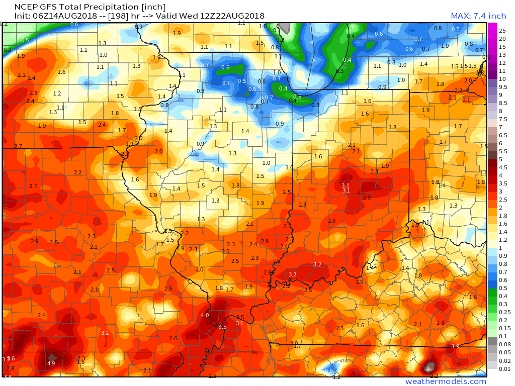
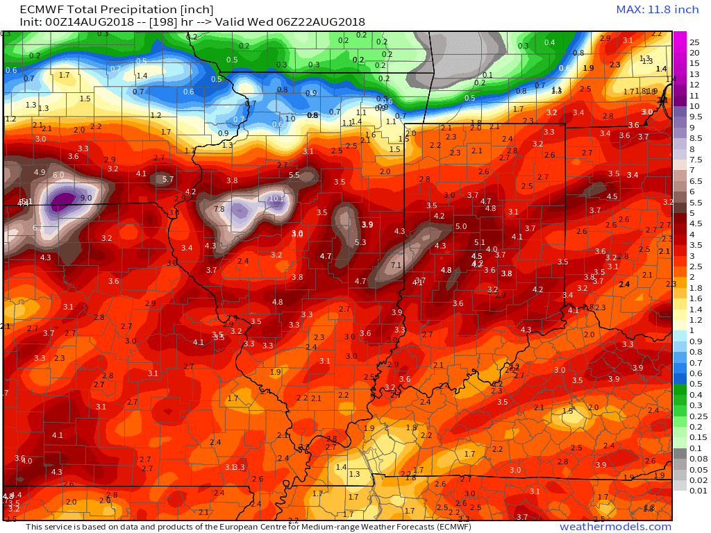
 As mentioned above, a couple of other storm systems promise for continued unsettled times over the weekend and on into early next week. When we total things up by the middle of next week, both the GFS and European model agree on widespread 3″ to 5″ totals.
Permanent link to this article: https://indywx.com/periods-of-heavy-rain-move-in-for-the-2nd-half-of-the-week/
Aug 13
VIDEO: Midweek Storm System Delivers Renewed Heavy Rain Threat…
You must be logged in to view this content. Click Here to become a member of IndyWX.com for full access. Already a member of IndyWx.com All-Access? Log-in here.
Permanent link to this article: https://indywx.com/video-midweek-storm-system-delivers-renewed-heavy-rain-threat/