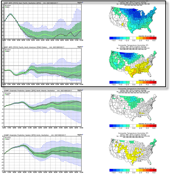
One of the many ingredients we like to throw into the mixing bowl when developing our medium range forecast is the teleconnection breakdown. Many times, the various teleconnections play into themselves and agree, but, at times, conflicting signals lead to a fight. At any given time, one or the other “big boy” teleconnections can take control of the pattern and simply overwhelm. As things stand now, it appears as if the two teleconnections trying to control are the EPO (Eastern Pacific Oscillation) and PNA (Pacific North America pattern), highlighted below.
 As we’d expect, as these two fight it out, a battle will ensue across the central and eventually eastern portion of the country. The negative EPO is a widespread cold pattern, while a negative PNA favors south-central and southeastern ridging (a warmer pattern).
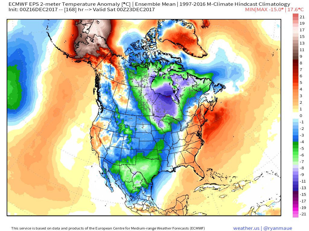
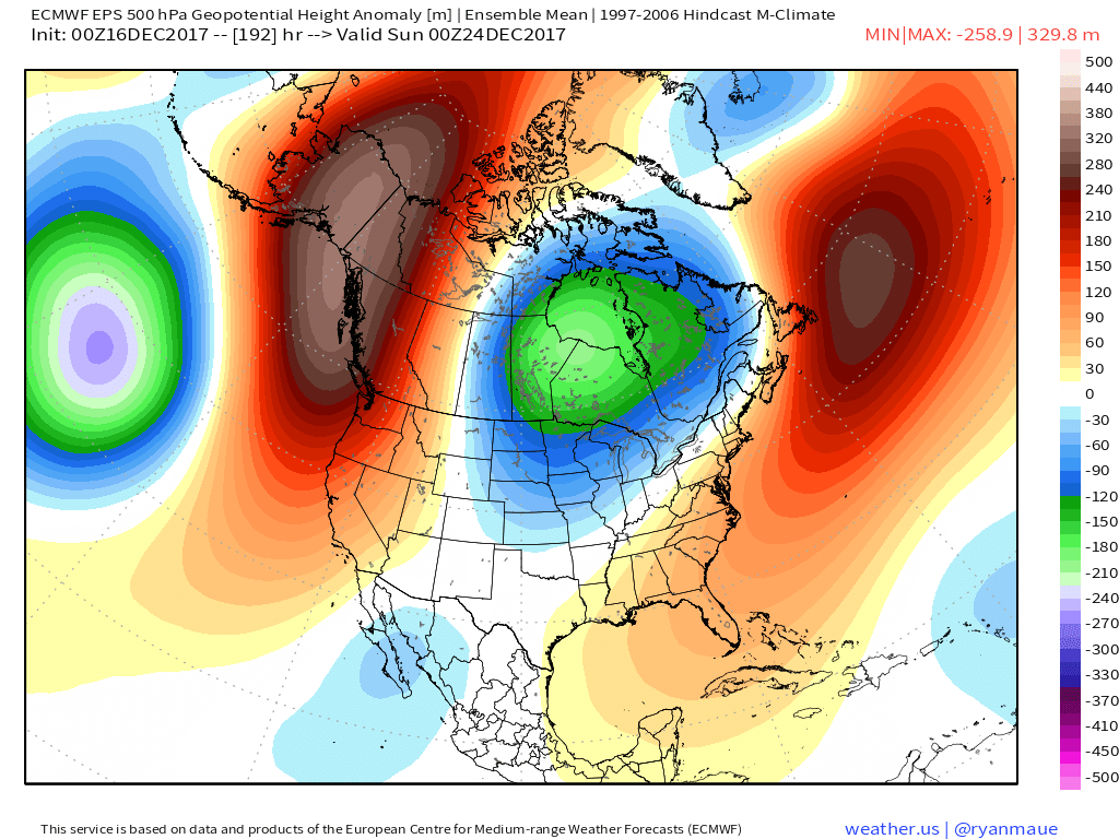
When we look at the latest ensemble data, we see this battle playing out within the modeling.

 Eventually, we expect the deeply negative EPO to take control and overwhelm the pattern with cold. However, as this transition of power takes place, the negative PNA won’t go down without a fight and will likely play a role in the weather leading up to Christmas.
The negative PNA suggests we need to remain on guard for the potential of an interior snow/ ice event around Christmas. As we’ve been mentioning, from this distance there’s no way to say whether this is an impactful wintry event for our region, or just to our north or south. We should be able to become more detailed within the next few days…
