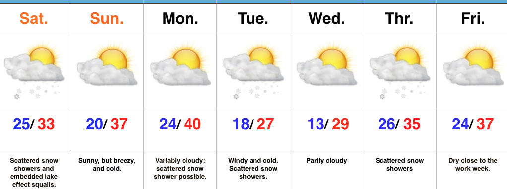
 Highlights:
- Lake effect squalls this afternoon
- Another arctic shot early next week
- Light snow chances
Hope You Like It Cold…Upper level energy is moving through the region this morning and is responsible for the scattered snow showers. Dry air “ate away” at the initial moisture and as a result we’re generally only looking at a dusting for most of central Indiana. The exception to that will be a narrow, but potentially intense lake effect snow band and embedded squalls that set up shop this afternoon. Under this band, an inch or two of snow will quickly accumulate.
Reinforcing cold, arctic air will pour into the state Monday night and Tuesday and will be accompanied by scattered snow showers. Another fast-moving disturbance will provide a shot of snow showers Wednesday night into Thursday.
All-in-all, no significant snow is on the horizon, but that may begin to change as Christmas nears. After brief moderation in the pattern next weekend, we’ll reload the cold pattern and likely see a stormy regime unfold, as well. Modeling suggests the southern stream will become more active in the weeks ahead…
Upcoming 7-Day Precipitation Forecast:
- Snowfall: 1″
- Rainfall: 0.00″
