 Highlights:
- Warm open to the work week
- T-storms return
- Weekend cold front
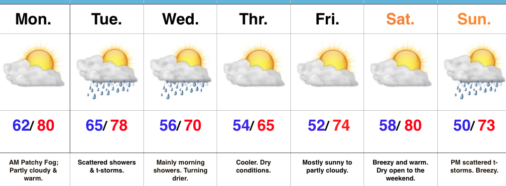
Active Times This Week…With the exception of patchy morning fog, the work week will get off to an uneventful start. Unseasonably warm conditions will continue with sunshine.
A storm system will move out of the Mississippi Valley and into the Ohio Valley Tuesday into Wednesday. This will help spread an initial round of showers and thunderstorms across central Indiana Tuesday morning, followed by more widespread showers and embedded thunder Tuesday evening into the predawn hours Wednesday. Drier and cooler air will return Wednesday afternoon and Thursday is shaping up to be the coolest day of the week (very close to our average high of 66° for the date).
The cool air won’t last long as a southerly air flow returns in advance of our next storm system. Saturday will be dry and breezy before clouds increase Sunday and scattered thunderstorms arrive Sunday afternoon and evening. A more significant shot of cool air will invade early next week behind the frontal passage.
Upcoming 7-Day Precipitation Forecast:
- Snowfall: 0.00″
- Rainfall: 0.50″ – 1.00″
