 Highlights:
- Dry open to the work week
- Unsettled times return
- Cooler air heading into the weekend
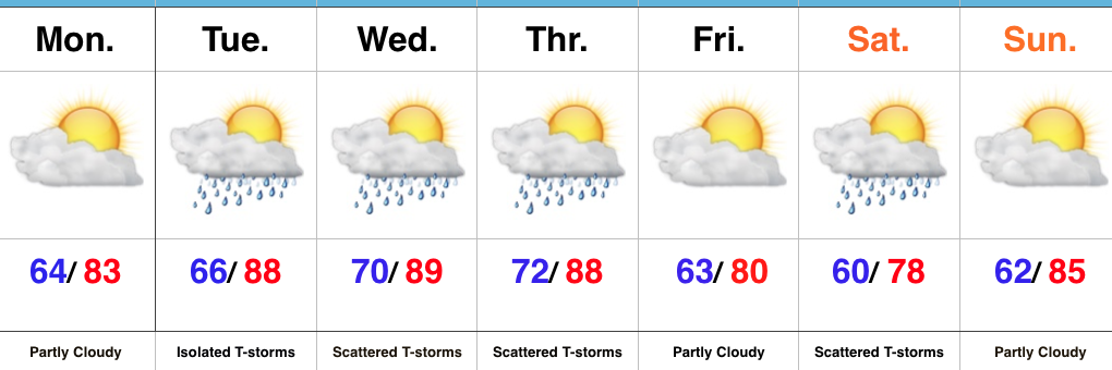
Storm Chances Begin To Increase…While southern portions of the state will get wet today, dry air should result in a rain-free Monday here across central Indiana. That will begin to change later this week as moisture returns and that muggy summer feel develops for midweek. In addition to the increasingly humid nature to our airmass, a cold front will approach from the west. Coverage of storms tomorrow should remain few and far between (isolated), but overall coverage will increase Wednesday into Thursday (scattered to numerous).
The cold front will sweep to our east Thursday night and result in a beautiful close to the work week, complete with cooler temperatures and lower humidity levels. The weekend will feature a disturbance dropping in from the northwest and this will be sufficient enough to kick up scattered showers and thunderstorms Saturday afternoon and evening before dry times return Sunday.
Upcoming 7-Day Precipitation Forecast:
- Snowfall: 0.00″
- Rainfall: 0.50″ – 1.00″
