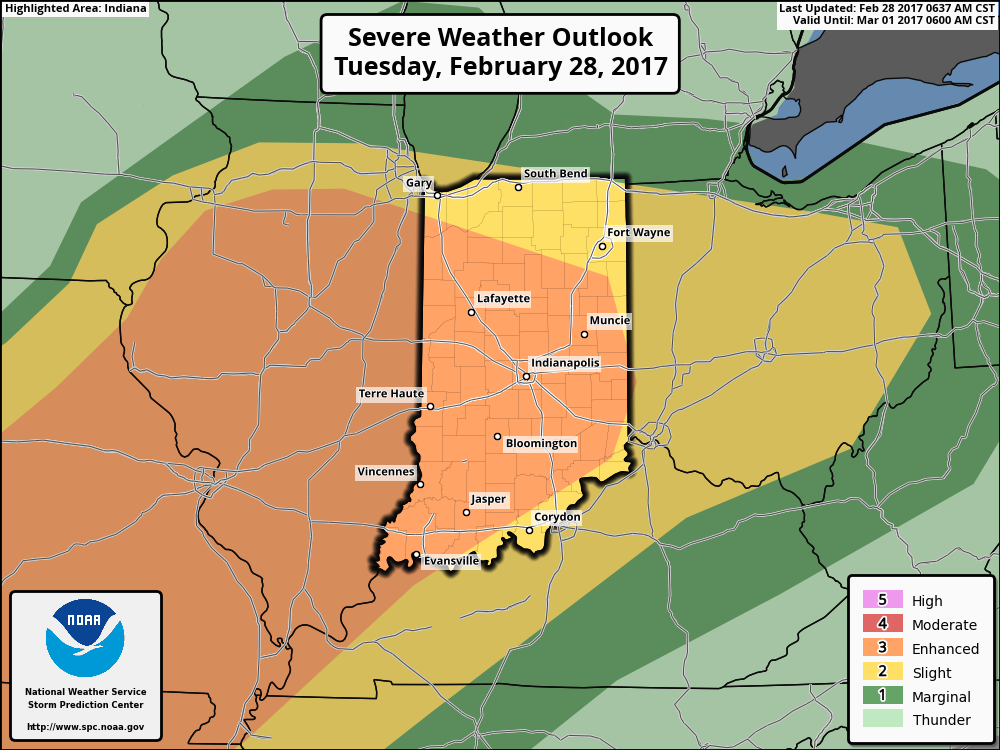
The updated outlook from the Storm Prediction Center shows an expanded “Enhanced Risk” to encompass all of central Indiana.
 This morning’s showers and thunderstorms were the first of (3) rounds of storms expected today. Ironically, most of the daytime hours should be rain and storm-free. We’ll note scattered showers and thunderstorms across northern portions of the state this afternoon, as a warm front continues to lift north.
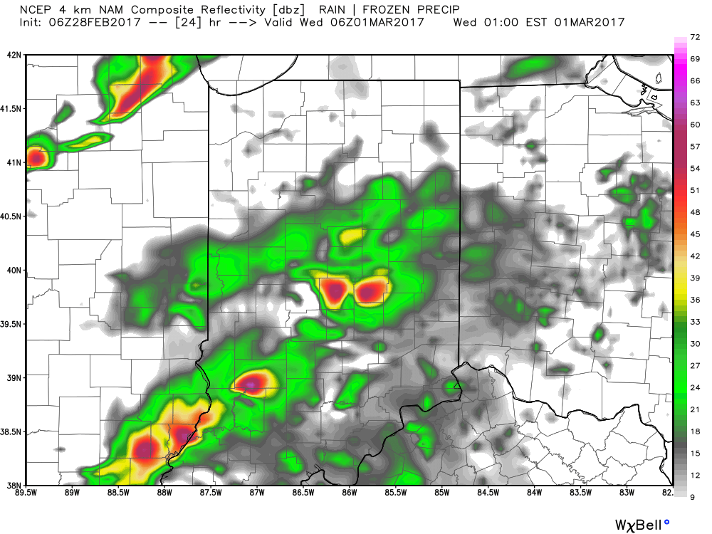
As we progress into the overnight hours tonight into Wednesday morning, that’s when we’re most concerned for potential severe weather impacts to central Indiana. Short-term, high resolution, modeling continues to suggest individual storms (perhaps super cells) will develop around midnight across the region. These would include all modes of severe weather, including the potential of large hail and a tornado.
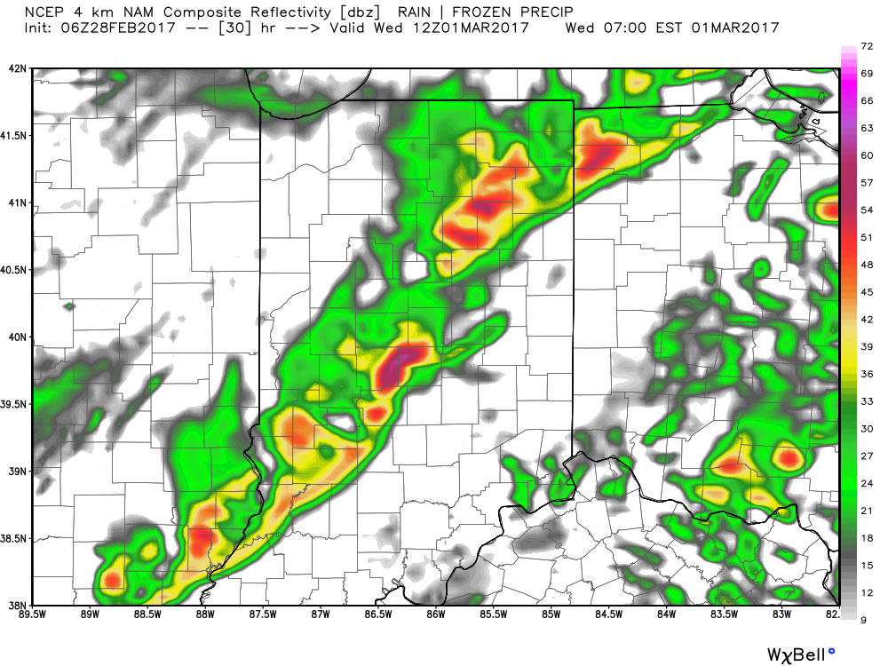
 Finally, our severe weather threat will come to an end with the passage of a squall line during the pre-dawn hours Wednesday morning. The biggest threat with this line of storms will be damaging wind, but a quick spin-up tornado can’t be ruled out either.
 With the majority of this event occurring when most are sleeping, please have a way to get the latest information on watches and warnings that are sure to come tonight. We highly encourage everyone to have a weather radio, and be sure to set the alert mode to “on” before bedtime tonight.
We’ll be back this evening with a fresh 7-day update! Make it a great Tuesday!
