February 23, 2017 archive

Don’t Get Lulled To Sleep…

Overall, as mild as this winter has been (particularly on the snow front), it’s easy to think we’re done with wintry precipitation- especially after this stretch of 60°+ weather.  That said, we still have to get through March, and as long-time Midwesterners know, the third month of the year can yield some wild swings, including late season wintry events.  Yes, including even the mild winters of the past…

Modeling is beginning to show at least a shift towards unseasonably cold conditions as we progress through the first couple of weeks of March.  In the face of the prolonged stretch of April-like warmth of late, this will be a shock in and of itself.
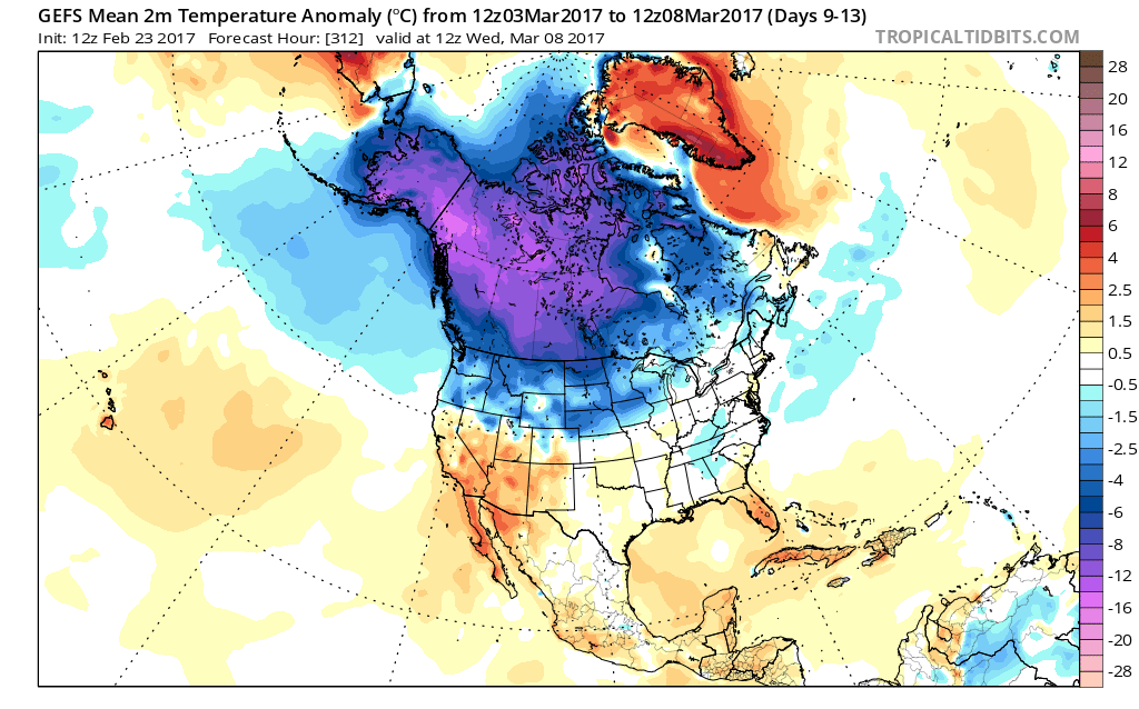
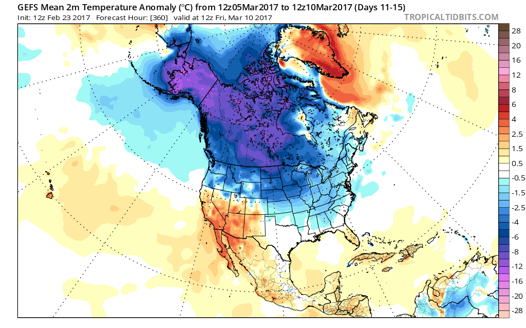
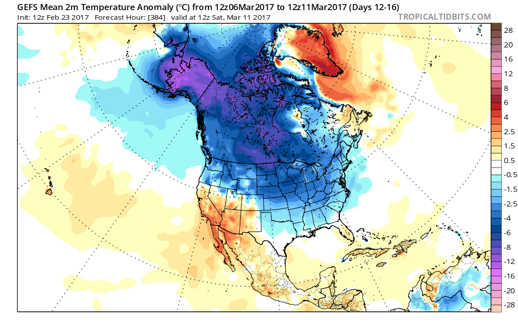
Longer-term indications would suggest the period of chilly, wintry-like, air has a window to take over, but the window is small.  Trends would seem to yield warmer solutions once past mid-month, with perhaps a “stick and hold” spring regime taking over.

Before that, we have a couple of weeks in front of us to open March that won’t only provide out-of-season cold, but we must also pay close attention to the potential of northwest flow clipper systems.  There’s no reason to get detailed and specific from this distance, but the pattern suggests we need to be on the look-out for the potential of one or two snow makers as we move through the first couple weeks of the month.  March clippers can be a headache as the March warmth south of the track of the system can help add energy and turn a weak event into an impactful snow event to the north of the low’s track.  Hoosiers don’t have to be reminded how significant March clippers can be at times.  Is this the year we have to deal with one or two of these stronger clippers?  Wouldn’t it be ironic after such a mild winter thus far?  Don’t let Mother Nature “lull” you to sleep…

Permanent link to this article: https://indywx.com/2017/02/23/dont-get-lulled-to-sleep/

Looking At Friday’s Severe Set-Up…

An updated 7-day forecast will hit later today.  This morning we wanted to take the time to dig in a little deeper on Friday’s severe weather threat.

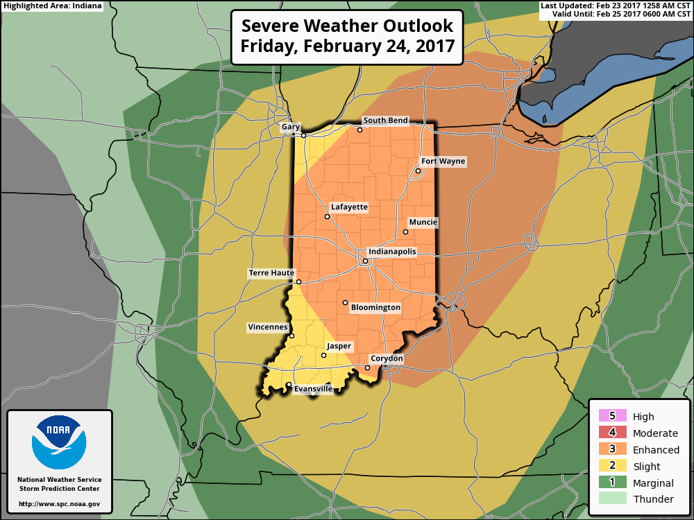
Severe Weather Outlook:

This morning the latest update from the National Weather Service Storm Prediction Center has expanded the ‘Enhanced Risk’ of severe weather Friday.  This includes all of central Indiana.

Summary:

A sub 1000 mb surface low pressure system will track northeast from northern MO (Friday morning) to central MI (Saturday morning).  Ahead of this, a warm front will lift north through central IN and into lower MI Friday afternoon.  A strong cold front will be located near the MS River Friday morning and barrel eastward, sweeping the state Friday night.

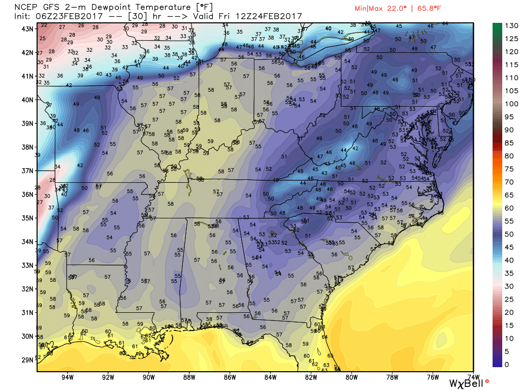
Unseasonably warm and moist air will be drawn northward and encompass the entire region Friday.  Forecast highs should break records tomorrow and be in the lower-middle 70s for most of the region (thinking we see plentiful sunshine during the daytime hours).  Dew points will near 60°. Considering this is late February, those are impressive ingredients coming into play.  The added sunshine tomorrow is actually a bad thing as it will add “fuel to the fire,” so to speak, and help play a role in potentially explosive thunderstorm development Friday evening.

Forecast dew points will reach around 60 degrees across the region Friday afternoon.

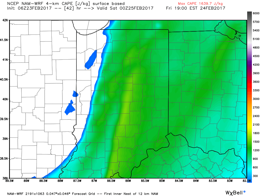
Surface-based CAPE (Convective Available Potential Energy) is modeled to reach between 1200-1600 J/kg Friday evening across the region.

Threats and Timing:

Most of Friday is going to be quiet, but it’s as we move into Friday afternoon and evening that we’ll need to keep close eyes to the sky and radar.  The potential exists for individual super cells to develop out ahead of an eastward-advancing line of thunderstorms Friday evening.  All modes of severe weather are possible Friday evening, including large hail, damaging winds, and tornadoes.  As of now, we bracket the hours of 4p and 10p for the period where severe weather may be impacting portions of central IN.

As mentioned yesterday, we highly recommend reviewing your family’s severe weather safety plan and ensure weather radios are charged with warning modes “on” Friday.

Permanent link to this article: https://indywx.com/2017/02/23/looking-at-fridays-severe-set-up/

IndyWx.com