 Highlights:
- Unseasonably warm weather continues for now
- Much cooler weekend ahead
- Unimpressed with rain coverage
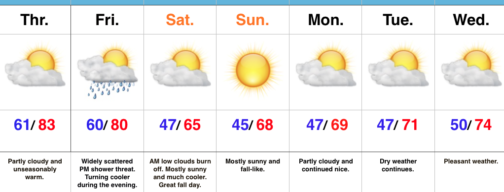
Feeling More Like It Should By The Weekend…A SW air flow will continue to pump unseasonably warm air into the Mid West as we go through the back half of the work week. Dry conditions will remain before a cold front serves up a widely scattered shower chance Friday afternoon. That cold front will sweep through the state Friday evening and much cooler air will spill into the region. Despite some low clouds and areas of fog Saturday morning, the weekend should feature lots of sunshine along with cool, crisp air. It’ll be a classic fall weekend in central IN. Make plans for a bonfire or to visit one of the many popular corn mazes throughout the region.
As we rumble into early next week, high pressure and pleasant weather conditions will remain.
In the tropics, Hurricane Matthew continues to be the headline. Our thoughts and prayers are with the Bahamas tonight as Matthew roars through. Tomorrow night and Friday will then feature Matthew coming dangerously close to the east coast of FL. Landfall or not, those living along the east coast of FL should brace for a long duration and damaging erosion event, along with hurricane conditions.
Upcoming 7-Day Precipitation Forecast:
- Snowfall: 0.00″
- Rainfall: 0.10″
