 Highlights:
- Scattered Showers
- Saturday storm chance
- Early fall feel on deck
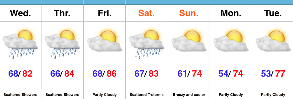
Drier Overall…It’s been a wet few days across the region. While we’ll begin to transition towards a drier regime to wrap up the work week, scattered showers and storms will remain in the forecast today and Thursday. Best concentration of storms will be located across north-central IN this evening. Rain/ storm coverage will be even less on Thursday.
Our next item of interest will arrive on the scene in the form of a cold front Saturday. Showers and a couple gusty thunderstorms are a good bet Saturday afternoon/ evening as the cold front sweeps through the state. Our winds will then shift to the northwest and help usher in a much cooler, drier time of things for the second half of the weekend. Stepping outside Sunday morning will provide a definite hint of fall, complete with a breezy NW wind.
Early next week will continue to feature dry and unseasonably cool times before we turn our attention to what could potentially be a heavy rain maker setting up just past the 7-day period…
Upcoming 7-Day Precipitation Forecast:
- Snowfall: 0.00″
- Rainfall: 0.50″-0.75″
