 Highlights:
- Tropical feel
- Heavy weekend rains
- Unsettled early next week
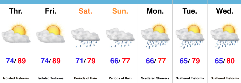
Zoning In On Heaviest Rains…It’s about as humid as it can get across central IN. “Air you can wear” is the appropriate way to describe this humidity and overall sultry feel. As we’d expect with this tropical air mass, isolated to widely scattered strong storms could pop at any point and result in locally heavy rain. We’ll “rinse and repeat” today’s forecast to wrap up the work week.
Attention then shifts to a widespread soaking rain event this weekend as two main players “team up” to produce a localized flood threat. A cold front will sag into central IN while remnant tropical moisture slowly moves north and eventually curls northeast. Precisely where the front stalls in response to the tropical low moving north will be where heaviest (4″+) rains set up. Thinking this morning places the greatest risk somewhere between Indianapolis and Louisville, but we caution that we still want to see a couple more model runs before settling on a given area. Unsettled weather will likely continue into early next week as tropical moisture slowly exits stage right.
Longer term, indications point towards an overall cooler, wetter, back half of August. Times- they are ‘a changing!
Upcoming 7-Day Precipitation Forecast:
- Snowfall: 0.00″
- Rainfall: 2.00″-4.00″
