 Highlights:
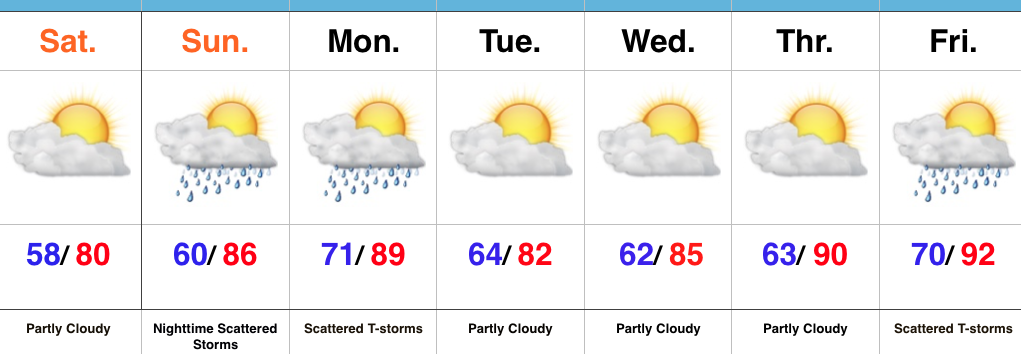
- Dry and pleasant weekend
- Storms return late Sunday night into Monday
- Heat builds late next week
Refreshing Feel…A weak disturbance is tracking through central IN this morning with a band of clouds and a couple sprinkles. That said, sunshine will quickly return late morning into the afternoon and set up a beautiful day, along with pleasant temperatures and low humidity.
Our next round of storms will arrive from the NW late Sunday night into Monday. A few of these storms could be strong to severe and also include locally heavy rain.
Modeling disagrees on the magnitude of cooling and drier weather behind Monday’s front. The more aggressive GFS would imply another push of pleasant air for a couple days Tuesday-Wednesday, while the European isn’t as bullish. For now, we’ll split the difference and revisit tomorrow.
One thing that modeling does agree on is building late week heat. Expect a hot, humid close to the work week.
Upcoming 7-Day Precipitation Forecast:
- Snowfall: 0.00″
- Rainfall: 0.75″-1.25″
