 Highlights:
- Pleasant air in the short-term
- Storm chances Friday
- Widespread soaker
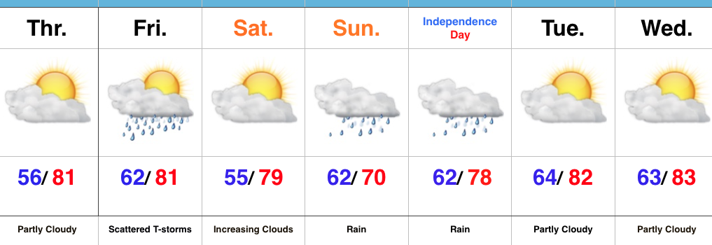
Looking Increasingly Wet For The Holiday Weekend…High pressure will supply continued dry times Thursday, but clouds will increase during the evening and give way to scattered showers and embedded thunder Friday. This doesn’t look like a huge deal, but don’t be surprised by rain and/ or a clap of thunder to close the work week. That said, there will be more dry time than wet Friday.
As we rumble into the long Independence Day weekend, confidence continues to increase for a widespread soaking rain to develop. Thankfully, Saturday still looks mostly dry, but we think clouds will be on the increase late in the day, followed by rain overspreading the region from west to east as Sunday afternoon approaches. Widespread rain should continue into Monday. We still have questions on timing and precise placement of heaviest rains (2″+ totals), but it’s safe to say most, if not all, of the region can expect a long-duration rain event developing Sunday. Stay tuned. It’ll also be cool. Areas where heaviest rains set up Sunday likely won’t climb out of the 60s.
Drier air will return late Monday into the middle of next week, but we caution that another wet weather maker appears to have eye on the region beginning next Thursday.
Upcoming 7-Day Precipitation Forecast:
- Snowfall: 0.00″
- Rainfall: 1.5″-2.5″
