 Highlights:
- Needed quiet time today
- Stormy mid week; high-impact severe event possible
- Drier to close the week
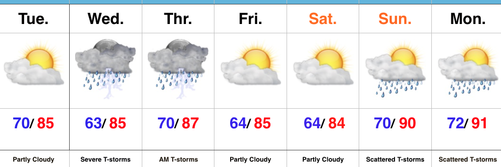
All Eyes On Wednesday…Today is an easy one. Drier air will move into central parts of the state as we progress into the afternoon and evening hours, and we’ll also enjoy lots of sunshine. It’ll feel fantastic out come evening!
All eyes will remain locked in on Wednesday as we monitor the prospects of potentially two rounds of thunderstorms. Timing and track will have to be fine tuned, but we think the day offers up the possibility of morning thunderstorms, followed by a second round of storms during the afternoon and evening hours. All modes of severe weather are in play, locally, Wednesday- particularly damaging wind. Additionally, localized flash flooding will be likely where storms train. It’ll be an important day to have a means to get the latest watches and warnings. It wouldn’t be a bad idea to review your severe weather safety plan with your family at some point today.
After morning storms Thursday we should dry things out during the second half of the day and on into the first half of the weekend. Storm chances return Sunday-Monday.
Upcoming 7-Day Precipitation Forecast:
- Snowfall: 0.00″
- Rainfall: 1.5″-2.5″ (locally heavier totals)
