 Highlights:
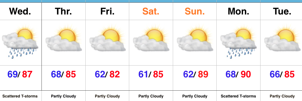
- Scattered strong-severe storm threat Wednesday
- Drier close to the week
- Next front arrives Monday PM
Keeping An Eye On Wednesday’s Storm Threat…Today’s rain numbers weren’t uniform in the least, but several neighborhoods picked up beneficial rains of over 1.5″. Wednesday will also feature the threat of showers and thunderstorms (again, some with locally heavy downpours). Some of these storms could also reach strong to severe levels during the afternoon/ evening, particularly if morning rain doesn’t “get in the way.” We’ll watch data overnight and update accordingly come morning.
We’ll turn drier and slightly cooler to close the work week and head on into the weekend. The heat will begin to crank again early next week, with highs around 90 Sunday and Monday. Our next weather maker looks to arrive Monday evening as a cold front pushes in from the north. We’ll feature shower and thunderstorm chances in our Monday PM forecast.
Upcoming 7-Day Precipitation Forecast:
- Snowfall: 0.00″
- Rainfall: 0.50″-1.00 (locally heavier totals)
