 Highlights:
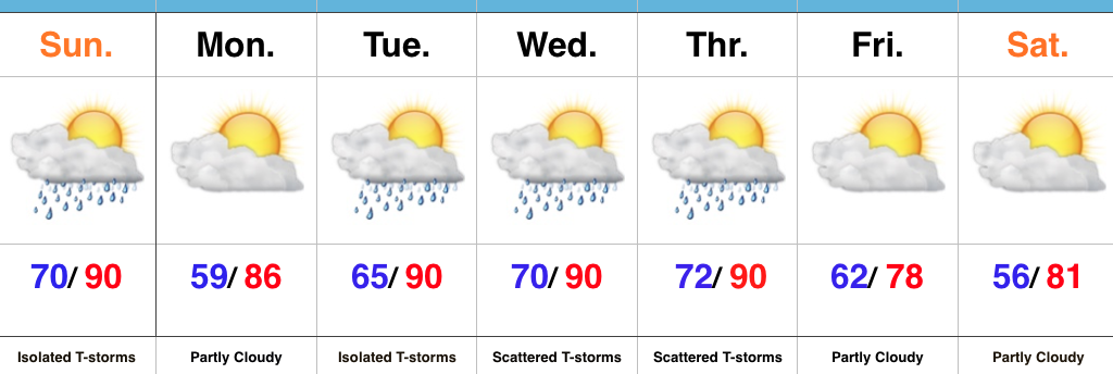
- Storm threat over the southern half of the state
- Turning less humid
- Scattered mid week storms
- Cooler to close the week
Another Hot One…A weak frontal boundary will slip through central IN this afternoon and evening and serve as a “trigger” for isolated to widely scattered thunderstorms for central and southern parts of the state. We’ll also turn less humid this evening into Monday.
Warmth and humidity surge again Tuesday and there will be times of scattered showers and thunderstorms through Thursday. Uniform rains aren’t expected, but there will be some localized heavy downpours. Remember the saying of “haves and have nots.”
A cooler northeasterly air flow will arrive to “freshen things up” a bit as we close the week.
Upcoming 7-Day Precipitation Forecast:
- Snowfall: 0.00″
- Rainfall: 0.25″-0.75″
