Highlights:
- Increasing sunshine today
- Rain/ embedded thunder end as snow Tuesday
- Accumulating mid week snow
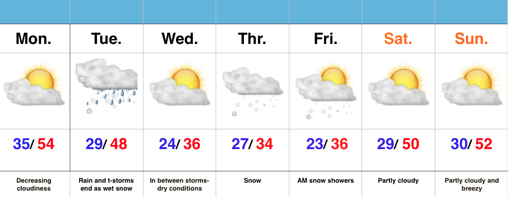
Busy Pattern This Week…After a windy and warm Sunday, a thin band of showers and embedded thunder moved through central IN last night. This was in association with a weak frontal boundary that will provide a dry start to the work week. Despite a cloudy start, sunshine should quickly develop as clouds decrease.
Quiet times won’t last long as our next storm system delivers showers and thunderstorms Tuesday. Colder air will quickly punch in here Tuesday afternoon and evening helping precipitation transition to wet snow before ending. We think the significant accumulations will remain north of central IN, but we’re keeping a close eye on things, nonetheless. Expect an evening update.
Busy times remain in the mid week period as a wave of low pressure spreads widespread snow across the area Thursday. Early indications would suggest this may be a plowable snow for some of the region.
As it stands now, moderating conditions and increasing sunshine are expected heading into next weekend. Longer term, a big ridge should develop across the area later next week. It’s a pattern supportive of anomalous warmth to the tune of 75-80 degrees….

