You must be logged in to view this content. Click Here to become a member of IndyWX.com for full access. Already a member of IndyWx.com All-Access? Log-in here.
February 1, 2016 archive
Permanent link to this article: https://indywx.com/2016/02/01/monday-evening-video-update-6/
Feb 01
Strong To Severe Storms Tuesday PM…
- Morning fog in spots
- Strong Tuesday storms
- Mid week snow showers
- Quiet end to the week
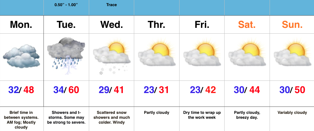
Strong To Severe Storms Tuesday Afternoon-Evening…Today is a day in between storm systems. We’ll deal with morning fog in spots (some freezing fog is being reported north and northwest of Indy this morning) and mostly cloudy skies. It’ll be colder when compared to the weekend, but still warmer than average.
All eyes for this forecast package remain locked on Tuesday. It’s still shaping up to be an active day, with strong to severe thunderstorms likely. We bracket 3p-11p for the most likely time frame of thunderstorms across central IN. Damaging straight line winds are of greatest concern, but caution a few embedded cells will be capable of producing a tornado.
Things turn much colder Wednesday and with lingering moisture, a few snow showers will be a good bet.
We turn much quieter to wrap up the week and head into Super Bowl Sunday.
Permanent link to this article: https://indywx.com/2016/02/01/strong-to-severe-storms-tuesday-pm/

