- Brief thaw
- Coldest air of the season awaits
- Snow squalls accompany the arctic air
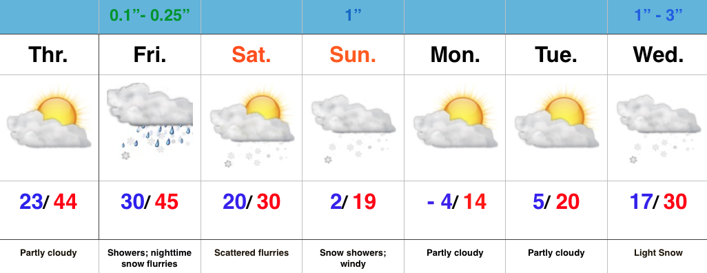
Enjoy Today; New Polar Plunge Coming…While we wait on the next severe blast of cold air, enough SW air flow will help boost temperatures to above normal levels today and Friday. We’ll introduce a few showers into the Friday forecast, so today is the “pick of the week!” Find a way to enjoy it!
What at one time looked like a significant storm system Friday into Saturday is now anything but. A very weak area of low pressure will provide showers Friday before transitioning to snow flurries as precipitation ends. Precipitation amounts will be light with this system.
Colder air begins to return tomorrow night and Saturday, but it’s Saturday night and Sunday that the next arctic invasion will get underway. By now you know the deal- we’ll also contend with snow showers and embedded heavier squalls, along with very gusty winds.
A frigid opening to next week will take place before we eye our next snow maker the middle of next week.

