Before we get into the thinking behind our set-up for Christmas, we want to be very clear in saying the overall warm pattern will continue as we head through the holiday season and into early parts of 2016. We do see signs of changes brewing that could (and should) lead to a dramatic flip of the coin for the second half of winter. With a weakening Nino, it’s also likely that the cold and wintry changes last deep into spring this year, but that’s for another discussion down the road.
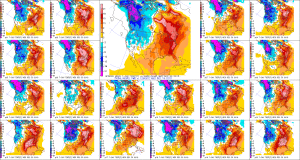
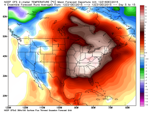
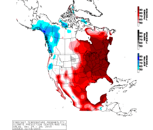
In the grand scheme of things, mid and long range model data strongly suggests a very warm pattern remains across the eastern half of the nation, while cold dominates the west, through the end of 2015.
 Just to be clear, we’re very confident on the medium range warmth to wrap up the year (and most likely open 2016). Contrary to how confident we are on the overall warm pattern through the mid range, we’re much less confident with the shorter term pattern that encompasses the all-important Christmas Eve – Christmas Day forecast. Getting right to the point, the American GFS forecast model suggests we’re dealing with a FROPA (frontal passage) Christmas Eve night that sets up a blustery, colder Christmas with morning snow flurries possible. The GFS says we make it into the lower to middle 40s for highs Christmas. On the flip side, the European model (usually, but not always, more accurate than the GFS) says we blow into early summer-like levels with highs around 70 degrees Christmas, including a mostly dry forecast with strong southwest winds. How does an afternoon BBQ sound Christmas with that sort of idea?!
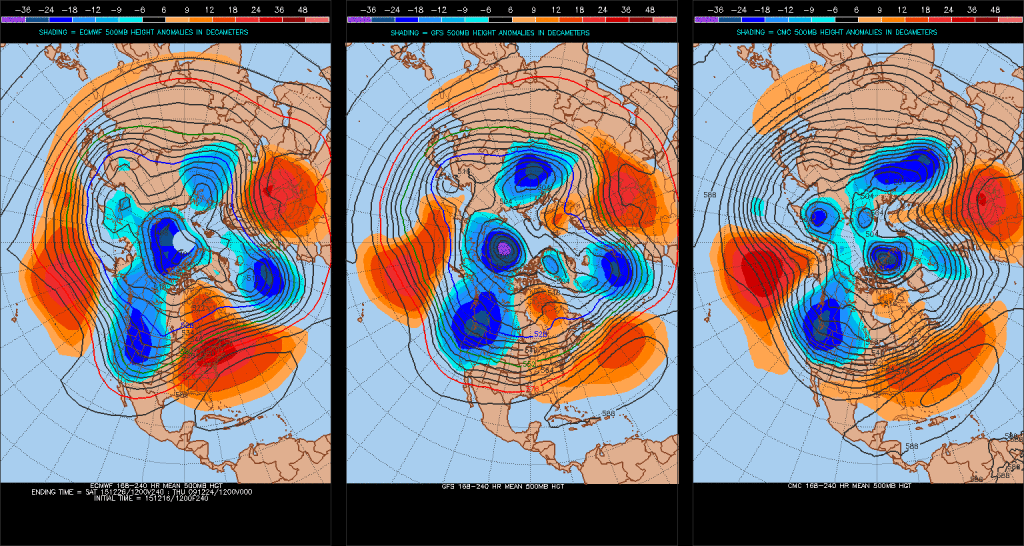
When we get down to the dirty details, the differences all have to do with the way the models handle the eastern (Bermuda) ridge. A snap-shot of the 8-10 day ensemble composite (that shows the Euro, GFS, and Canadian) highlights small, but significant, differences with the ridge placement.
The GFS model (and Canadian, as well) suggests we’re dealing with a more progressive pattern Christmas that results in the cold “sloshing” it’s way east much quicker than its’ European counterpart. Meanwhile, the European model says the eastern ridge flexes it’s muscle going into the Christmas period and results in the warmer, breezy solution as opined above.
When we dig in further, experience tells us we should “raise an eyebrow” to both solutions. How many times have we seen the biases that both models have impact the mid to long range forecast? The GFS has an eastern (more progressive) bias while the European has a western (slower) bias. Hint: It’ll be important to remember that as we rumble into more active cold and wintry times come mid and late in the season.
To sum things up, while we’re supremely confident in the long term warm pattern to wrap up the year, we remain very cautious with either solution currently being portrayed by either *normally* more-trusted mid range models. Lets give it a couple more days and see where things go. I wish we could be more certain with that all-important Christmas forecast, but we simply can’t at this juncture. Both solutions have been very consistent with their respected idea for the past couple days. One thing’s for sure and that’s that we’ll be looking at a major model bust sooner rather than later…


