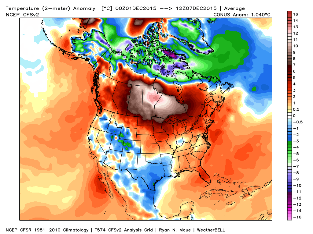
Ironically, the only area of normal to below normal air (with the exception of the Rockies and southern Plains) is located over our region, month-to-date.
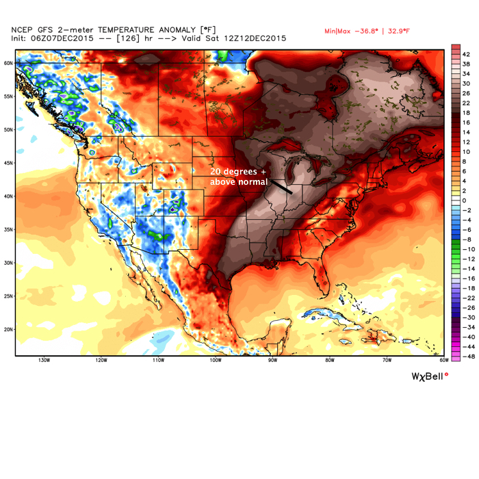
 From a winter lover’s perspective, this December has been one to forget this far, and it’ll only grow more frustrating in the days ahead (we still forecast mid to upper 60s over the weekend).
The basic drivers of our pattern remain generally unchanged from ideas in October when we posted our Winter Outlook. Our complete Winter Outlook can be found here. We feel the need to remind some that we thought we would get off to warmer than normal and relatively quiet start:
- “We feel this model best represents the likely milder than average start to winter before colder conditions mid and late winter.”
- “We think the winter opens warmer than normal and relatively dry before shifting towards a colder than average pattern for mid and late winter.”
- “The word “volatile” comes to mind at times.”
In short, there’s nothing out there that would suggest any reasons we should deviate from our current winter outlook that’s out there. Despite the warm start, we still feel the winter, when all totaled up, will end up slightly colder than normal. Additionally, though still falling short of normal snowfall, we also feel there will be plenty of winter weather potential come mid and late winter.
That leads us to the shorter term and what happens after the near record warmth of the upcoming weekend.
To sum it up:
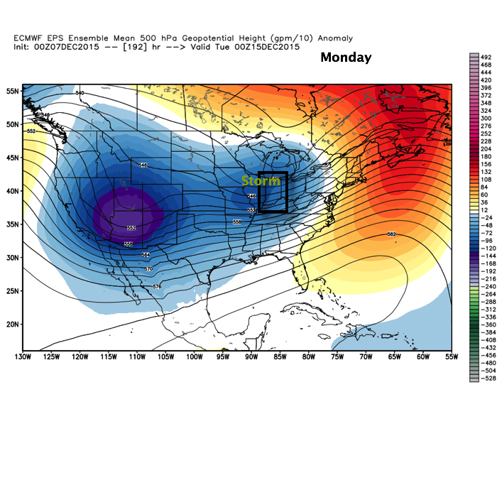
- A very active pattern develops this weekend with storms to track every 3-4 days.
- Despite a storm or two that may have a favorable storm track for winter potential, it’s important to note sufficient cold air is tough to come by in the more immediate term.
- Last week’s crashing SOI (Southern Oscillation Index) will lead to poor run-to-run consistency.
- We do see a way the pattern could get cold enough for more interesting times the closer we get to Christmas. Does this mean we’re guaranteeing a snow storm? No, but, as mentioned this morning, the teleconnections will at least make an attempt to transition closer towards a state that could offer up wintry mischief at some point during the last (10) days of the month.
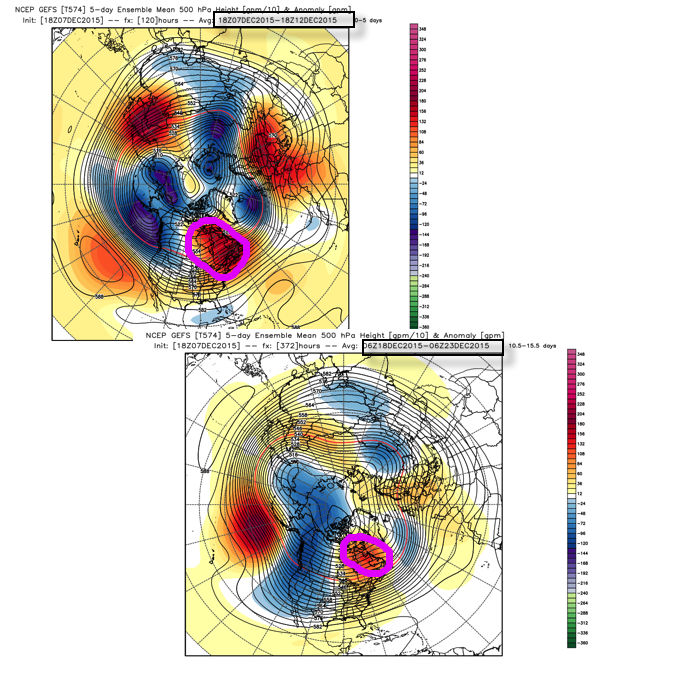
Bottom line is that the overall pattern is one that favors more in the way of warmer than average conditions through the next couple weeks before we begin transitioning towards more sustained wintry conditions mid and late winter. The idea here is that with each successive storm that comes through, it’ll cut into the mean ridge position and the heights will continue to lift further and further north with time over the upcoming 10-14 days. The GFS ensembles show this.
 Is it an ideal set up for “lock and load” winter? Not at all. Is it an improvement that can at least offer up a couple attempts of wintry potential around Christmas? Yes.
As stated above, in the longer term, based off current data and seasonal modeling, there’s no reason to walk away from the idea the slow start to winter continues for the duration. Patience friends. 🙂


