You must be logged in to view this content. Click Here to become a member of IndyWX.com for full access. Already a member of IndyWx.com All-Access? Log-in here.
November 17, 2015 archive
Permanent link to this article: https://indywx.com/2015/11/17/tuesday-evening-video-update-4/
Nov 17
Couple Storms To Watch And Much Colder Air…
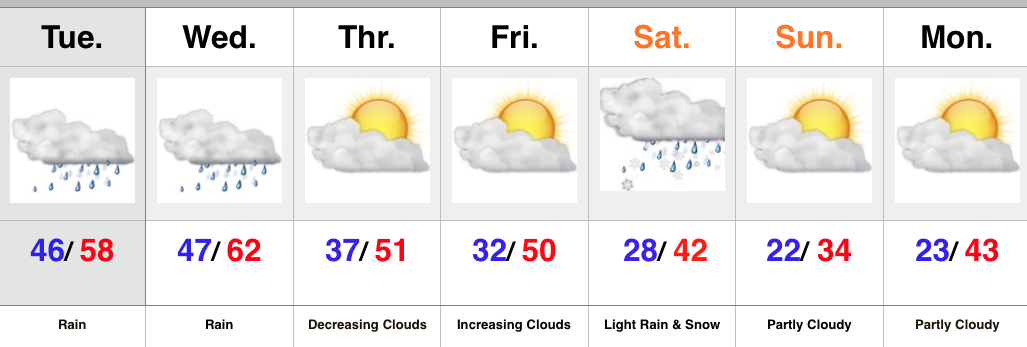
- Periods of rain
- Turning cooler
- Next storm offers up wintry precipitation for parts of the state
- Early arctic blast
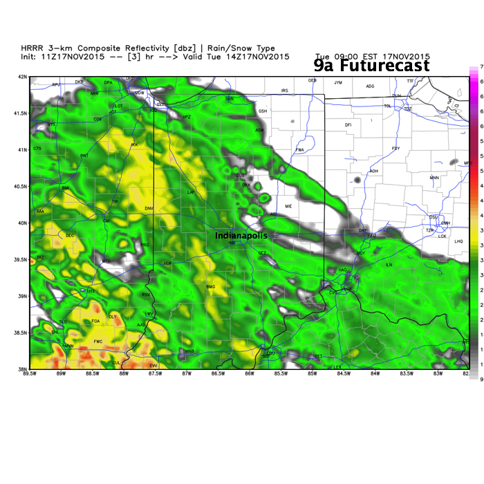
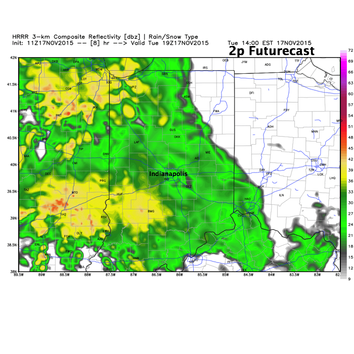
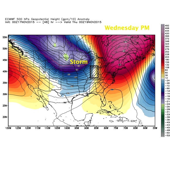
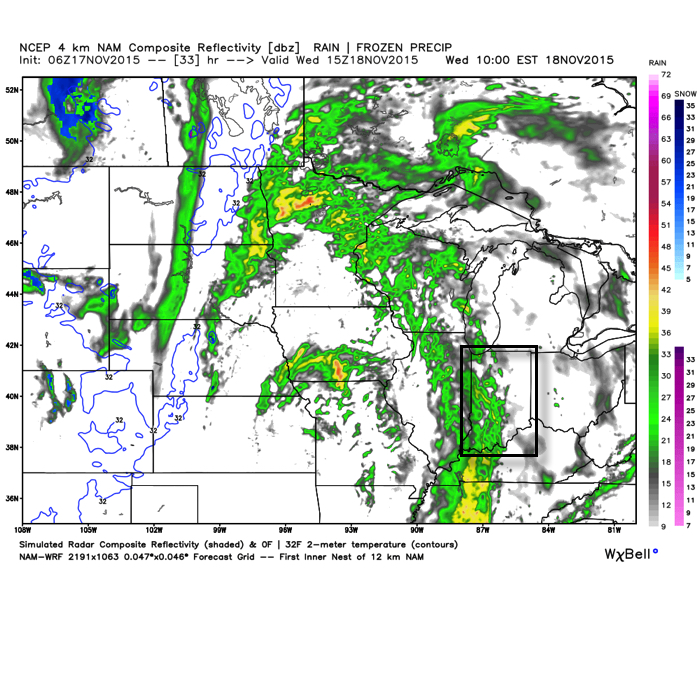
Periods of rain will continue into the mid to late afternoon across central IN as “wave 2” of our current storm system moves through. We’ve added a couple simulated radar images below, courtesy of Weatherbell.com.
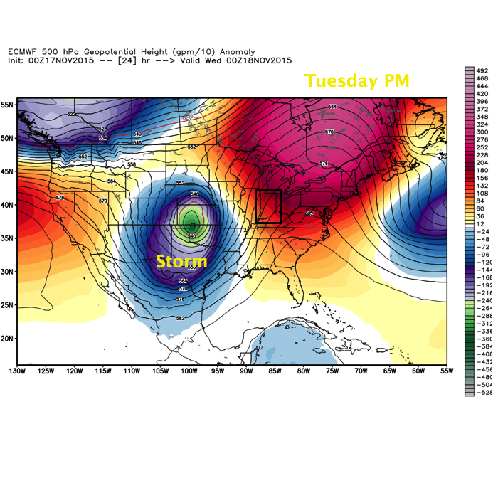
 This is all in association with a significant autumn storm system that’s been responsible for delivering hefty snows across the Rockies, blizzard conditions across the High Plains, and severe weather across the central and southern Plains. This storm will lift northeast over the next 24-36 hours.
 A third, and final, wave of moisture will push through the state Wednesday, in a weakened state from what our friends to the west will experience (where another round of severe is expected today and tonight). This is what the radar may look like mid-morning-ish Wednesday.
 When all is totaled up from rain that began Monday afternoon and ends Wednesday afternoon, many locales will pick up 1.5″-2″ of needed rainfall. While significant, those numbers are lower than what originally model data implied, but we’ll take what we can get to push closer to average for November rainfall.
All eyes will then shift to our second storm system that will arrive over the weekend. There are still more questions than answers in regards to track of this next “wave” of low pressure, but with much colder air in place and pouring in behind the system, snow will fly across northern IN. As of now we forecast the majority of this event to fall in a liquid form across central IN, but even here precipitation may end as light snow showers the way things stand now. Stay tuned as we continue to fine tune the track. Regardless, much colder air will be with us to end the period.
Permanent link to this article: https://indywx.com/2015/11/17/couple-storms-to-watch-and-much-colder-air/

