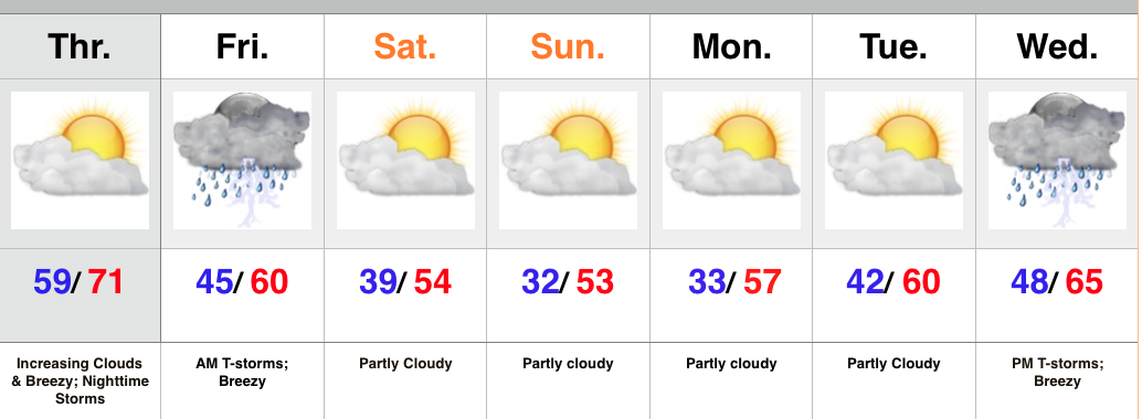
- One more warm day
- Gusty storms late tonight-Friday morning
- Feeling more seasonal this weekend
- Next storm arrives at the end of the period
High pressure will give way to an approaching cold front tonight. Variably cloudy skies this morning will turn increasingly cloudy as the afternoon/ evening progresses. Gusty SW winds will increase and gust over 20 MPH by afternoon.
The cold front will move through central IN early Friday morning and be preceded by a line of showers and embedded thunderstorms. A few of these storms may contain strong winds, and this potential is something we’ll continue to keep a close eye on through the day Thursday. Beneficial rains will also accompany the frontal passage.
The big story going into the weekend will be a much cooler, more seasonable feel, but sunshine will also be in our forecast.
Our next storm system of note appears to have eyes on the region by the middle of next week.
Upcoming 7-Day Rainfall Forecast: 0.5″ – 1″

