- Rain moves in later today-Saturday
- Cooler second half of the weekend
- Heavy rain event next week
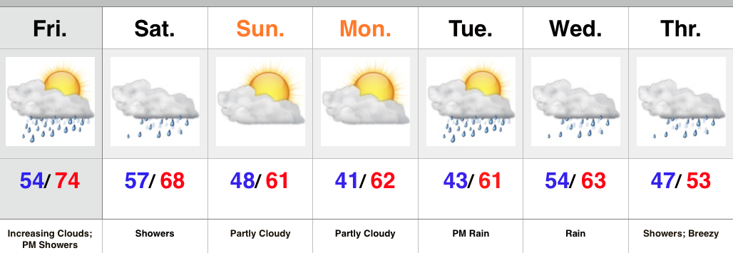
High pressure will give way to an approaching cold front later today and Saturday. Showers will accompany the front and may spread into western IN as early as this evening before continuing to advance east tonight. Most of the rain should fall through the first half of Saturday, but we’ll maintain a mention of showers up until the front passes Saturday night.
Cooler, drier air will move in Sunday and to open the new work week. High pressure will supply a return of sunny, ideal fall conditions.
As we progress deeper into the week, another cold front will team up with moisture from the remnants of Patricia to provide a much needed soaking. We forecast skies to cloud up Tuesday with rain developing by evening. Periods of heavy rain can be expected Tuesday night into Wednesday before turning more “showery” in nature. Much cooler air and blustery conditions can also be expected Thursday.
Upcoming 7-Day Rainfall Forecast: 1.75″ – 2.25″

