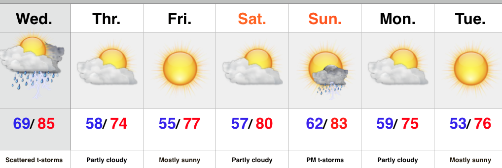
- Strong to severe storm potential Wednesday
- Much cooler to end the week
- Second cold front delivers storms Sunday and cooler air
Tuesday featured mostly dry conditions across the majority of central IN, but the same likely won’t be said for Wednesday. A cold front will swing through the region Wednesday night and in advance of the front scattered strong to severe thunderstorms will be possible, especially Wednesday afternoon/ evening. Damaging wind is the biggest severe threat. The reasoning behind the turbulent Wednesday weather? A strong cold front that will sweep through the area and deliver much drier and cooler air to finish the work week.
While the weekend will get off to a quiet open, another cold front will deliver scattered thunderstorms by Sunday afternoon and evening. Behind the front we can expect much cooler, fall-like air to open the new work week.
Upcoming 7-Day Rainfall Forecast: 1″ – 1.5″
Tonight’s “@cryptics Cam” shows a very nice time lapse of the foggy start and afternoon sunshine in Danville today. Be sure to follow @cryptics on Twitter for awesome views of the sky and associated weather conditions here across central IN!


