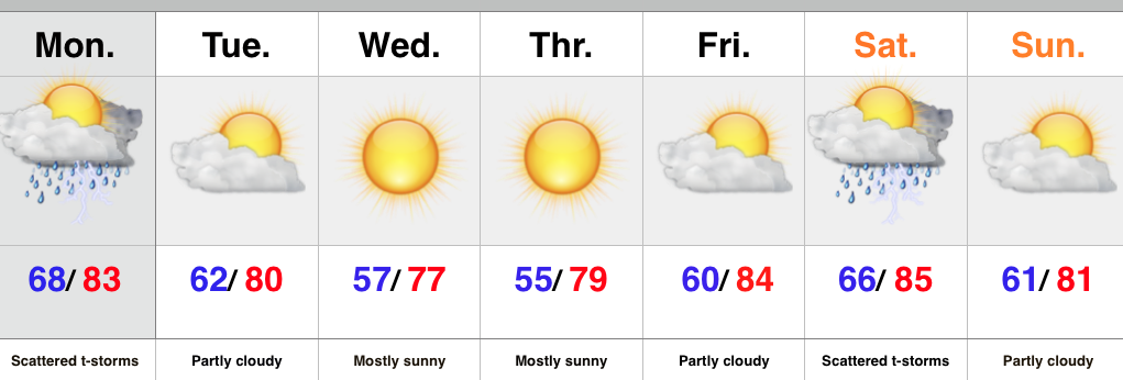
- Early week storm threat
- Drier, cooler air inbound
- Next rain chance comes Saturday
The week will open with a typical humid and oppressive feel, but take heart in knowing it won’t last long. A cold front will move through the region Monday night and drier air will filter into the Hoosier state Tuesday. A much cooler and drier air mass will be with us through mid week before warmth builds heading into the weekend. Thursday morning will have many really craving those cool, crisp autumn mornings.
As far as rain and storm chances are concerned, we’ll keep an eye to the sky for scattered shower and thunderstorm coverage today. Forecast models differ on the weekend. The GFS suggests a cold front moves through here Saturday with scattered showers and thunderstorms and we’ll lean in that direction for now. Stay tuned.
Upcoming 7-Day Rainfall Forecast: 0.50″ – 0.75″
Interested in winter weather and snow removal consulting? Email us at bill@indywx.com

