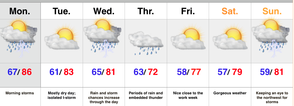
- Monday morning storms
- Wet mid week stretch
- Keeping a watchful eye to the northwest
As we type this, storms are expanding and intensifying in coverage to our north, across the Great Lakes region. We expect these storms to continue to build west as they sink south and southeast with time. As such, don’t be surprised by a predawn wake-up call, courtesy of Mother Nature Monday morning. A few storms could be strong to severe with the primary concern being damaging winds.
After a nice Tuesday, low pressure will track east and provide widespread rain and thunderstorms Wednesday into Thursday. Locally heavy rainfall is a good bet.
Once to late week and the weekend, confidence begins to lower. We’ll remain in a challenging northwest flow and models can struggle in handling specific features. That said, we’re keeping our fingers crossed for pleasant weather to wrap up the work week and head into the weekend, along with well below normal temperatures. Rain and storm chances return Sunday.
Upcoming 7 Day Rainfall Forecast: 2″ – 3″ with locally heavier totals

