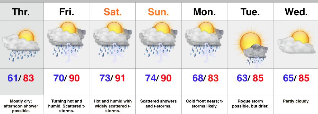
 Highlights:
- Afternoon light shower possible
- Very humid, tropical feel this weekend as things heat up
- Splash and dash weekend storms
- T-storms likely with a cold front Monday
We’re off to a pleasant start today, but clouds will increase this afternoon with a light shower possible, particularly from the city and points north. Most of today will be dry.
The big story this weekend will be a much more humid feel. While it’ll be hot, it won’t be anything out of the ordinary for late July around these parts. That said, factor in a dew point in the lower to middle 70s and it’ll feel extremely oppressive. A warm front will pass Friday morning with a thunderstorm threat, and then we’ll also mention a widely scattered thunderstorm during the afternoon/ evening through the weekend.
A cold front will move in Monday with more widespread showers and thunderstorms, along with a return to “average” temperatures by the middle of next week.
Upcoming 7-Day Rainfall Forecast: 1″-1.5″

