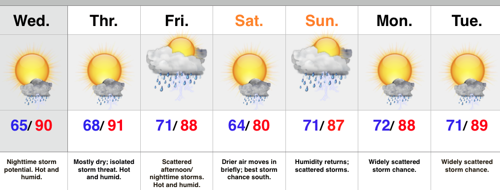
- Big time heat and humidity through late week
- Watching storm chances Wednesday night
- Briefly drier air Saturday
- Summer-like pattern continues next week
The big weather story over the second half of the week will be the heat and humidity. Many will reach, or exceed, the 90 degree mark Wednesday and/ or Thursday. We’ll keep a close eye on the northern portions of the state for storms to initialize Wednesday afternoon/ evening. Those at greatest risk for strong to severe storm potential will be from areas along and north of the I-70 corridor Wednesday evening. Damaging winds and hail are of biggest concern.
A cold front will slide into the area Friday and provide better coverage of showers and thunderstorms Friday afternoon and night. Latest model runs then deliver a briefly drier surge of air Saturday and we’ll lean in that direction with our Saturday forecast for now. Don’t get used to the drier air as heat and humidity will be plentiful early next week, along with renewed shower and storm chances.
Upcoming 7-Day Rainfall Potential: 1″ – 1.5″

