After a dry mid week stretch, a Gulf low will transport copious amounts of moisture into the southern Mid West region Friday into Saturday. This will target MO and IL into the Ohio Valley. Locally heavy rainfall can be expected, including amounts up to 2-3″ across southern portions of the aforementioned areas.

The upcoming 7-10 days will feature two additional storms impact the area, including storm number 3 potentially providing wintry precipitation to northern regions as colder air gets back involved with the pattern. No reasons for specifics now, but make a mental note that the pattern will be trending colder in the coming 7-10 day period.
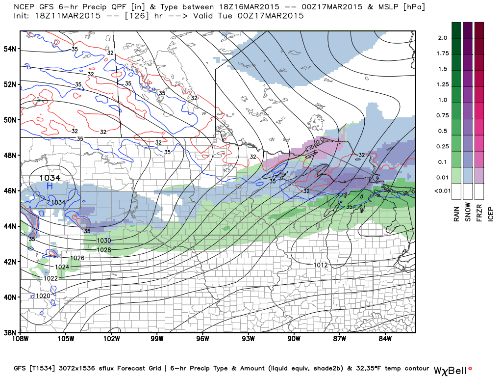
A cold front will deliver light precipitation (rain and snow) to northern regions Monday into Tuesday.
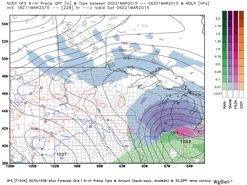
Another, stronger, storm system is due to impact the Mid West next weekend.
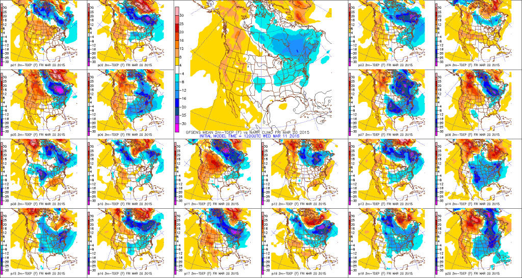
Despite the spring “fling” we’ve enjoyed the past couple of days, the pattern is expected to reverse and deliver a return of the cold around, and after, the 20th.
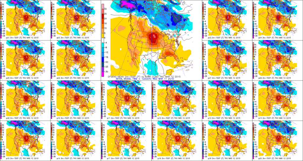
Note the warmer than average conditions continuing tomorrow. Get outside and enjoy!
 Models see the cold returning later next week as troughiness returns.
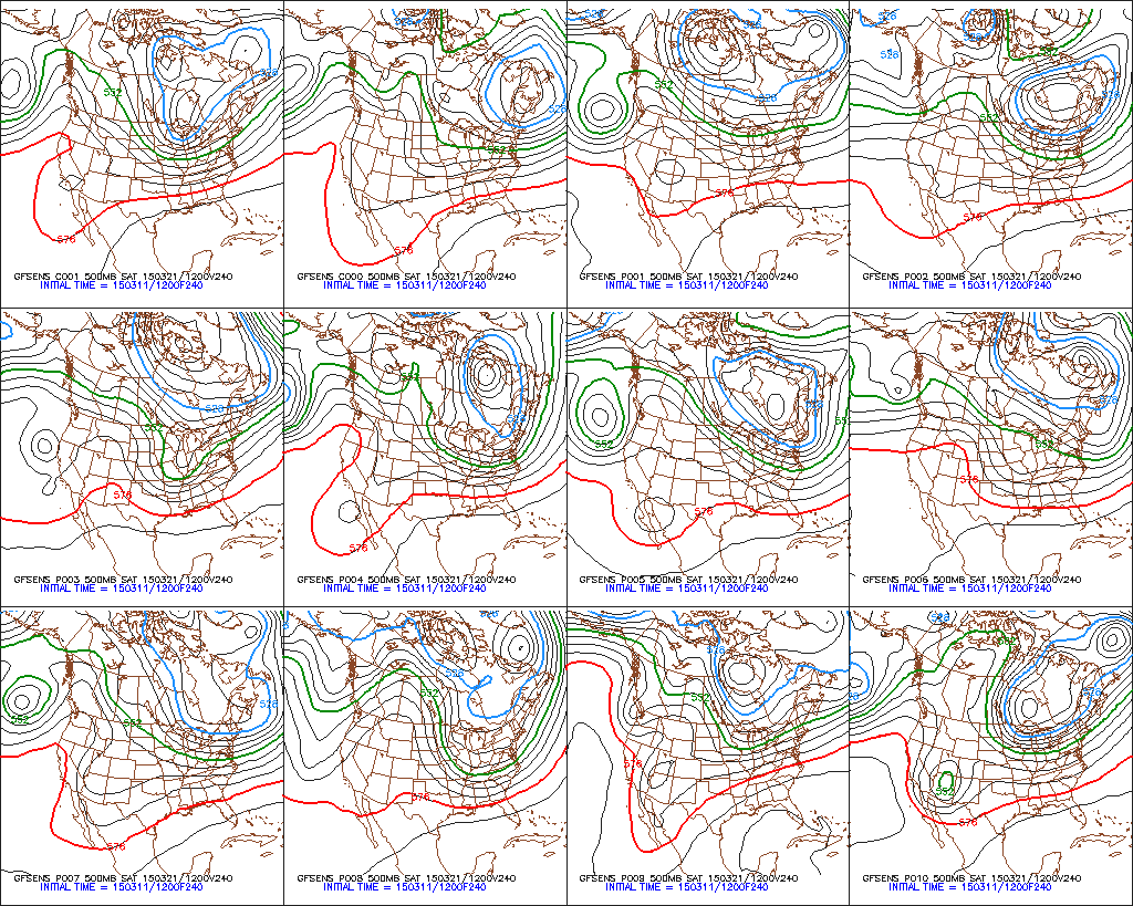 The CFSv2 weeklies see the reversal coming to a colder than normal pattern, as well.

No one should be surprised by the return of the cold pattern. Here’s a look at the median date of the last 32 degree temperature across the region.

Let’s keep a close eye on the Arctic Oscillation (AO) in the coming days. Should it remain negative then the cold pattern may rumble well into April. After a sharp decline mid month, members vary thereafter. We’ll watch carefully.

The latest drought monitor shows abnormally dry conditions across MN, southern WI, southwestern MO, and northern KY. Upcoming 7 day precipitation will help out southern growing areas, but the northern regions remain relatively quiet.


Great Lakes ice coverage remains impressive, to say the least, for mid March at 69% total ice coverage- a byproduct of yet another frigid winter.
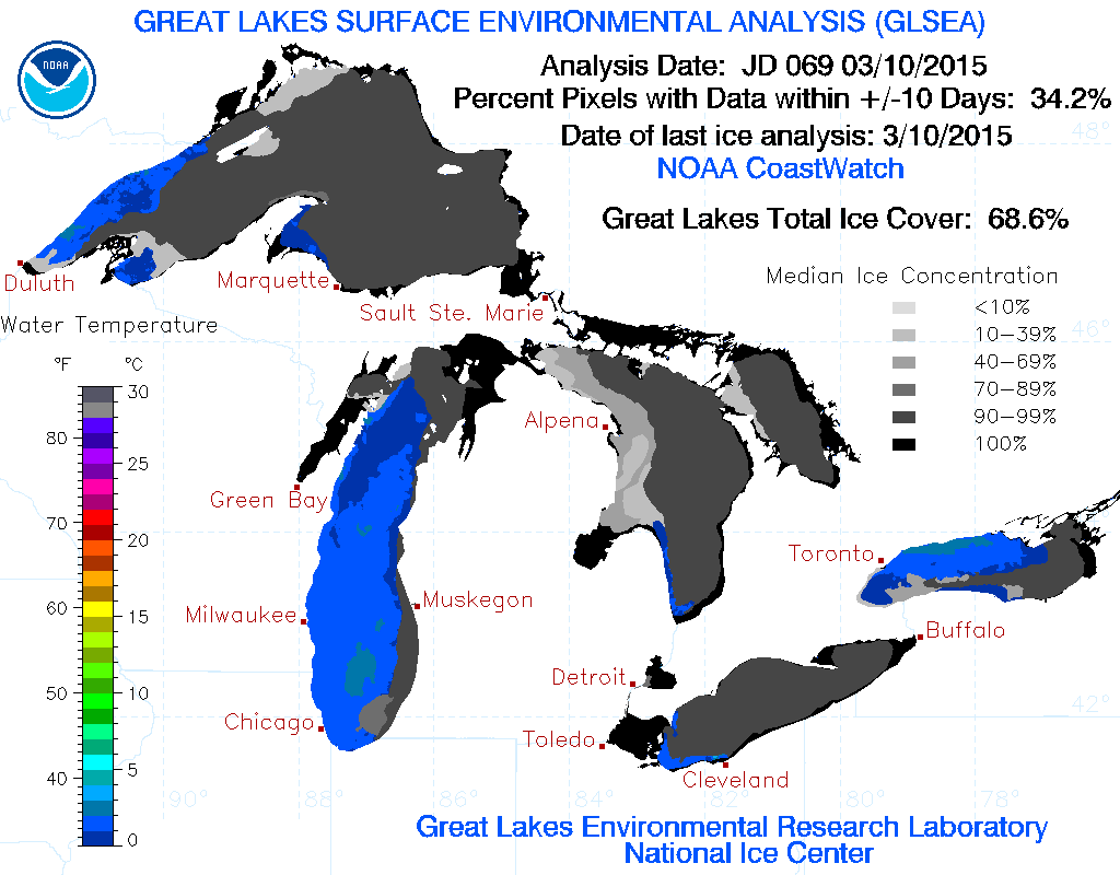 Similar to last summer, the abnormal GL ice may help aid in another cooler than normal spring-summer period.
Speaking of the longer range, the latest JAMSTEC shows widespread cool and wet conditions over the Lower 48 for the March, April, and May period.


 Sun-filled Couple Days…We’re in position for an absolutely beautiful couple days- complete with lots of sunshine and above normal temperatures! After the frosty start to the morning, temperatures will zoom into the lower 60s this afternoon. We’ll beat that Monday with a push for 70! Enjoy, my friends!


