January 2015 archive

Light Snow Impacts Some This Evening…

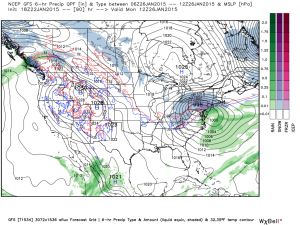
Screen Shot 2015-01-26 at 7.44.39 AMSlick Travel This Morning; More Light Snow This Evening…Rain changed to snow in and around Indianapolis between 5-6 Sunday evening.  The changeover occurred earlier just north and northeast of the city where anywhere from a quarter inch of snow fell to as much as 3 inches in and around the Muncie area.  The big problem last night and this morning is the combination of moisture freezing on the roadways, light snow, and strong and gusty winds.  Area roadways have been reported slick with numerous accidents.  Take it slow this morning.

Most of today will be quiet and dry, but light snow will build into the state later this evening into tonight.  We target areas along and west of I-65 for the greatest opportunity of accumulating a dusting to half an inch of snow tonight.  Sunshine returns Tuesday before a mid week system brings light rain Wednesday night into Thursday.  Light rain will diminish as light snow Thursday.

Colder air will be with us as we wrap up the work week before our next storm system impacts the Hoosier state over Super Bowl weekend.  We forecast increasing clouds Saturday with snow developing Saturday night into Sunday.

Upcoming Precipitation Forecast:

  • 7-Day Rainfall Forecast: 0.10″ – 0.25″
  • 7-Day Snowfall Forecast: 2″ – 4″
Permanent link to this article: https://indywx.com/2015/01/26/light-snow-impacts-some-this-evening/

A Word Of Thanks…

First, I just want to take a moment to thank each and every one of our viewers.  Your support of what we’re doing here is incredible and, at times, truly…

You must be logged in to view this content. Click Here to become a member of IndyWX.com for full access.  Already a member of IndyWx.com All-Access?  Log-in here.

Permanent link to this article: https://indywx.com/2015/01/25/a-word-of-thanks/

Tough Forecast Today…

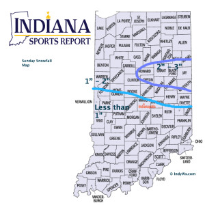
Screen Shot 2015-01-25 at 9.04.28 AMHigh Bust Potential Today…Clippers are always tough to forecast, but particularly so today.  This is a vigorous system and while temperatures will only be marginally cold, the concern here is that precipitation rates may help cool the entire column of air a bit quicker this afternoon than modeling currently suggests.  If (big if) that’s the case, then snowfall amounts below would have to be increased.  As it is now, we feel about as confident as we can be right now that the “slimmed” down numbers below will suffice.  As has been the case with a couple of other events this winter, it’ll be a nowcast scenario this afternoon.  Winds will also become quite gusty out of the east and northeast this afternoon into tonight.

Colder, drier air builds in late tonight and Monday before a weak weather system scoots through and delivers light snow showers Tuesday.  A wintry mix is possible Thursday and then we’ll eye late next weekend for the next snow opportunity.

Upcoming 7-Day Precipitation Forecast:

  • 7-Day Snowfall Forecast: 2″ – 4″
  • 7-Day Rainfall Forecast: 0.50″

12515SnowfallMapV2

Permanent link to this article: https://indywx.com/2015/01/25/tough-forecast-today/

So Long Boring Weather…

Screen Shot 2015-01-24 at 8.49.04 AMBusy Times In The Forecast Office…Let’s get to the easy part of this forecast package and that’s today.  Look for lots of sunshine along with seasonably mild temperatures after a cold and frosty start.

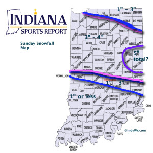
Things get fun tomorrow as a clipper low dives southeast and tracks in a favorable position for accumulating snow- especially from the city and points north (snowfall forecast below).  A mixture of rain and snow will overspread central Indiana Sunday morning and transition to all snow through the late morning into the early afternoon.  This will be a heavy, wet snow (perfect for snowball fights or making a snowman).  The other aspect to this storm system will be an increasing east and northeast wind Sunday evening into Monday morning.  Snow will diminish Sunday night, but the “damage” will likely be done by that point, leaving a mark on your Monday morning commute.

Another (weaker) weather maker may deliver scattered snow showers Tuesday.

Briefly milder air will move in here Thursday with a mixture of rain, snow, and sleet (depending on where you’re viewing us through the state), but the bigger story will be MUCH colder air set to pour into the region to close January and open February.  Some forecast models suggest a winter storm will precede the bitterly cold air around Super Bowl Sunday…. Stay tuned.

Upcoming 7-Day Precipitation Forecast:

  • 7-Day Snowfall Forecast: 2″ – 5″
  • 7-Day Rainfall Forecast: 0.10″ – 0.25″

12515SnowfallMap

Permanent link to this article: https://indywx.com/2015/01/24/so-long-boring-weather/

Sunday Clipper: Various Model Solutions

Quick update this morning on the various model solutions for Sunday’s clipper system:

You must be logged in to view this content. Click Here to become a member of IndyWX.com for full access.  Already a member of IndyWx.com All-Access?  Log-in here.

Permanent link to this article: https://indywx.com/2015/01/23/sunday-clipper-various-model-solutions/

Step Down Process To Cold Before The Return Of Truly Frigid Times…

The past 5-7 days have featured a common “January thaw-” something typically seen in even the coldest Januarys.  The coming 5-7 days will see a “step down” process of colder weather, interrupted by a day or two of milder southwest breezes.  In the longer range, we hold firm on the idea of more sustained cold, and potentially frigid air, setting up shop to open February.

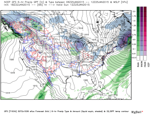
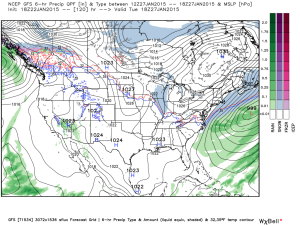
See the GFS track the clipper through the lower lakes this weekend.  This is a mild track for central Indiana and will keep the accumulating snows over the Lakes region, extending into northern portions of the state.  Some light snow will fly here late Sunday night/ early Monday, but accumulations should be minimal.

gfs_ptype_slp_conus2_12

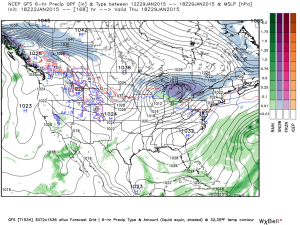
gfs_ptype_slp_conus2_16A brief surge of arctic air will invade early next week and may be accompanied by light snow Tuesday.

gfs_ptype_slp_conus2_21A brief southwesterly flow will allow milder air into the region by the middle of next week, but we caution this will be brief.

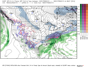
gfs_ptype_slp_conus2_29Much colder times loom to open February, potentially with a winter storm.  Obviously with this being in the 8-10 day period, there will be a lot of time to watch the storm potential.  Models have struggled mightily with storms this winter so far.  We’re much more confident on the cold, and potentially downright frigid air at that (still don’t think we’ve seen the coldest air of the winter yet).  Note the GFS sees the arctic highs “lining up.”

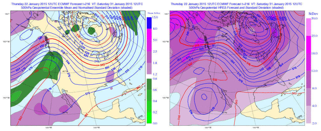
gfs_ptype_slp_conus2_41The European ensembles and operational are also keying in on the cold and wintry pattern closing January and to open February:

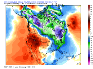
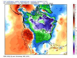
Geopotential32at32500hPa_North32America_216Initially the cold attacks the northeastern portions of the country, but “backs” west with time in the longer range:

Days 5-10

1Days 10-15

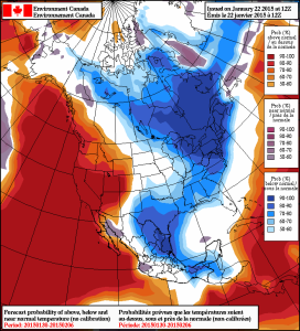
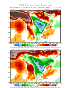
2The NAEFS and CFSv2 see the colder pattern returning:

2015012212_054@007_E1_north@america_I_NAEFS@TEMPERATURE_anomaly@probability@combined@week2_186

wk1.wk2_20150122.NAsfcT

We still think there’s a lot of “winter” left in the coming months.  Many folks enjoy snow Christmas into January, but begin to crave spring in February and March.  This is the type pattern that can be quite “ugly” for spring lovers as colder and snowy weather can push well into the spring months…  (Noted that we still have a lot of catch up to do in the snow department, but we’re not ready to say we won’t make up for “lost time”).

Permanent link to this article: https://indywx.com/2015/01/22/step-down-process-to-cold-before-the-return-of-truly-frigid-times/

Colder, But Nothing Drastic…

Screen Shot 2015-01-21 at 6.28.17 PM

Colder, But Nothing Too Out Of The Ordinary…A colder theme will be with us as we put a wrap on the work week.  That said, temperatures will actually be much closer to where they should be for this time of the year.  A quiet weather pattern will continue until we watch a clipper system for the second half of the weekend.  As of now, the accumulating snow looks to stay north of our immediate region, but we’ll keep a close eye on it.  Officially, we’ll call for increasingly cloudy skies Saturday night into Sunday morning with scattered rain showers Sunday afternoon changing to snow showers Sunday night before ending. If traveling north, prepare for several inches of snow across northern portions of the state into the Great Lakes region.  Stay tuned as this system is still a few days off and changes can take place moving forward.  Colder air follows for early next week.

Upcoming 7-Day Precipitation Outlook:

  • 7-Day Rainfall Forecast: 0.10″ – 0.20″
  • 7-Day Snowfall Forecast: Dusting

Permanent link to this article: https://indywx.com/2015/01/21/colder-but-nothing-drastic/

Facts Are Facts…

I’m hearing rumblings out there that you can’t get sustained cold across Indiana without a negative Arctic Oscillation (AO) and/ or negative North Atlantic Oscillation (NAO).  I would ask those with that belief to please explain the following:

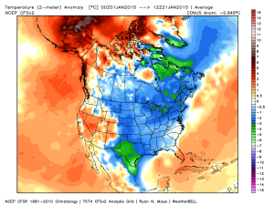
January temperature anomalies month-to-date show widespread cold (even accounting for the January thaw the past week).

ncep_cfsr_noram_t2m_anom


The first two weeks of the month were downright frigid and this was in the face of an AO that was not just positive, but strongly positive.

AO

To take this a step farther, the recent relative warmth has come with a negative AO.

Bottom line is that a ton of drivers are trying to take the wheel this winter.  Admittedly, that makes things incredibly difficult for forecasting- short-term or longer range.  That said, coming out with a “blanket statement” that you can’t have sustained cold without a negative AO or NAO is a flat-out lie and we wanted to address it.  Teleconnections can help many times with coming weather patterns, but not always.  This winter is a prime example of that.

Quick note on the clipper system- all forecast models today have taken the primary impacts (at least from a snow standpoint) north of the immediate region (central Indiana). Heaviest snows are favored across the Great Lakes, extending down into northern IN. We’ll continue to keep a close eye on things…

Permanent link to this article: https://indywx.com/2015/01/21/facts-are-facts/

Light Rain And Snow Showers Around This Afternoon/ Evening…

Scattered light rain and snow showers will dot the central Indiana landscape this afternoon and evening as colder air moves into the region.

hrrr_ref_indy_14

Thursday and Friday will be colder than what we’ve been used to the past few days, but nothing out of the ordinary and actually more seasonal.

We’re still eyeing a late weekend clipper system, but the precise track will determine who sees “several” inches of snow, versus little to nothing. Feast or famine, we’ll call it!  Overnight computer model guidance would place the heavier snow totals across northern portions of the state, but we still have a ways to go before anything is set in stone.

Back later this evening with a complete 7-day update!

Permanent link to this article: https://indywx.com/2015/01/21/light-rain-and-snow-showers-around-this-afternoon-evening/

Tuesday Evening Update

Quick video update this evening discussing our next weather system and looking ahead to the next opportunity for accumulating snow…

You must be logged in to view this content. Click Here to become a member of IndyWX.com for full access.  Already a member of IndyWx.com All-Access?  Log-in here.

Permanent link to this article: https://indywx.com/2015/01/20/tuesday-evening-update-2/

IndyWx.com