|
Wed.
|
Thr.
|
Fri.
|
Sat.
|
Sun.
|
Mon.
|
Tue.
|
|

|

|

|

|

|

|

|
|
31/ 40
|
27/ 35
|
34/ 42
|
37/ 42
|
27/ 39
|
32/ 43
|
25/ 35
|
Watch For Slick Spots This Morning…A light wintry mix of freezing drizzle, snow, and sleet fell across central Indiana during the overnight. Most roads have been treated, but still leave extra time to reach your destination and travel safely. We think we’ll get rid of the low clouds, fog, and pesky light wintry precipitation during the afternoon and introduce at least a look or two of sun into your forecast! It’ll be a chilly day as highs struggle to reach 40.
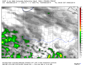
Tricky Thursday…Another fast moving disturbance will deliver light precipitation to central Indiana as early as Thursday morning. With temperatures below freezing during the onset of precipitation, much of this may fall in the “frozen” or “freezing” form. We’re concerned about light freezing rain and light sleet arriving during the morning commute Thursday and we’ll fine tune timing and precipitation type with tonight’s update. Temperatures should slowly “warm” above freezing during the afternoon switching wintry precipitation over to just plain ole rain. Stay tuned.
Wet Open To The Weekend…This morning’s model data is in much better agreement in regards to our wet weather maker slated for the opening to the weekend. A slug of widespread moderate to heavy rain will push in here Friday and continue into early Saturday. We think the back half of Saturday will feature drier air moving into the region which will set up a dry, but cold Sunday.
Cold Push Early Next Week…We’re siding with the colder solution early next week for now. We forecast a cold front to blow through the area Monday afternoon with a quick shower possible (not a big deal). Tuesday will feature colder northwest breezes and a scattered snow shower, or two.
Upcoming 7-Day Precipitation Forecast:
- 7-Day Rainfall Forecast: 1.00″ – 1.50″
- 7-Day Snowfall Forecast: Dusting to less than 1″


