Happy Saturday afternoon to all! This evening’s video covers what continues to look like an active weather pattern, including multiple rain chances ahead for the upcoming week. We also discuss the upper air pattern and the expanding area of heat.
August 16, 2014 archive
Permanent link to this article: https://indywx.com/2014/08/16/talking-heat-humidity-and-rain/
Aug 16
JAMSTEC Take On Upcoming Fall/ Winter
With each passing day our thoughts turn more and more towards the upcoming busy fall and winter months ahead. Among the vast array of data to sort through, we wanted to show you the latest JAMSTEC (Japan Agency For Marine-Earth-Science And Technology) take on the upcoming fall and winter. Admittedly, we’re still a ways off from being able to tell you with any sort of certainty what the upcoming winter holds in store, as far as the “concrete details” go. That said, thinking, at least here, remains on the side of the camp that believes another colder/ snowier than normal winter lies ahead for our region.
As far as the fall goes, we’re likely to see a predominant southeast ridge dominate the pattern, with more of a “back and forth” fight across our immediate neck of the woods. In some ways, we’re beginning to see this type reflection in the pattern this week.
In any event, the latest JAMSTEC fall (Sept-Nov) idea as far as temperature anomalies go:
Note the southeast ridge should keep the south-central and south-east (on up along the eastern seaboard) a touch warmer than average. The center of the cool will back west for a time to include the Rockies, N Plains, and northern Lakes. Again, more of a back and forth fight here, and quite active!
Before we close, as stated above, we think another cold, snowy winter lies ahead for our area. The JAMSTEC remains bullish on another cold winter (Dec-Feb) for the 3rd month in a row:
Permanent link to this article: https://indywx.com/2014/08/16/jamstec-take-on-upcoming-fall-winter/
Aug 16
Unsettled Weekend…
Some are waking up to the pitter-patter of rain drops this morning and this is a sign of what’s ahead this weekend. While it won’t rain the entire time, most folks will see beneficial rainfall over the weekend. In this case, rain is a good thing, as we’re running under normal rainfall totals month-to-date by 1.23″.
Morning showers will push through the region before dry conditions return late morning into the early afternoon. Scattered showers will then again “dot” the central Indiana landscape this evening before potentially a more widespread rain moves in overnight.
Forecast radar at 10am:
Forecast radar at 6pm:
Heavier rainfall may push in overnight from the west as low pressure draws closer…
Forecast radar at 10pm:
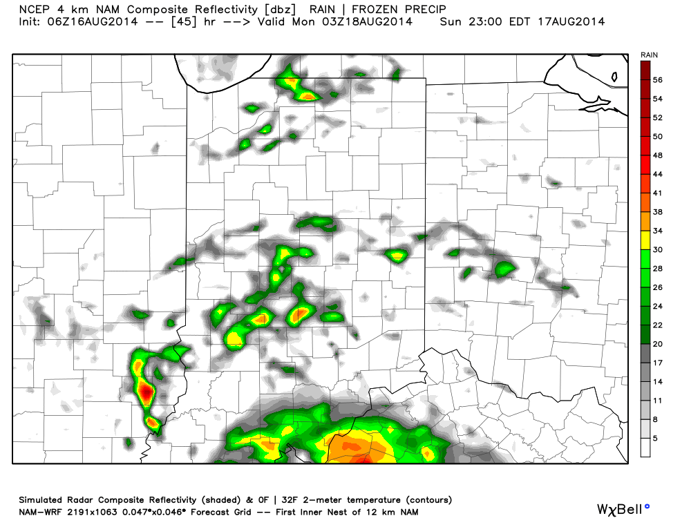
Sunday will have a more humid feel to the air and scattered showers and thunderstorms will remain in our forecast:
This is only the beginning of a rather unsettled week ahead, including multiple rain and storm chances. Widespread upcoming 7-day precipitation totals range between 1.5″ and 2″, but locally heavier totals can be expected.
Permanent link to this article: https://indywx.com/2014/08/16/unsettled-weekend/


