June 2014 archive
-
Filed under 7-Day Outlook, Flooding, Forecast, Forecast Discussion, Forecast Models, GFS, Hail, Heavy Rain, Rain, Severe Weather, Summer, T-storms, Weather Videos
-
June 2, 2014
An active few days lie ahead though it won’t rain and storm the entire time, and many dry hours can be expected over the course of the next few days. The video covers the details below!
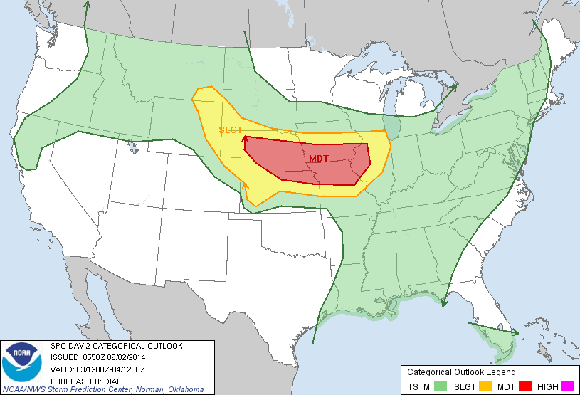
Tuesday is shaping up to be a very active severe weather day to our west.
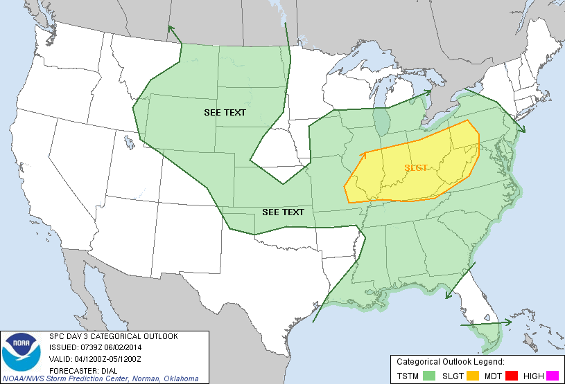
Wednesday will feature severe weather chances across the Ohio Valley.
Permanent link to this article: https://indywx.com/monday-morning-video-update-severe-weather-potential-and-heavy-rain/
-
Filed under 7-Day Outlook, Forecast, Forecast Discussion, Forecast Models, GFS, Heavy Rain, NAM Model, Rain, Severe Weather, T-storms, Unseasonably Warm, Weather Videos
-
June 1, 2014
We discuss the regime change from the low humidity, dry, feel to our air mass to one that turns increasingly muggy through the afternoon. This sets the stage for a rainy, stormy week upcoming. We think thunderstorms fire across central Indiana as early as 5-6 o’clock this evening.
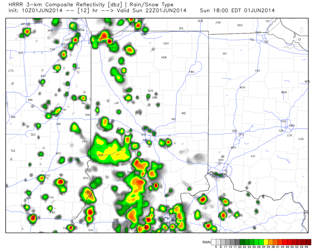
Future scan radar suggests thunderstorms erupt as early as 5-6pm across central Indiana.
Permanent link to this article: https://indywx.com/sunday-morning-video-update-storms-arrive-this-evening/

