It’s been a bit of a frustrating afternoon as I’ve been trying to upload a video discussing our thoughts around tomorrow for a couple of hours….only to no avail.
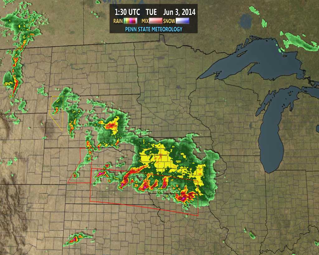
So this post will have to do. Really our thoughts remain unchanged concerning the way things unfold late tonight and Wednesday. The severe thunderstorms to our northwest continue to rumble as of the 10 o’clock hour.
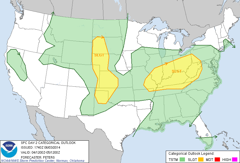
The Storm Prediction Center holds firm to the Slight Risk for the Ohio Valley and northern Tennessee Valley Wednesday.
We wouldn’t be surprised to see a portion (most likely the southern half) of the Slight Risk area upgraded to a rare Moderate Risk area with the update from the SPC early Wednesday morning.
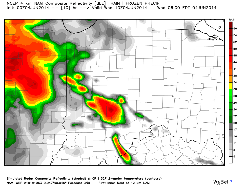
Our thinking hasn’t changed in that we believe the current complex of severe storms arrives into north central Indiana in a weakened state early Wednesday morning. The rush hour will likely include heavy rain and plenty of thunder, though we think the majority, if not all, of this activity Wednesday morning will remain below severe levels across our immediate region. Showers and thunderstorms will rumble into the area, especially north of the city during the predawn hours and include plenty of heavy rain.
A second round of showers and thunderstorms will fire during the afternoon Wednesday and is likely to turn severe across south central Indiana and points south Wednesday afternoon. Dangerous conditions are a good bet, including large and destructive hail, damaging straight line winds, and tornadoes. Certainly if you have plans from Indianapolis to Louisville or Cincy tomorrow afternoon and evening please keep tuned to the latest weather conditions and radar updates. Further north, the severe potential is much less certain. We continue to think areas north of the I-70 corridor will struggle to shake the stability provided from the early morning rain and storms. We caution though that this remains a now-cast scenario and will require a close eye tomorrow afternoon.
Looking farther ahead, we’ll enjoy a refreshing blast of air Thursday-Saturday with bright sunshine, low humidity, and cooler temperatures. Warmth and humidity will return Sunday with rainfall potential around 1″ additional precipitation. This will be followed by yet another big push of cooler, drier air early next week. More on this in the days to come.


