May 2014 archive
Good morning and happy Friday, Hoosiers! The region will remain under the influence of a swirling upper level low as we put a wrap on the work week. This will keep chilly, unsettled weather in our forecast. Temperatures will remain below normal through the weekend, though begin to moderate from the ridiculously chilly readings of late week.
We’re dealing with showers around the area now, but showers will intensify this afternoon and with all of the cold air aloft could easily produce small hail. Here’s a look at forecast radar early this afternoon- 2pm.
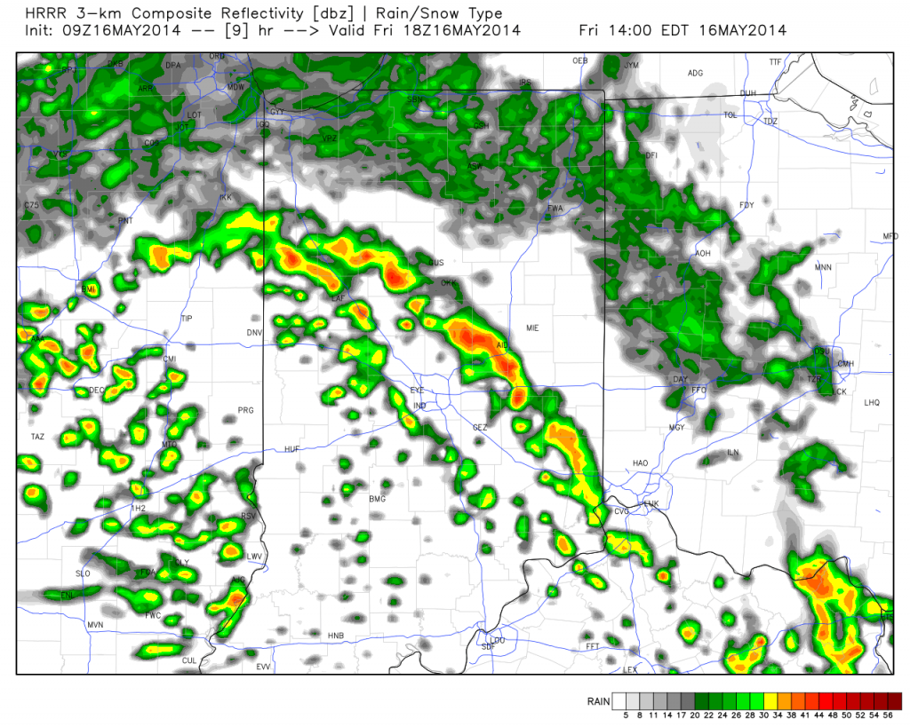
The Storm Prediction Center (SPC) highlights the region for the possibility of small hail.
The other huge story will be the very cold temperatures tonight into Saturday. In fact, we wouldn’t be surprised to hear reports of light frost in outlying areas Saturday morning with forecast lows in the mid 30s! Sunshine will increase as we progress through the weekend and temperatures will respond, albeit slowly! We’ll take what we can get!
- Friday: Mostly cloudy, scattered showers and thunderstorms (some stronger storms could produce small hail), 41/55
- Saturday: Cold start to the day! Increasing sunshine, still a possible light shower, 35/59
- Sunday: Partly cloudy and nice! 38/64
Permanent link to this article: https://indywx.com/weekend-look-hail-producing-showers-storms-this-afternoon/
Many central Indiana neighborhoods are still in the 40s as of this update. Officially, the high so far today at IND has reached 50 and is more than 20 degrees below where we should be for this date.
The upper low continues to swirl over Iowa this afternoon and will help push a band of showers into central Indiana during the wee morning hours Friday. Additionally, the threat is there that a couple of the stronger showers Friday afternoon include some small hail with added instability and the very cold air aloft.

As we look ahead to the second half of May, don’t be surprised by a repeat performance in this weather pattern. We think brief ridging will be responsible for highs above the 80 degree mark the middle of next week, but the stage may be set for another stretch of unseasonably cool air to wrap up the month…. Additional details can be found in the video!
Permanent link to this article: https://indywx.com/thursday-evening-update-repeat-in-the-pattern-coming-to-end-may/
|
Thr.
|
Fri.
|
Sat.
|
Sun.
|
Mon.
|
Tue.
|
Wed.
|
|

|
|

|

|
|
|
|
|
42/ 51
|
38/ 52
|
36/ 58
|
37/ 63
|
41/ 67
|
52/ 70
|
60/ 80
|
|
Light
|
Light
|
Light
|
– – –
|
– – –
|
Light
|
– – –
|
We’re locked into a cloudy, raw, and wet weather pattern and there’s no let up until later into the upcoming weekend. A big upper low is positioned across Iowa this morning and will remain the primary driver in our weather here through Saturday. Unseasonably chilly conditions, gusty northwest winds, and periods of drizzle and rain can be expected through the period. We’ll finally begin to shake the clouds and rain, but unseasonably cool air will linger into early next week. As for the pick of the weekend, it still easily appears to be Sunday, with mostly dry conditions, increased sunshine, and moderating temperatures. An additional one half to three quarters of an inch of rain will be possible between today and Saturday. Warmer times are ahead early next week as a warm front blows through the area with a possible shower or storm Tuesday.
Permanent link to this article: https://indywx.com/raw-and-chilly/
The remainder of the work week will feature plenty of rain and well below normal temperatures.
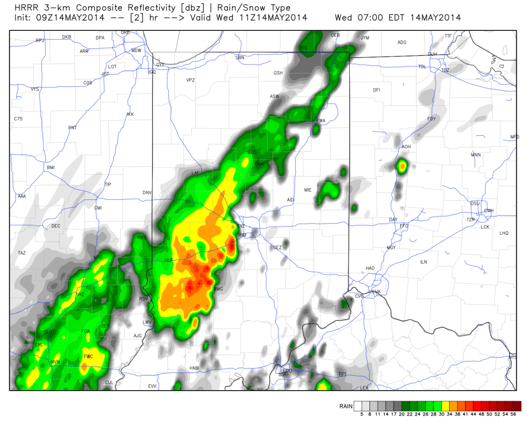
A surface wave will move up along a cold front today into Thursday and be responsible for widespread rain, some of which will be heavy, across central Indiana. Additionally, severe thunderstorms, including possible quick spin-up tornadoes, will be possible across far eastern Indiana and Ohio this afternoon and evening.
Note the forecast radar stays rather busy in the hours ahead!
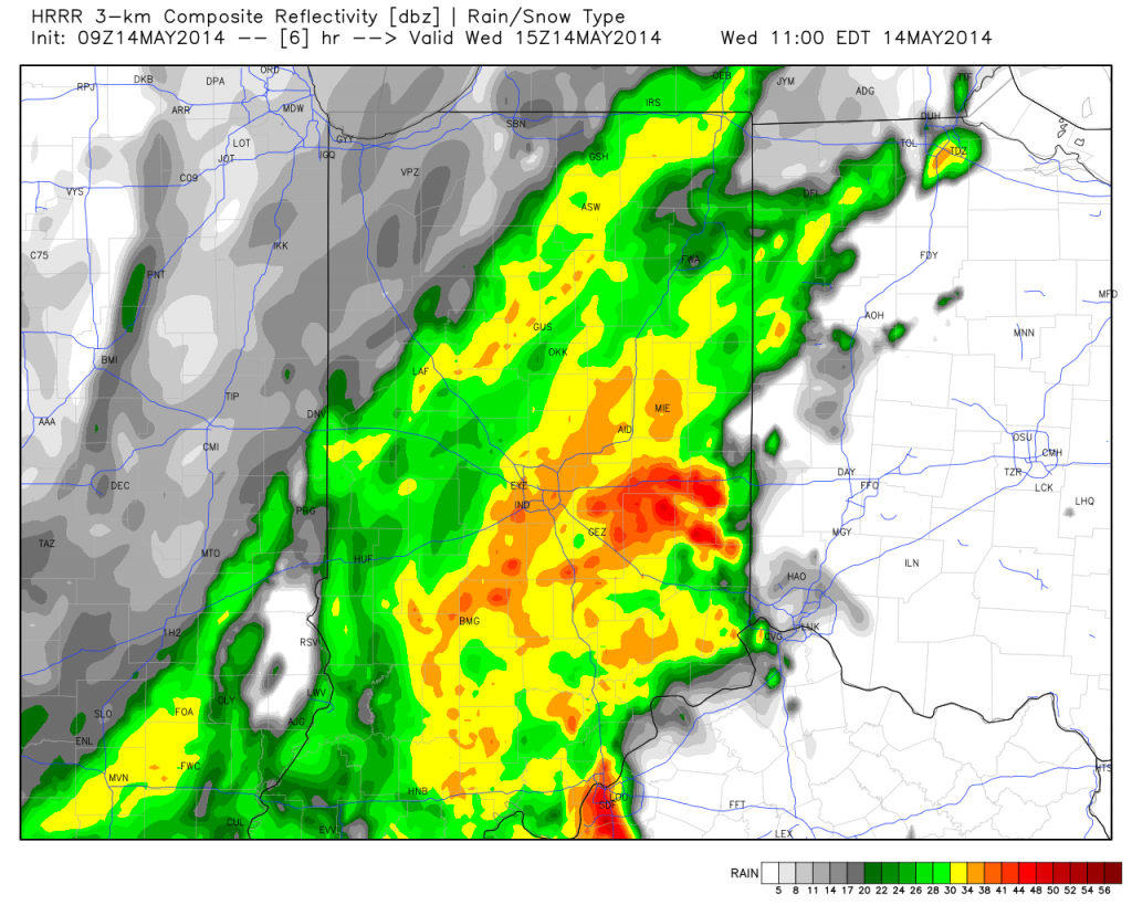
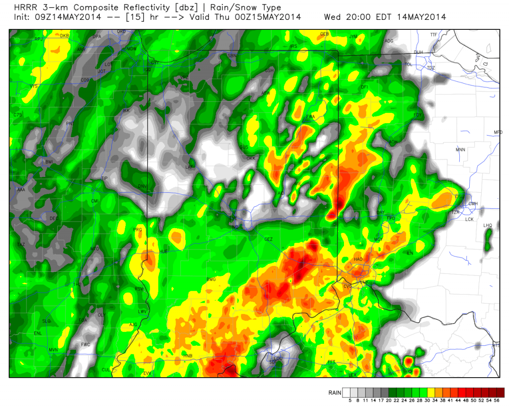
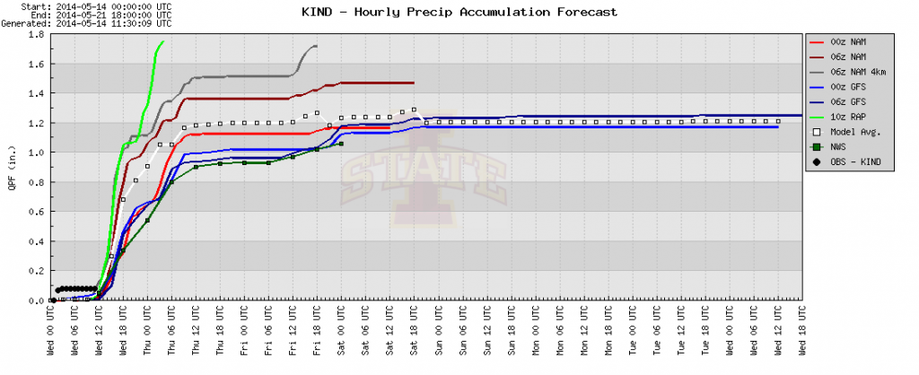
Area additional rainfall total will reach between 1-2″ between this morning and Friday afternoon.

The other big story is the chill. Temperatures are drastically cooler this morning than what we’ve gotten used to the past several days, and the step down process will continue. We still think most of Thursday is spent in the 40s.

Permanent link to this article: https://indywx.com/promised-wet-chilly-pattern-here/
-
Filed under 7-Day Outlook, Forecast, Forecast Discussion, Forecast Models, NAM Model, Rain, Severe Weather, T-storms, Unseasonably Cool Weather, Weather Videos
-
May 13, 2014
Note how dramatic of a temperature shift is occurring to our west- temperatures are down more than 30 degrees from this same time last night.
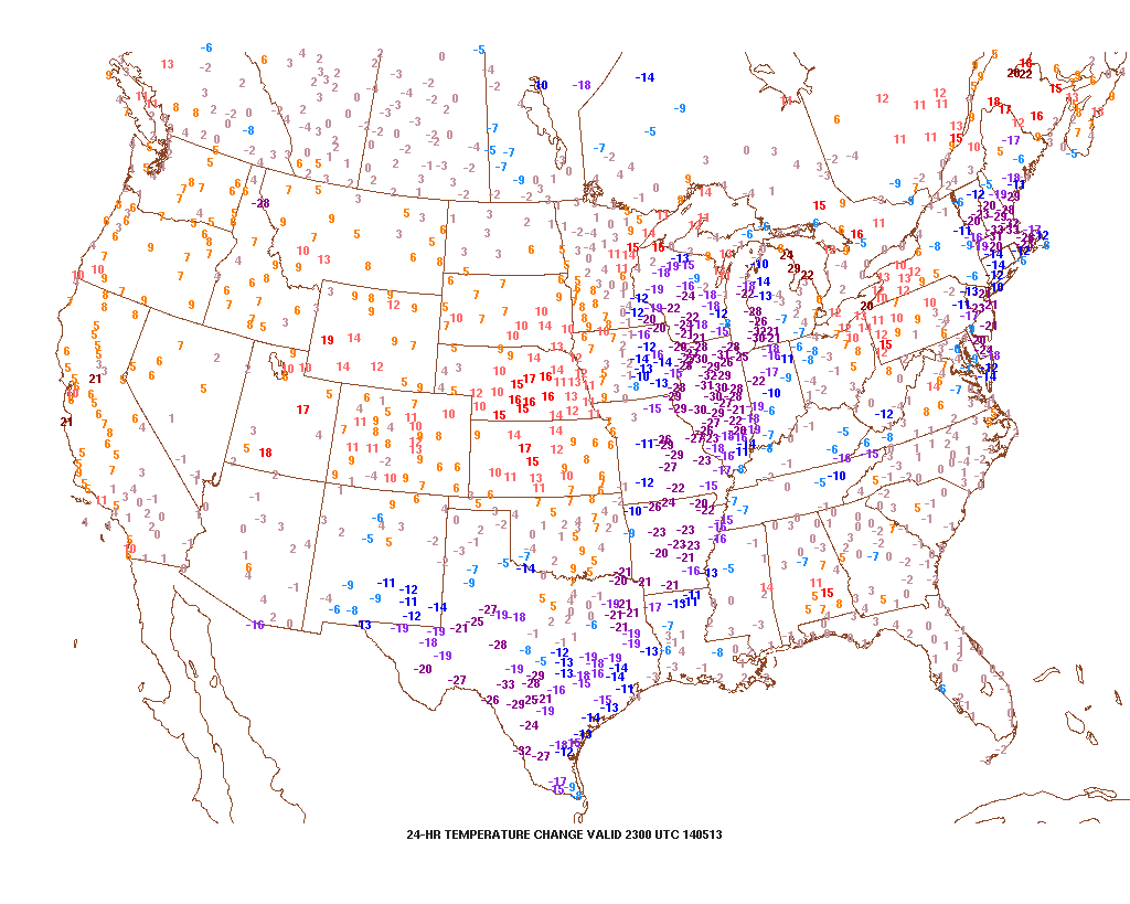
That cool air will filter into our region tonight and Wednesday. As a matter of fact, we still think Thursday has the potential to remain in the 40s for the better part of the day. The video below has more details on this and a look ahead to continued rainy times.
Permanent link to this article: https://indywx.com/tuesday-evening-video-brief-the-cool-down-is-on/


