The remainder of the work week will feature plenty of rain and well below normal temperatures.
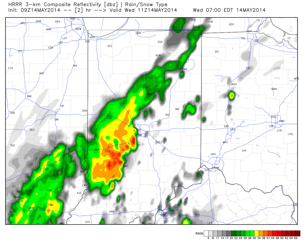
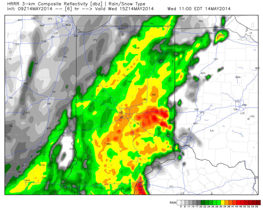
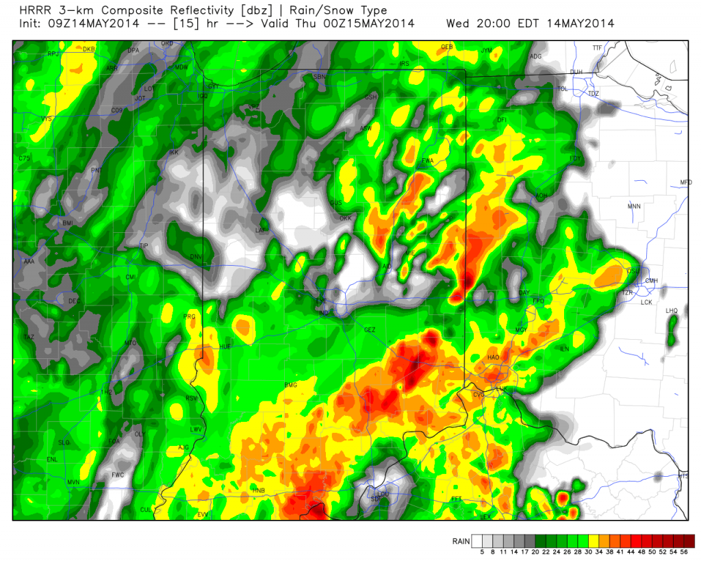
A surface wave will move up along a cold front today into Thursday and be responsible for widespread rain, some of which will be heavy, across central Indiana. Additionally, severe thunderstorms, including possible quick spin-up tornadoes, will be possible across far eastern Indiana and Ohio this afternoon and evening.
Note the forecast radar stays rather busy in the hours ahead!
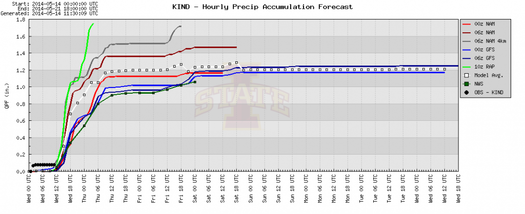
Area additional rainfall total will reach between 1-2″ between this morning and Friday afternoon.
The other big story is the chill. Temperatures are drastically cooler this morning than what we’ve gotten used to the past several days, and the step down process will continue. We still think most of Thursday is spent in the 40s.


