|
Fri. |
Sat. |
Sun. |
Mon. |
Tue. |
Wed. |
Thr. |
|
39/ 54 |
31/ 39 |
26/ 54 |
34/ 64 |
42/ 54 |
38/ 55 |
50/ 68 |
|
Light |
Light |
– – – |
Light |
– – – |
Heavy |
Heavy |
Forecast Updated 03.28.14 @ 7:57a
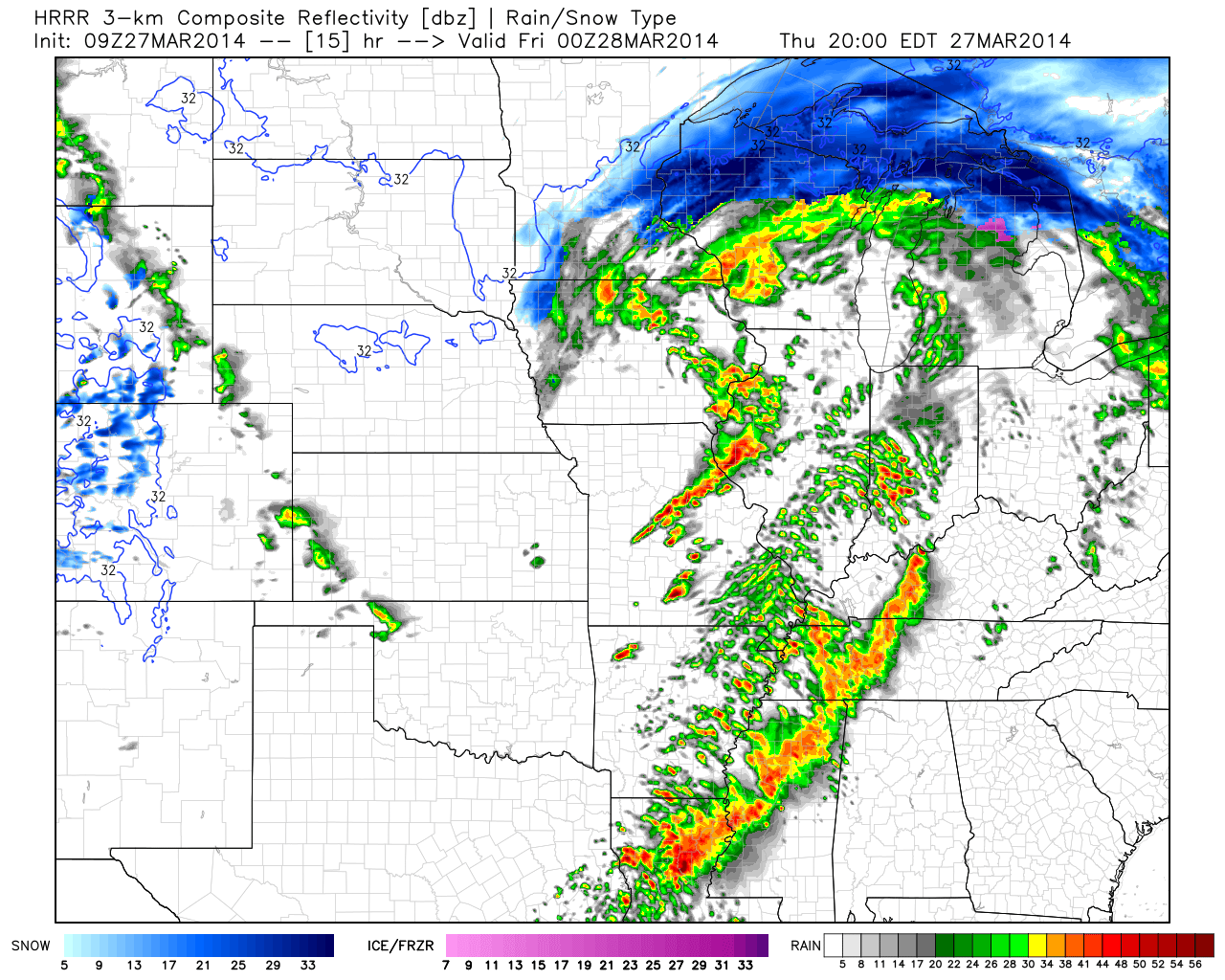
Early Rain. . .Some lingering showers will be possible early this morning, but the majority of the heavier rain and thunderstorms are exiting stage right as we kick off the last day of the work week. We may even note some afternoon clearing, but otherwise think the day will be a mostly cloudy one, along with steady or slowly falling temperatures and a gusty northwest wind.
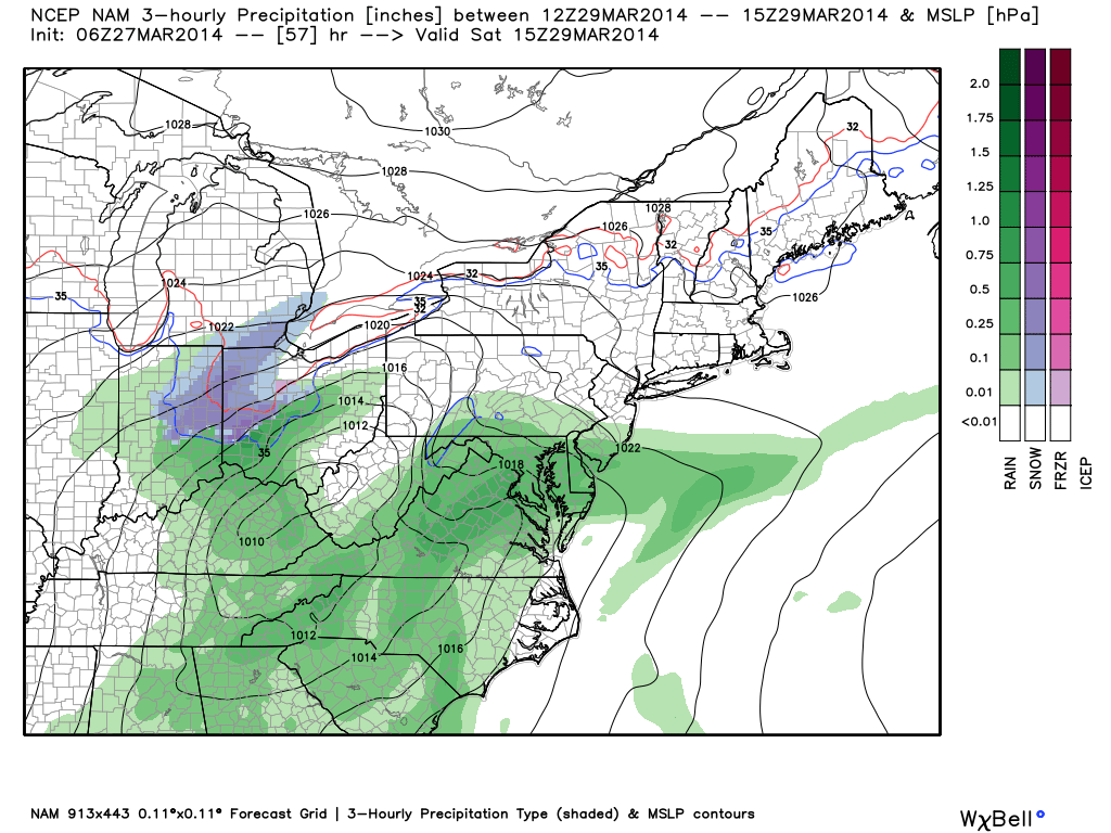
Tricky Saturday Situation; Better Sunday. . .As fast as one storm system departs, our attention has to turn to the next event. Rain will overspread the area late tonight into early Saturday morning. As low pressure moves from the southern TN Valley into the central and eastern parts of KY, colder air will be drawn into the storm along the northern periphery of the precipitation shield. Additionally, precipitation rates will likely be heavy enough to assist in cooling the column of air just enough to allow for a transition to wet snow across portions of the region during the morning Saturday.
While we’re not expecting major snowfall accumulations, it’s likely some communities (especially north and northeast of IND) see a slushy 1-3″ of snow Saturday morning. It’ll be a wet snow and will likely fall “fast and furious” for a short time period Saturday morning. Stay tuned as we continue to fine tune. Otherwise, look for a rather cloudy, cold, and raw day with precipitation ending from southwest to northeast during the late morning into the early afternoon.
After a very cold start to Sunday, that March sun will get to work and help salvage a pleasant second half of the weekend. In fact, Sunday is looking mostly sunny and much milder at this point.
Weak Front. . .A weak front will swing through here late Monday into early Tuesday morning, but moisture will be lacking with this front and a scattered shower or thundershower is possible Monday night. That said, most will likely remain dry.
Big, Wet Storm System. . .A significant storm system will organize over the Plains by the middle of next week. Unlike our early week storm, the Gulf of Mexico will be wide open and help supply copious amounts of moisture. We target Wednesday and Thursday for heavy rain and thunderstorms (some of which may be strong Thursday). While it won’t rain the entire time, early ideas place 1-2″ of rain down in the Wednesday-Thursday time period alone.
Upcoming 7-Day Precipitation Forecast:
- 7-Day Rainfall Forecast: 1.5″ – 2.5″
- 7-Day Snowfall Forecast: 1-3″
 For weather updates and more “behind the scenes” data on the go, be sure to Follow Us on Twitter @indywx or become a Friend of IndyWx.com on Facebook!


