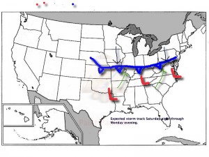
As we’ve been discussing, a significant winter storm is developing this weekend. The set up is one that will feature an arctic cold front sinking south and stalling out across southern and central Indiana Saturday night. Low pressure will then organize over the Ark-la-tex region and head northeast, tracking into the northern Tennessee Valley Sunday and Sunday night. The low will move off the southern Mid Atlantic coastline Monday evening. This will be more of a prolonged event when compared to our last two winter storms as waves of moderate to heavy snow move into central Indiana beginning late Saturday night.
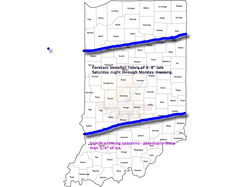
This is an ominous set up for more heavy snow across central Indiana- one that’s notorious for heavy snow events across central Indiana. We hoisted our initial snowfall forecast Thursday morning and placed central Indiana under the threat for 6-8″. As of this morning, we’re remaining firm on that idea. It should be noted that the GFS remains very bullish on heavier totals (and consistent, as well), but it should also be pointed out it’s somewhat of an outlier as of this morning as the GEM and ECMWF are more suppressed with lighter totals. All of that said, we lean more towards the GFS solution versus the more suppressed Canadian and, to some extent, European forecast model. Should the other model data begin to trend towards the snowfall idea per the GFS then the initial 6-8″ forecast will have to be adjusted upward. The storm is just now coming onshore and will be sampled better with model runs later today.
Any way you slice it, a significant and disruptive winter storm is brewing this weekend and could make an absolute mess of your Sunday and Monday. A shot of bitterly cold air will flow in behind our departing storm early next week.
Our current accumulation idea and storm track can be found below: We’ll have another update here late tonight and you can keep up-to-date with all of our thoughts on the go on Twitter (@indywx).


