We’ll have your updated 7-Day forecast posted later today.
The latest mid and long range guidance continues to suggest we’re heading into another prolonged period of below normal temperatures.
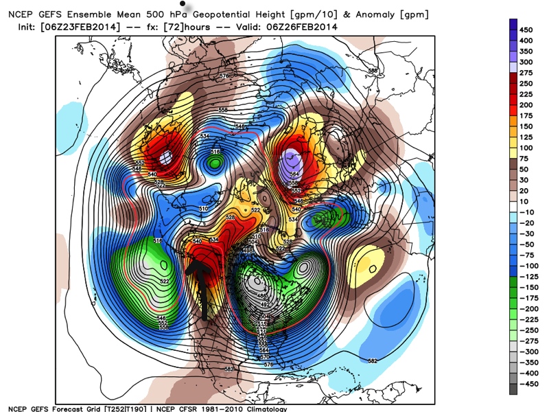
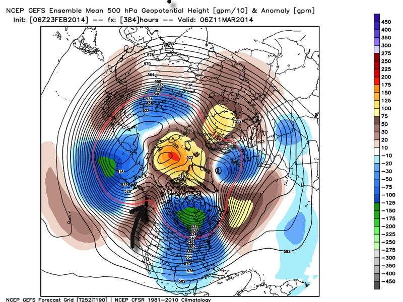
Ensemble data (below) shows ridging in the northeast Pacific, extending into Alaska and this pattern has been one of the big reasons as to why we’ve dealt with so many arctic intrusions this winter. (The first image is a look at the upper air pattern dated Feb. 26th and the second is dated March 11th).
Ridging in this particular part of the globe often times dislodges the cold air and someone “down stream” has to deal with below normal air. The recipient of being “down stream” has just so happened to be the upper Mid West into the Ohio Valley and much of the eastern half of the country this winter. That doesn’t show any signs of changing over the next couple weeks, at least. It’s possible we could deal with a day or two of milder weather thrown in the mix, but the overwhelming majority of the upcoming couple weeks looks much colder than normal.
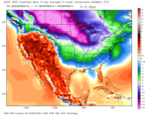
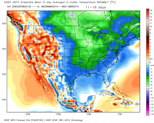
The result is a continuation of much below normal cold in our part of the country. The following graphics illustrate temperature anomalies (in celsius) centered on 5 days between Feb. 23rd-28th and March 6th-11th. Below normal temperatures continue.
A couple of additional thoughts around the upcoming cold pattern: While we can’t show the images here (license issues), the “secret” European weeklies and ensemble data continues the cold, stormy regime across the east for the better part of the upcoming 30 days, with a couple of brief periods of milder, “calmer” weather.
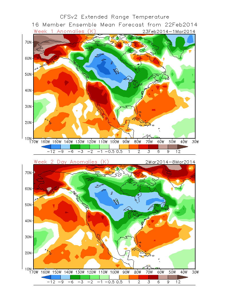
Finally, the CFSv2 suggests the cold regime continues, as well. The first image shows upcoming weeks 1 and 2 and the second shows temperature anomalies weeks 3 and 4. Note the CFSv2 shows southeast ridging developing towards the end of the period, potentially suggesting a big fight goes on between the cold to the north and the budding spring conditions to the south- a stormy suggestion…
In closing, it’s important to note that all of the fancy graphics shown above are simply model guidance and it’s up to us, the forecasters, to interpret the data the best way possible to put together the most accurate mid to long range ideas for you, the viewer. While nothing is a guarantee in this business, it does appear as if chances are quite high that our region deals with another few weeks of colder than normal conditions and potentially active weather ahead. Stay tuned.

