February 2014 archive

Tracking A Late Weekend Winter Storm

Wed.

Thr.

Fri.

Sat.

Sun.

Mon.

Tue.

 Status-weather-clouds-icon

 Status-weather-clouds-icon

 Status-weather-snow-scattered-day-icon

 Status-weather-snow-scattered-day-icon

 Status-weather-snow-scattered-icon

 Status-weather-snow-scattered-day-icon

 Status-weather-snow-scattered-day-icon

5/ 18

8/ 14

2/ 23

22/ 37

20/ 30

10/ 20

5/ 18 

– – –

– – –

Light

Light

Heavy

Light

Light

Forecast Updated 02.26.14 @ 7:43a

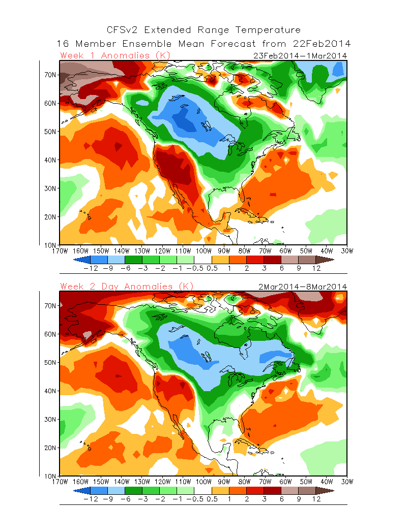
Frigid Midweek…A brutally cold air mass is blowing into the region this morning, especially considering we’re nearly into March!  This is laying the groundwork for a snowy weekend, but we’ll get to that in a bit.  Forecast highs average at 44 degrees this time of the year and today’s high will be lucky to reach 18.  EVEN COLDER air blows in late tonight into early Thursday and will result in continued dangerous below zero wind chill values.  Needless to say, plan to bundle up upon heading outdoors.  While the calendar may suggest spring is near, Mother Nature and Old Man Winter have other ideas.

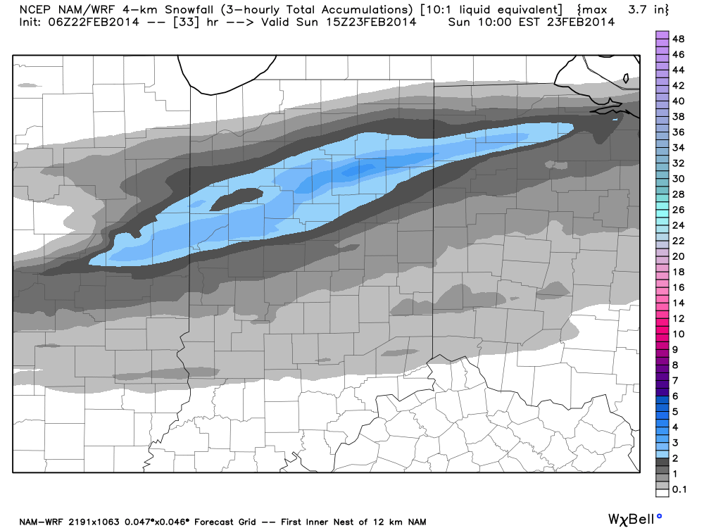
Late Week Light Snow…A warm front will lift north through the region Saturday morning and will be responsible for producing a round of light snow Friday night into Saturday AM.  As of now, early numbers suggest around an inch of snow is possible, but we’ll continue to monitor things and update as needed.

Late Weekend Winter Storm…While details are still far from etched in stone, there’s no doubt behind a significant winter storm brewing for the second half of the weekend.  This storm will have significant snow for portions of central Indiana and significant icing potential for others.  As of now, we anticipate air cold enough to support frozen, or freezing, precipitation across our immediate viewing area of central Indiana.  All of that said, we caution that the track and intensity of the storm will likely change between now and Sunday and we’ll continue to keep close tabs on this event.  Early numbers are impressive as far as precipitation goes with liquid equivalent amounts around 1″ churned out, on average, from a variety of computers models.

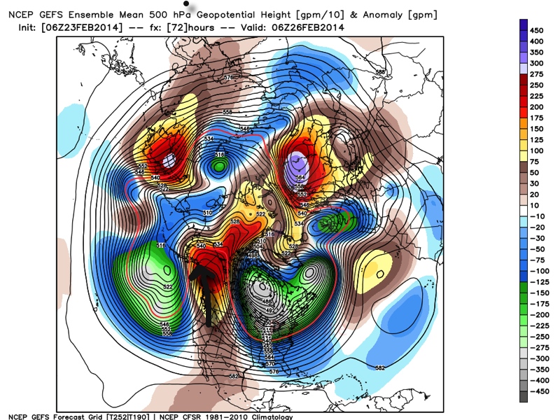
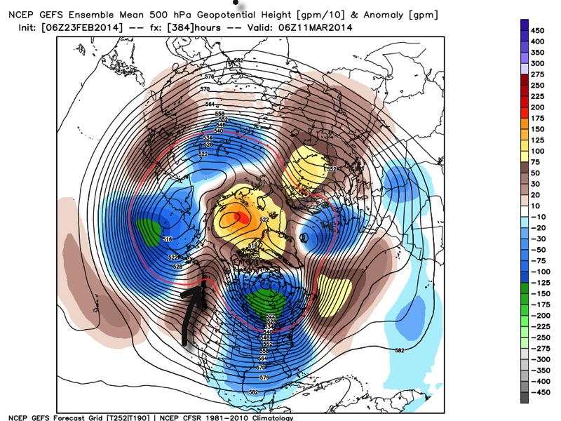
Arctic Air Reloads…We may be into meteorological spring next week, but Old Man Winter continues his relentless ways that we’ve grown so accustomed to over the past several months. Fresh arctic air will plunge into central Indiana’s potentially snow packed ground early next week and could ultimately help yield below zero air by the middle of next week.  What an impressive winter.

Upcoming 7-Day Precipitation Forecast

  • 7-Day Snowfall Forecast: 4-8″
  • 7-Day Rainfall Forecast: 0.00″

twic

For weather updates and more “behind the scenes” data on the go, be sure to Follow Us on Twitter @indywx or become a Friend of IndyWx.com on Facebook!

images

Permanent link to this article: https://indywx.com/tracking-a-late-weekend-winter-storm/

Old Man Winter Is Back… (Did He Ever Leave)?

We touch on the potential winter storm brewing in the Sunday-Monday time period in this video.  A significant winter storm is brewing for some and we cover some initial thoughts…

You must be logged in to view this content. Click Here to become a member of IndyWX.com for full access.  Already a member of IndyWx.com All-Access?  Log-in here.

Permanent link to this article: https://indywx.com/old-man-winter-is-back-did-he-ever-leave/

Feeling More Like The Heart Of Winter

Mon. Tue. Wed. Thr. Fri. Sat. Sun.               16/ 29 21/ 29 2/ 19 18/ 29 13/ 27 13/ 20 10/ 22  Light Light…

You must be logged in to view this content. Click Here to become a member of IndyWX.com for full access.  Already a member of IndyWx.com All-Access?  Log-in here.

Permanent link to this article: https://indywx.com/feeling-more-like-the-heart-of-winter/

Looking Ahead; Cold Pattern Reloads.

We’ll have your updated 7-Day forecast posted later today.

The latest mid and long range guidance continues to suggest we’re heading into another prolonged period of below normal temperatures.

Ensemble data (below) shows ridging in the northeast Pacific, extending into Alaska and this pattern has been one of the big reasons as to why we’ve dealt with so many arctic intrusions this winter.  (The first image is a look at the upper air pattern dated Feb. 26th and the second is dated March 11th).

Ridging in this particular part of the globe often times dislodges the cold air and someone “down stream” has to deal with below normal air.  The recipient of being “down stream” has just so happened to be the upper Mid West into the Ohio Valley and much of the eastern half of the country this winter.  That doesn’t show any signs of changing over the next couple weeks, at least.  It’s possible we could deal with a day or two of milder weather thrown in the mix, but the overwhelming majority of the upcoming couple weeks looks much colder than normal.

GEFS1GEFS2

The result is a continuation of much below normal cold in our part of the country.  The following graphics illustrate temperature anomalies (in celsius) centered on 5 days between Feb. 23rd-28th and March 6th-11th.  Below normal temperatures continue.

GEFS3GEFS4


A couple of additional thoughts around the upcoming cold pattern: While we can’t show the images here (license issues), the “secret” European weeklies and ensemble data continues the cold, stormy regime across the east for the better part of the upcoming 30 days, with a couple of brief periods of milder, “calmer” weather.

Finally, the CFSv2 suggests the cold regime continues, as well.  The first image shows upcoming weeks 1 and 2 and the second shows temperature anomalies weeks 3 and 4.  Note the CFSv2 shows southeast ridging developing towards the end of the period, potentially suggesting a big fight goes on between the cold to the north and the budding spring conditions to the south- a stormy suggestion…

CFSv2Wk1:2CFSv2Wk3:4

In closing, it’s important to note that all of the fancy graphics shown above are simply model guidance and it’s up to us, the forecasters, to interpret the data the best way possible to put together the most accurate mid to long range ideas for you, the viewer.  While nothing is a guarantee in this business, it does appear as if chances are quite high that our region deals with another few weeks of colder than normal conditions and potentially active weather ahead.  Stay tuned.

Permanent link to this article: https://indywx.com/looking-ahead-cold-pattern-reloads/

Light Accumulating Snow Targets Areas Just North Of Indianapolis

Latest high resolution data overnight suggests we focus our attention from Indianapolis and points north for tonight’s light snow event.  Before that, be sure to get out today and enjoy the sunshine and one last day of relative warmth as highs zoom close to 50 for many throughout central Indiana on a gusty southwest wind this afternoon.

Light rain moves in this evening- initially around 6-7 for north-central Indiana, but may not reach the city, itself, until mid to late evening (more like 8 to 9 o’clock).  Rain will then mix with and change to snow (from north to south) during the overnight.  Our official accumulation idea looks very much like the latest high resolution NAM model.

hires_snow_acc_indy_11

Specific snowfall forecasts from a few select locations for tonight into early Sunday:

  • Indianapolis: 0.50-1″
  • Northern ‘burbs (Zionsville, Carmel, Westfield): 1″-1.5″
  • Lafayette: 2-3″

In other words, this isn’t anticipated to be a huge snow event by any means.  That said, we’ll keep a close eye on things as we fine tune the timing between the arrival of the cold air and departure of precipitation tonight.  We’ll fine tune later this evening if needed.

Enjoy your Saturday!

Permanent link to this article: https://indywx.com/light-accumulating-snow-targets-areas-just-north-of-indianapolis/