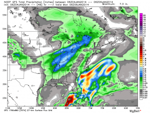
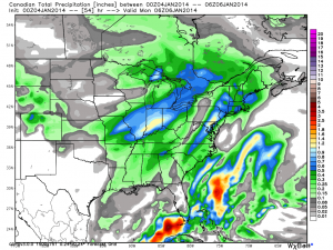
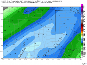
We awake this morning to most of the data very consistent with what we’ve been passing along to you over the past few days…a very serious winter storm is taking aim on Indiana and will result in a combination of significant weather events that ultimately may end up being something we’ll remember for quite some time…
Quick Bullet Points:
- Snow develops early Saturday morning
- Heaviest snow falls between 10a-5p
- Wind increases through the day Sunday and gusts in excess of 30 MPH leading to white outs and severe blowing and drifting
- Temperatures crash to 10-14 below zero Monday morning with wind chill values of 40 to 50 below zero.
- Widespread snowfall of 5-9″ is likely across central Indiana, with a heavier band of 9-12″ including Indianapolis and running along and just north of the I-70 corridor on the south side north to include Vermillion to Adams counties on the north side.
This is a hazardous and severe winter weather event that will likely lead to road closures from the heavy snow and wind, as well as extremely dangerous conditions to spend anytime outdoors Sunday into early next week due to the cold. The bitter wind chills will be capable of frostbite in less than 30 minutes to any exposed skin.
Latest model data shows consistency in precipitation amounts, or QPF. We’re showing you the GFS, Canadian, and European models below. Please note that the numbers and maps below don’t show snowfall amounts, but show precipitation totals. Bring in a 12-15:1 snowfall ratio with these numbers and you get the snowfall discussed above. We’re leaning heavily on a Canadian/ European model blend as the GFS has been more erratic.
Much more later this evening!


