Fresh on the heels of a significant winter storm that impacted central Indiana Wednesday night-Thursday, we’re eyeing our next winter storm and, quite frankly, it could be a memorable one.
We continue to keep a close eye on the pending winter storm Sunday and remain impressed with what we see. A severe winter storm is brewing and may require blizzard watches and warnings before all is said and done as a combination of heavy snow, strong winds, and severe blowing and drifting promises to make travel difficult, if not impossible, for some areas Sunday.
Setting the stage:
A powerful arctic boundary will drift south towards Indiana Saturday night and Sunday morning. As this takes place, low pressure will track off the lee of the Rockies and move east, northeast. Model data continues to suggest this area of low pressure taps into some Gulf of Mexico moisture and really begins to deepen (strengthen) as it tracks into the central/ eastern Ohio Valley Sunday. To the northwest of the low’s track, a deep blanket of fresh snow will fall. As the winter storm departs, the coldest air since 1994 will pour into the region on a gusty northwest wind. Temperatures will reach record territory, and downright dangerous levels, by Monday and Tuesday.
Last night we mentioned a couple of things going “for” and “against” a major winter storm here in central Indiana. While there’s no doubt going to be a sharp “cut off” of heavy snow with this storm, this “cut off zone” is most likely well north and west of central Indiana. Additionally, the impressive thermal gradient between the brutal arctic air mass to the north and the warmer air (relatively speaking) to the south and east will only add fuel to a deepening storm moving northeast into the Ohio Valley. Finally, with arctic air pouring into the region, the “fluff effect” will be in full-go mode, meaning the northwest flank of the heavy precipitation is likely to have snow ratios of 15:1 as compared to the “normal” 10:1 ratio. This will be very important to watch as the system develops and will most likely be the spot (far too early to pinpoint at this juncture) where snowfall amounts in excess of one foot will fall.
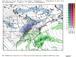
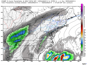
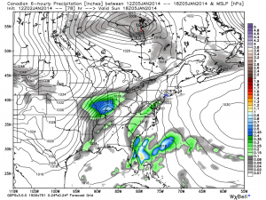
All of our medium range model data is in agreement on central Indiana receiving quite the blow from Old Man Winter Sunday. Here’s a look at the latest GFS, European, and Canadian forecast models, valid Sunday afternoon:
As you can see, there’s excellent agreement and this leads to a rather high confidence idea on a high-impact and rather rare severe winter storm set to impact Indiana. Can we tell you with certainty exactly where the 12″+ band of snow will lie across the state? Not at this time. That said, we suggest preparing now for a rare and potentially crippling winter storm Sunday. The combination of heavy snow, strong winds, historic cold, and severe blowing and drifting will make for an extremely dangerous situation Sunday, continuing into early next week. Temperatures by Tuesday morning will approach 20 degrees below zero, with wind chill values plummeting to 40-50 degrees below zero Monday into Tuesday…


