Your latest 7-Day video forecast can be found in the video player to the right of this post.
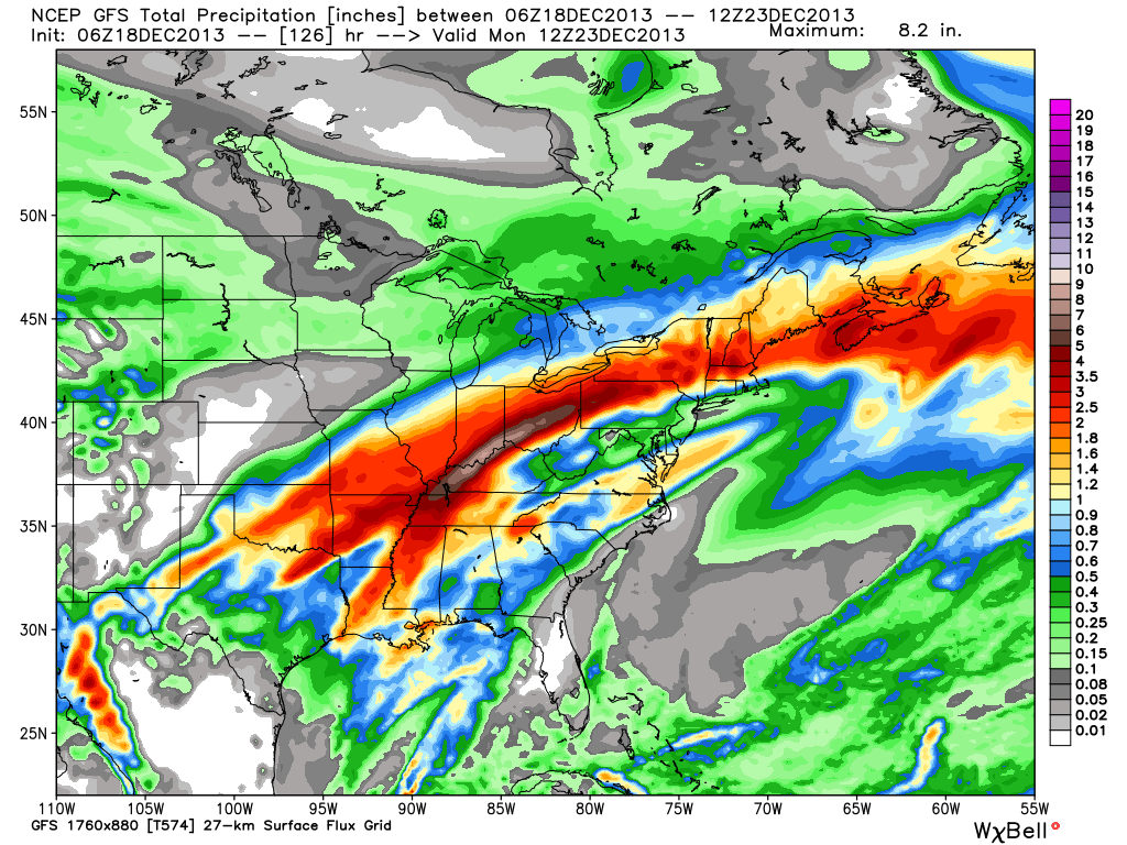
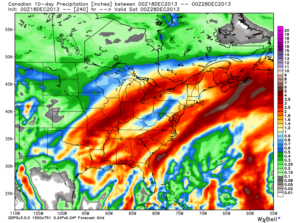
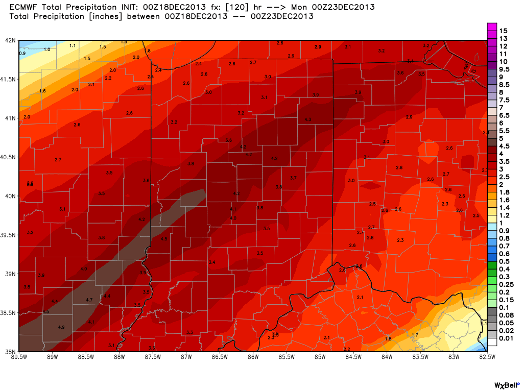
We’ve known for over a week now that we’ll have to deal with a pre-Christmas storm. Latest guidance suggests our region undergoes a 3-4 day thaw with a decidedly warmer southwest flow ahead of this storm. Additionally, with the more northern track of the surface low, we’re looking at nearly all of the precipitation associated with this storm falling as rain. Combine our frozen ground with a significant early-season snow pack and multiple inches of rain ahead in the Thursday night through Sunday time period and the stage is set for a significant flood situation this weekend.
Here’s a look at what the latest forecast models show. We’ve posted the GFS, Canadian, and European models below to display total rainfall between Thursday through Sunday. The majority of this rain falls in two waves- Friday and again late Saturday into early Sunday.
If the rainfall numbers are even half of what is projected above, we’re looking at a significant flood situation. Needless to say, if your property is in a low-lying area, or one that is prone to flooding, I would begin to prepare now for major water rise in the days to come.
Much more later!


