Mother Nature seems determined to put us weather forecasters to hard work as we get set to head into the Christmas season and welcome in 2014. We’re tracking a major flood situation that will unfold across central Indiana over the upcoming weekend, followed by a reload of the cold and potentially a storm with a more wintry component as we get closer to the New Year.
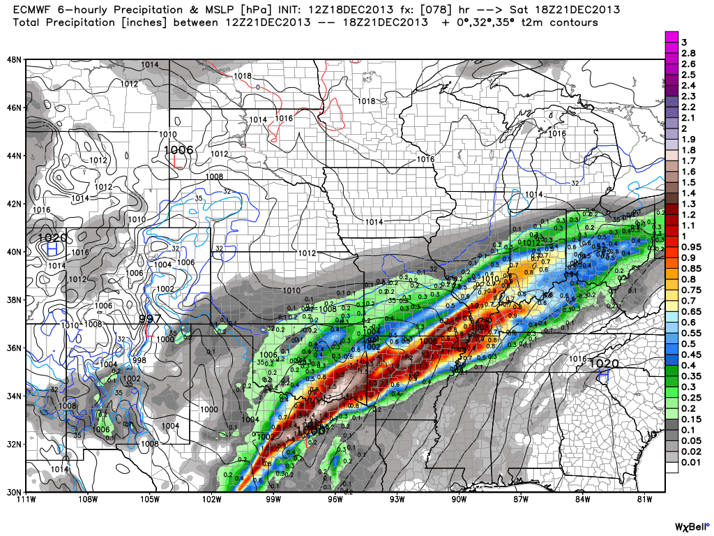
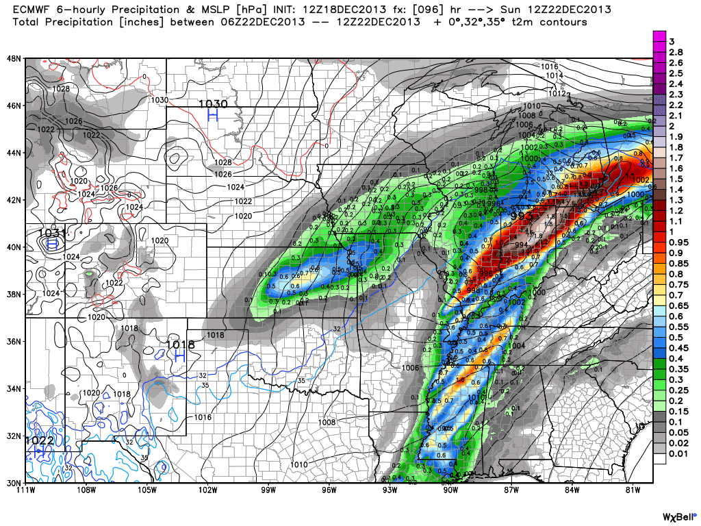
First things first and that’s the significant flood threat in the short-term period. Without trying to go into scare tactic mode, current model data would result in a downright dangerous flooding event for many low lying and flood prone areas this weekend. Rainfall numbers are extremely impressive with this event and with a deep tropical connection, widespread 3-4″ totals are certainly likely, including some localized higher amounts. Note the latest European chart, courtesy of the model suite off Weatherbell Analytics. Needless to say, the Gulf of Mexico is officially “open for business” and will help contribute to excessive rainfall totals and, as stated above, potentially a dangerous flooding event this weekend across central Indiana.
Latest numbers averaged off a variety of computer models would place just under 4″ of rainfall down by noon Sunday, most of which falls between Friday and Sunday morning. We note (2) waves of enhanced rainfall intensity set to impact the region. As of now we’re targeting Saturday afternoon and again late Saturday night/ Sunday morning for extremely heavy rain, shown below.
We still have time to watch the data and monitor the track of the storm. It’s possible the “heaviest of the heavy” axis of rain shifts somewhat in the days ahead, but it’s also important to note that even a light to moderate rain event combined with a frozen ground and a solid snow pack still in place will lead to flooding problems here across central Indiana. The question of whether or not we’ll deal with flooding here this weekend shouldn’t be asked, but instead the question that remains is just how severe will the flooding be? Stay tuned and if you live or work in a flood prone area, we would recommend preparing now for flooding.
Now, as we look ahead and focus on the Christmas to New Years period our thoughts will shift from a flood threat in the near term to one that’s more wintry. We’ll turn dramatically colder Sunday afternoon behind the big rain storm and that will set the stage for a colder-than-average run up to Christmas. In fact, latest raw numbers off some forecast model guidance has some frigid readings ahead next week (upper single digits not ruled out for lows).
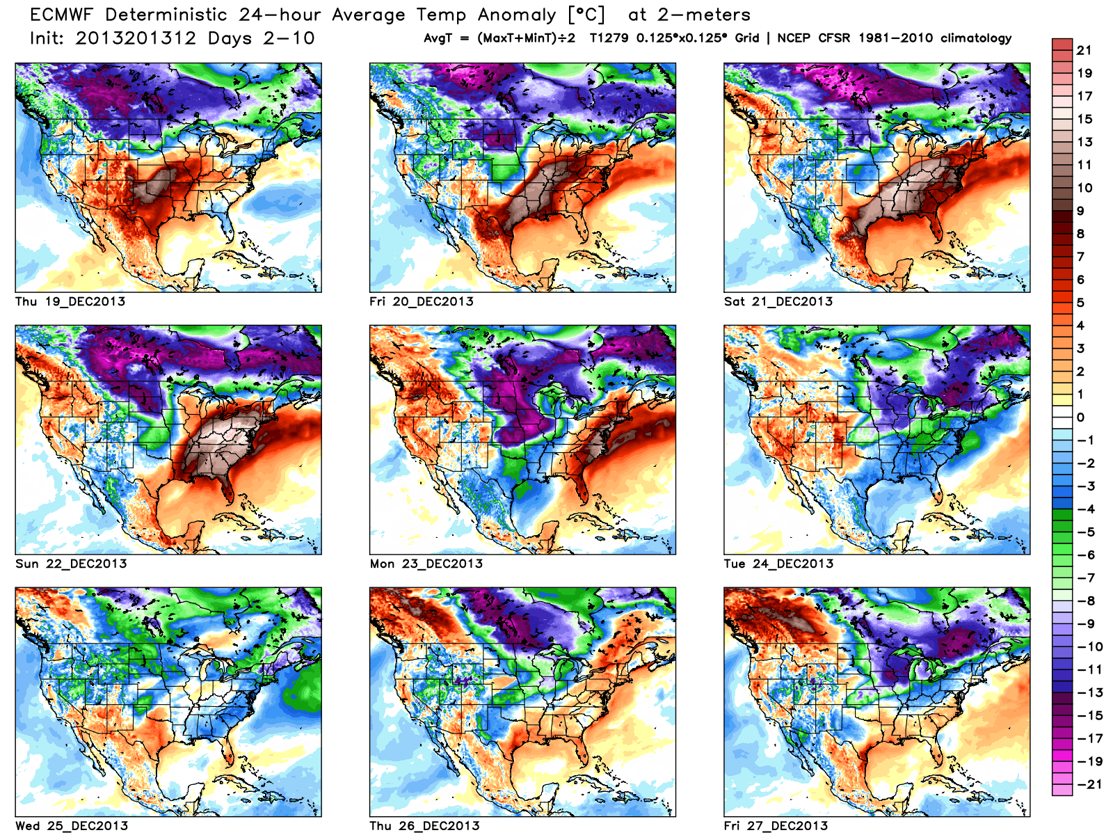
The upcoming 10 days off the European forecast model charts show an interesting scenario with the coming thaw, but the key word is brief. Note days 6-10 are back into a colder-than-normal regime.
Additionally, we think we’ll have to deal with another storm prior to the New Year period and with the colder air back in place, there’s the threat we could have to contend with a wintry side to the next storm. The details with storm number two will have to wait until we finish dealing with the first storm and associated serious flood threat it’s presenting.


