Good evening, Hoosiers! Showers are developing now, and these will increase in coverage and intensity as we progress through the overnight. As we move into the wee morning hours, don’t be surprised if you’re awoken with loud claps of thunder, gusty winds, brief heavy rain, and small hail. That said, we think overnight thunderstorms remain below what would officially be considered “severe.”
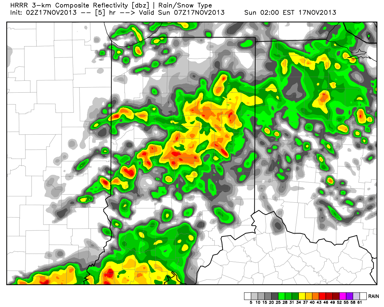
Here’s a look at the simulated radar later tonight, valid at 2am local time, courtesy of the HRRR model.
As for Sunday, we continue to look over the latest data and our thoughts haven’t changed. It still appears the two biggest threats will be from damaging straight line winds and the possibility of quick spin-up tornadoes associated both within the squall line, itself, but also with any individual severe cells that develop before “morphing” into the squall line. It should also be pointed out that even outside thunderstorms, southwest winds will howl across central Indiana, periodically gusting upwards of 40-45 MPH even outside of thunderstorms. Hunker down…
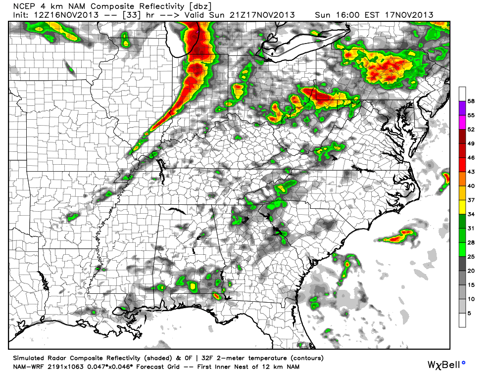
The latest high-resolution NAM suggests the possibility of super cells entering western Indiana early Sunday afternoon before organizing into a squall line as it moves through central and western Indiana. This line will mean business as it moves east across the state, and latest data suggests the most significant severe threat for central Indiana will be from 12 noon through 6p, moving west to east. By sunset Sunday, most of central Indiana will see a much needed (and much colder) wind shift to the northwest, ending any threat of severe weather.

