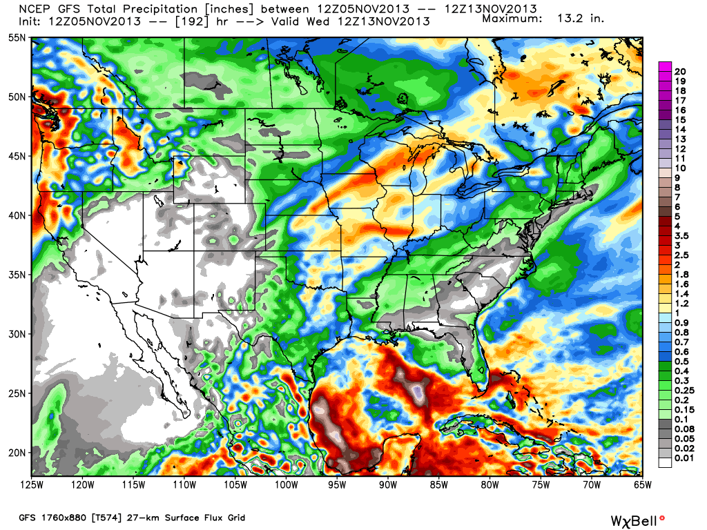
While the midday model data continues to flip flop on the temperature outcome next week, one thing seems rather likely and that’s the idea we remain in a pattern that will produce significant rainfall over the next 10 days.
Let’s take a look at the ECMWF, GFS, and GEM (Canadian) for precipitation amounts over the next 7-10 days.
Model data paints a wet picture of widespread 1.5″-2″+ type rainfall totals over the upcoming 7-10 day period.


